Curated OER
World: Political Map
In this world political outline map worksheet, students examine boundaries of each of the countries in the world. This map not is labeled.
Curated OER
Asia and the South Pacific: Political Map
In this Asia and the South Pacific map instructional activity, learners examine national political boundaries and national capitals in this region of the world.
Curated OER
World Political Map
In this blank outline map worksheet, students note the political boundaries of the nations of the world on a Mercator projection map.
Curated OER
Central American Map
In this Central American political map worksheet, students examine the boundaries of this region of the world. The map may be used in a variety of classroom activities.
Curated OER
Central America: Unlabeled Map
In this Central American political map instructional activity, students examine the boundaries of the countries and capital cities located in this region of the world.
Curated OER
Central America Map
In this Central American political map worksheet, learners make note of national boundaries and capitals in this region of the world.
Shaker Junior High School Library Media Center
WWII Project Outline
Work together as a class and get to know the ins and outs of World War II with this engaging collaborative project. Class members are broken into groups to research particular war topics, from life on the home front to the Holocaust and...
Curated OER
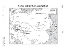
Central and Northern Asia: Political
In this Central and Northern Asia map instructional activity, students examine national political boundaries and national capitals in this region of the world. The map is labeled.
Curated OER
Asia and the South Pacific : Political Map
In this Asia and the South Pacific map worksheet, learners examine the boundaries of the nations in this region of the world. Students also note the location of capital cities as they are denoted by stars. Major bodies of water are labeled.
Curated OER
Central America Outline Map
In this Central American political map activity, students make note of national boundaries and capitals in this region of the world. National capital city locations are noted with stars.
Curated OER
Central America Outline Map
In this Central American political map learning exercise, students make note of national boundaries and capitals in this region of the world. National capital city locations are noted with stars.
Curated OER
Central America Outline Map - Labelled
In this Central American political map worksheet, students make note of national boundaries and capitals in this region of the world. National capital city locations are noted with stars.
Curated OER
World: Continents Map
In this World outline map worksheet, students note the political boundaries of the continents of the world on this Robinson projection map.
Curated OER
South east Asia and the South Pacific: Political: Labeled Map
In this Asia and the South Pacific map worksheet, students examine the boundaries of the nations in this region of the world. Students also note the location of capital cities as they are denoted by stars. This map is labeled.
Curated OER
Organization of a Territory, Map Elements
Third graders compare printed and online maps and use proper geographic terminology to answer questions.
Curated OER
Eastern Hemisphere Map
In this Eastern Hemisphere polar map worksheet, students examine the Eastern Hemisphere including the political boundaries formed by the countries in this region of the world.
Curated OER
World: Continents Map
In this outline map worksheet, students note the political boundaries of the continents of the world. The map is labeled with the names of the 7 continents.
Curated OER
World: Continents
In this blank outline map worksheet, students note the political boundaries of the continents of the world on a Robinson projection map.
Curated OER
Rivers, Maps, and Math
Students use maps to locate and label the major rivers of North and South America. Using the internet, they identify forests, grasslands, mountain ranges and other landforms on the continents as well. They compare and contrast the...
Curated OER
Mapping Your Community
Students define the boundaries of their community by comparing the community's official boundaries with other historical, political, physical, and perceived boundaries of the area and create a community map.
Curated OER
Mapping the Middle East
Students examine how the countries of the Middle East were created. They explore the influence of various political and geographic factors in their creation. They list the things they should consider in deciding how to draw new borders...
Curated OER
Through the Looking Glass: Recognizing Developing and Industrialized Countries
Students examine the regions of the world, and identify the basic characteristics of industrialized and developing countries. They conduct Internet research on the economic and population characteristics of industrialized and developing...
Latin America Network Information Center
Urbanization
Brazil's population has been changing dramatically in the last century. Study the causes of Brazilian urbanization, including industrialization and and migration, and the implications for the country of the populations'...
Curated OER
A Brief History of Vietnam (1858-2004) and Its Evolving Communist System
Students examine the French colonization of Vietnam, the Vietnam War, and the current evolving Communist system. They develop political maps, outline the major events of the Vietnam War, write an essay, and compare/contrast democracy...


