Curated OER
Underground Railroad
Fourth graders read about Harriet Tubman and develop vocabulary lists. In this Underground Railroad lesson, 4th graders find similarities and differences in primary and secondary sources, create a timeline and recognize important people...
Curated OER
The Amazing Maud Lewis
Students investigate cultural art from Canada by reading about Maud Lewis. In this Canadian history lesson plan, students identify the work of Lewis by visiting her magazine website. Students identify other heroes in Nova Scotia before...
Curated OER
Africa Unite!
Learners work in pairs to research assigned African countries. They compile their research to label a continent map of Africa, present their research to the class and design a game of trivia using their findings.
Curated OER
Microclimates of Our School
Students read the story "Weslandia" by Paul Fleischman, define the term microclimate, gather and record data in various places on school grounds to establish the presence of difference microclimates, analyze and compare microclimates,...
Curated OER
Reach for the Stars
Students investigate the Underground Railroad. In this slavery lesson plan, students read books about slavery, the Undeground Railroad, and how slaves escaped the south. Students develop knowledge about coded songs and constellations...
Curated OER
Old Kids From The Bloc
Students study about wide scale construction and development in Moscow and its impact on cultural and historic preservation. They research the political, social, economic, and cultural changes in the former Eastern Bloc and create a...
Curated OER
The Good, The Bad, The Ugly
Sixth graders examine the causes of the stock market crash of 1929. In this integrated math/history unit on the stock market, 6th graders study, research, and read stocks, visit a local bank, and create a PowerPoint to show the finished...
Curated OER
Exploring Egyptian Culture and Pyramids
Students access a variety of Egyptian Culture and pyramid related resources on the Internet. They explore various websites, read articles, create an Egyptian art figure, construct a model of a pyramid, and describe the mummification...
Curated OER
A Star Sheds a Comet Tail!
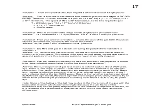
In this comet tails and stars learning exercise, students read about the star Mira and the vast clouds of gases it emits. They use a photograph from the Galaxy Evolution Explorer satellite to solve 5 problems about the scale of the...
Curated OER
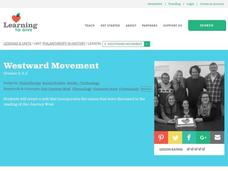
Westward Movement
Students explore the concept of philanthropy in historical context. In this Westward Movement lesson, students read Our Journey West and explain examples of settlers working together for the common good.
Curated OER
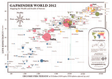
Gapminder World 2012
Here is a very interesting infographic that compares the average life expectancies, per capita incomes, and population sizes of every country in the world in 2012.
Teaching Tolerance
Identity Portraits
When you look at me, what do you see? Young learners answer this question by creating a portrait that reflects the identity of one of their peers. First, class members create interview questions. Then, they interview classmates to...
Curated OER
A Bird's Eye View of our 50 States
Third graders focus on state birds as they learned absolute location (latitude/longitude) of each state, as well as their relative location (bordering states).
Curated OER
THE TRAVELS OF BABAR: An Adventure in Scale : Integrating Visual Art and Social Studies
Students comprehend how the use of color impacts a work of art. They research how a theme can be rendered in a variety of ways (words, music, visuals). Students analyze how an artist's choices affect the aesthetic quality of artwork.
Curated OER
Country Mouse, City Mouse?
Students recognize the characteristics of a rural area. They analyze land use to determine whether the map is of a rural (country) area or an urban (city) area.
Curated OER
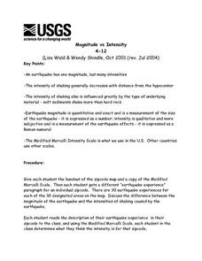
Magnitude vs Intensity
Students use a zipcode map to locate earthquake experiences based on the Modified Mercalli Scale. They discuss the difference of the magnitude of an earthquake compared to the intensity of the shaking it causes.
Curated OER
The Artifact Problem
Learners work in small groups and make a map of a familiar room. In this artifact lesson, students decide on a suitable scale for their maps, the tools they will use and how they will make it and decide on strategies they would use to...
Curated OER
Rosie's Walk
Students use maps and globes to locate and describe locations, directions and scale. Using the maps, they identify man made or natural features of different environments. They practice using geographical terms to describe a specific...
Curated OER
Finding an Earthquake's Epicenter
High schoolers examine the process used to identify the epicenter of an earthquake. They identify the Richter scale and interpret a seismograph reading. They also view photographs of the aftermath of earthquakes.
Curated OER
Evaluating an Illinois Earthquake
Young scholars examine the frequency of earthquakes in Illinois. They discover the distribution of earthquakes in the Midwest. They also practice reading measurements from the Richter scale and Mercalli Intensity scale.
Curated OER
Comparing Ratios
For this comparing ratios worksheet, students solve and complete 3 different problems using the screens shown. First, they write a ratio that compares the shaded part to unshaded part illustrated. Then, students use the same grid to...
Curated OER
Guide Me "Home"
Students find how freedom quilts helped free slaves. For this American History lesson, students read the story Sweet Clara and The Freedom Quilt and discuss the Underground Railroad. They use their map skills to locate places that...
Curated OER
The Greatest Survival Story of All Time
Students use the Internet to read about an explorer's survival in the Antarctic. They try to find a better route for him to have taken.
Curated OER
Earth Science: In Depth Look at Earthquakes
Students engage in an interactive Internet lesson plan covering the reasons and results of earthquakes. After reading eyewitness accounts and viewing animations, they use seismograms to measure and locate the epicenters. In an ongoing...


