Curated OER
Educational Technology Clearinghouse: Maps Etc: Southern Rockies, 1911
A map from 1911 of the southern Rockies showing the main topographic features of the region, including; the eastern foothills (hogback topography); the Colorado or Front Range and Wet Mountains; the Park, Sawatch (or Saguache), and...
Curated OER
Educational Technology Clearinghouse: Maps Etc: Northern Rockies, 1911
A map of the northern Rockies in Montana showing the mountain systems, ranges, and intermontane trenches of the area.
CGFA
Carol Gerten Fine Arts: Albert Bierstadt
This museum article provides fifteen thumbnail images of Albert Bierstadt's paintings are available for enlarging, with biographical information on a separate page.
University of Alberta
University of Alberta Press: Physical Geography of Alberta
Here, the physical geography of Alberta is succinctly discussed via text and maps.
Other
The Colorado River
Features basic information on the Colorado River including a map of the states it flows through.
Massachusetts Institute of Technology
Mit: Inventor of the Week: Lloyd Conover
Use this site to learn about Lloyd Conover, the inventor of tetracycline, an antibiotic which is used to treat bacterial infections, such as Lyme Disease.
Other
Denver.gov: Denver's History
Discover the history behind the capital city of Colorado. There is a timeline of important dates with additional in-depth history and facts about Denver's symbols and government.
Smithsonian Institution
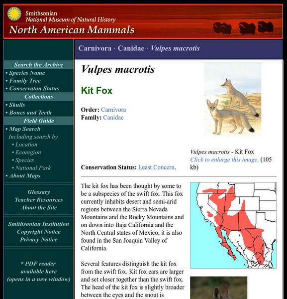
National Museum of Natural History: American Mammals: Kit Fox
The kit fox has been thought by some to be a subspecies of the swift fox. This fox currently inhabits desert and semi-arid regions between the Sierra Nevada Mountains and the Rocky Mountains and on down into Baja California and the North...
Discovery Education
Discovery Education: The Fossil Record
This lesson plan explores the fossils of animals that lived in the ancient oceans such as in the area now known as the Burgess Shale in the western Canadian Rocky Mountains.
PBS
Pbs: Nature: Born to Be Wild, Polar Bears
Research the diet, habitat and behavior of polar bears, and compare and contrast the issues surrounding polar bears in their environment with those of bears in the U.S. Rocky Mountains. Rewrite a human/bear encounter from the bear's...
Smithsonian Institution
National Museum of Natural History: American Mammals: Olive Backed Pocket Mouse
The striking olive dorsum of the Olive-backed Pocket Mouse is set off by a yellowish stripe on the side and a white underside. This is the only species of pocket mouse east of the Rocky Mountains whose range extends well into Canada....
Smithsonian Institution
National Museum of Natural History: American Mammals: Swift Fox
Swift foxes are primarily nocturnal, but can sometimes be seen sunning themselves near the entrance to a den. They live on prairie grasslands just east of the Rocky Mountains. Learn more about the Vulpes velox, more commonly known as a...
Canadian Museum of Nature
Canadian Museum of Nature: Bighorn Sheep
Bighorn sheep can be found in the Canadian Rockies and in some parts of the United States and Mexico. Read some fascinating facts about these unique creatures. Pictures can also be found here.
Curated OER
Kids Health: Hey! A Tick Bit Me
This site is provided for by Kids Health. Learn more about ticks, the diseases they can carry, how to avoid them, and what to do if you are bitten by a tick. Watch a demonstration of how to remove a tick and what to do with it after...
Curated OER
Etc: Maps Etc: Mexico, Central America, and the West Indies, 1898
A map from 1898 of Mexico, Central America and the West Indies. The map includes an inset map of Cuba and the Isthmus of Nicaragua. "The surface of the Rocky Mountain highland in Mexico is quite similar to that of the great plateau...
Curated OER
Etc: Maps Etc: Forest Map of the United States, 1910
A map from 1910 of the United States showing the forest regions of the Pacific, Rocky Mountains, Northern Forest in the Great Lakes and New England areas, Southern Forest along the Gulf and East Coast, and the Hardwood Forest. The map...
Curated OER
Etc: Maps Etc: Orographic Chart of North America, 1891
An orographic map from 1891 of North America showing the principal mountain systems, rivers, and terrain features of the region. The map is coded to show high lands and mountain regions, and shaded regions of plains, with dark lines...
Curated OER
Etc: Maps Etc: Relief of the United States, 1910
A relief map from 1910 of the United States showing the physical features of the New England Highlands, Adirondacks, Appalachian Plateau and Mountains, Piedmont Plateau, Coastal Plains, Lake Superior Highlands, Red River Valley Plains,...
Curated OER
Educational Technology Clearinghouse: Maps Etc: North America, 1885
A map from 1885 of North America and Central America showing the major relief features of the region. The map shows the primary highland known as the Pacific Highland, with the Sierra Nevada and Rocky Mountains, the secondary highlands...
Curated OER
Educational Technology Clearinghouse: Maps Etc: North America, 1901
A map from 1901 of North America, Central America, the Caribbean, and Greenland showing general land elevations, mountain systems, rivers, coastal features, and ocean currents. The map is color-coded to show land elevations ranging from...
Curated OER
Etc: Maps Etc: Relief of the United States, 1904
A relief map from 1904 of the United States showing the mountain systems and highlands, plateaus, plains, lakes, rivers, and coastal features. This map divides the area into the main groups of the St. Lawrence Basin, Allegheny Region,...
Curated OER
Educational Technology Clearinghouse: Maps Etc: Denver and Vicinity, 1916
A map from 1916 of the Denver and Central Rocky Mountain area showing the railroad routes into the mining areas and south to Pueblo and the southern routes of the Atchison Topeka and Santa Fe Railway.
Curated OER
Etc: Maps Etc: United States Forest Regions, 1901
A map from 1901 of the United States showing the forest regions, coded to show heavily forested and moderately forested areas. Areas of typical forest types are shown, including pine and hardwoods, spruce, birch, and maple in the...
Curated OER
Educational Technology Clearinghouse: Maps Etc: The United States, 1910
A map from 1910 of the United States showing general elevations, water depths, watershed boundaries, and terrain features, including the Pacific Slope, Great Basin, Colorado Plateau, Cordilleran Highlands, Rocky Mountains, Great Central...
Other popular searches
- Rocky Mountains Formed
- Rocky Mountains States
- Fossils Rocky Mountains
- Rocky Mountains Formation
- Rocky Mountains Geography
- The Rocky Mountains
- Canada Rocky Mountains
- Rocky Mountains Activity
- The Rocky Mountains States
- Mammals of the Rocky Mountains


