Curated OER
Identifying Creatures
Students use a classification key from a provided worksheet to identify creatures. This task assesses student's abilities to interpret data, make decisions, identify, and classify.
Curated OER
Sun, Shadows, Surface Structure...and the Face on Mars
Students use light and shadow information to make inferences regarding the three dimensional shapes of specific objects photographed on the surface of Mars. Limitations of the of the data provided are discussed and entries made into the...
Curated OER
Under the Ice: Imaging Glacier Bases with Sound
Students investigate with radio waves that are used to remotely sense the topography beneath the ice sheet. They experiment with travel time of waves and convert data to distance and depth. As a result, they develop a profile of the...
Curated OER
All Shook Up
Students calculate the amount of displacement after an earthquake. In this seismic event lesson plan students research the Internet, and fill out a CORS data sheet.
Curated OER
Megabeasts
In this biology activity, students use their mathematical skills to create a three dimensional scale model of an ancient insect. They draw a diagram of their insect and label it with as much information as possible.
Curated OER
Travel Mug Design
Students create and develop a travel mug. They create visuals and a three dimensional infomercial. They apply an engineering design and demonstrate knowledge of thermodynamics involved in heat transfer. They illustrate Newton's Law of...
Curated OER
Using GIS to Construct Water Table Maps and Flow Nets
Pupils examine how to use GIS software to analyze patterns of groundwater flow. Seepage lake elevation data from the Sand Hills of Nebraska is used to construct a water table map and flow net using Esri's Arc Map software.
Curated OER
Send in the Clouds
Learners culminate a study of the water cycle by following step-by-step directions to make a three dimensional cloud. On the model, they draw a diagram of the water cycle and label it, and add a written report they completed in a...
Curated OER
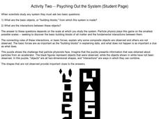
Activity Two--Psyching Out the System (Student Page) Asking Questions, Using Clues
Students observe two-dimensional shapes and work on the challenge that what is observed is as important as what is not observed.
Students determine constructions, rules and connections.
Full references listed for further reading and...
Curated OER
Volcanoes and Urban Planning
Students analyze satellite image data of Volcan Villarica. In this earth science lesson, students identify dangerous areas surrounding the volcano. They propose a new safe location for the town.
Curated OER
Heart Mobiles In Action
Students design a mobile or wall hanging that reviews the circulatory system. In this circulatory system lesson, students work in small groups to identify the structures of the heart, and create a model in the form of a two or three...
National Gallery of Canada
The Tools of Perspective
Make a study of perspective in the real world. Learners examine and discuss works of art that show examples of perspective before trying their own hands at it. Using a grid drawn on transparent paper, class members transfer a view from a...
National Gallery of Canada
Mastering One-Point Perspective
Cover one-point perspective through observation and practice. Class members examine several works of art that use one-point perspective, look at magazine images to find the vanishing points and horizon lines, and draw their own city...
University of Colorado
Patterns and Fingerprints
Human fingerprint patterns are the result of layers of skin growing at different paces, thus causing the layers to pull on each other forming ridges. Here, groups of learners see how patterns and fingerprints assist scientists in a...
Curated OER
Map-A-Buddy
Middle schoolers investigate the concept of tracking and spatial movements of animals in relation to the environment in which they live. They participate in an interactive activity by tracking one another over a pre-defined region,...
Curated OER
Recycled Paper
Sixth graders keep track of the amount of paper they consume on a daily, weekly, and monthly basis. The goal of the lesson is to have them all find ways to reduce the amount they use. Everyone creates recycled paper from old newspapers...
NOAA
Wet Maps
How do oceanographers make maps under water? Junior explorers discover the technologies and processes involved in creating bathymetric maps in part three of a five-part series designed for fifth- and sixth-grade pupils. The activity...
Curated OER
Organic Chemistry Problem Set Exam 1
Though there are technically only 13 questions on this exam, they take up six pages and make a thorough assessment of organic chemistry principles. There are plenty of diagrams to label or complete. Emission spectra are displayed for...
Curated OER
Layers of Rock
Juvenile geologists drill clear plastic straws down into a playdough sedimentary rock model, pulling out sample rock cores. As they analyze their cores, they apply the law of superposition and discover that originally horizontal layers...
Star Date
Shadow Play
Three activities make up a solar system lesson that features the sun, its light, and the shadows it produces. Scholars step outside to discover the changes shadows make at different times of day, take part in a demonstration of...
Curated OER
Classification in Action
Young scholars work with a set of objects to set up both quantitative and qualitative classification systems. As a group, students follow an example to design and complete two classification systems using a set of objects provided. ...
Curated OER
Climb Every Volcano
Middle schoolers use a contour map to distinguish the elevation of a volcano. In this volcano lesson, students use styrofoam to create the contour of their map. Middle schoolers glue and assemble their volcano. ...
Curated OER
Scientific Sampling
Learners take a sample of fish and try to determine how many fish are in the sea. In this scientific sampling instructional activity, students explore the way scientists measure large areas of samples. Learners record the...
Teach Engineering
Let's Learn About Spatial Viz!
Can you see your class working on spatial visualization? The first installment of a five-part module introduces the concept of spatial visualization and provides a 12-question diagnostic assessment to test spatial visualization skills....


