NOAA
Watching in 3D
Bring the ocean floor to life! Earth science scholars discover the process of deep sea mapping in the third installment in a series of five lessons about ocean exploration. The teacher's guide includes helpful resources, worksheets, and...
American Museum of Natural History
Journey to the Bottom of the Sea
Properties of water make it essential for the life of marine species. Learners complete an online game to answer questions about the role water fulfills for organisms in ocean habitats. The game emphasizes the properties of water and how...
Curated OER
Ocean Planet: Sea Secrets
Students identify ocean features and draw a profile using data points on a map. Through discussion and research, they discover the importance of oceanography and plot a profile of the ocean floor in search for a vessel full of precious...
Curated OER
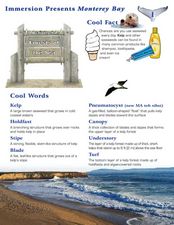
Forests of the Sea
Students read about and conduct experiments to learn about the vegetation under Monterey Bay. For this Monterey Bay lesson, students read about and look at brightly colored pictures of the different types of seaweed that grows in the...
Curated OER
Mapping the Ocean Floor
Students construct and interpret a line graph of ocean floor depth and a bar graph comparing the height/depth of several well-known natural and man-made objects and places. In addition, they calculate the depth of two points using sonar...
Curated OER
Animals A to Z: Urchin
In this sea urchin worksheet, 3rd graders will add pages to their "animal books." Students will read 10 facts about a sea urchin to gain an understanding of the animal's characteristics.
Curated OER
Sunken Slave Ship
Learners investigate shipwrecks. In this marine archaeology lesson plan, students create the site of a shipwreck by using a tub filled with sand and items from a "ship". Learners excavate the site and analyze the findings.
Curated OER
The Galapagos Spreading Center
Students explore the basic concept of seafloor spreading. They describe the processes involved in creating new seafloor at a mid-ocean ridge. They investigate the Galapagos Spreading Center system.
NOAA
Mapping the Ocean Floor: Bathymetry
Bathymetry is not a measure of the depths of bathtubs! Through the three lessons, scholars explore two different types of maps and how they are made. The resource focuses on topographic and bathymetric maps and teaching the techniques...
Curated OER
ROV Grid Search
Students perform activities to recreate the exploration of the sea bottom. They attach magnets to the bottom of the remote controlled car to see how many camouflaged objects it can pick up. As a class, students examine the results of...
Curated OER
Mapping Ancient Coastlines
Most of this lesson plan is spent working on the "Bathymetry Worksheet." It includes a graph of the changes in sea level over the past 150,000 years and a bathymetric map of changes in an imaginary coastline over time. Participants...
Curated OER
Pangaea Puzzle: Exploring the Tectonic Forces That Shape the Earth
Sixth graders follow in the footsteps of early scientists as they put the pieces of Pangaea back together and discovered the forces that create the variety of landforms and sea-floor features of our Earth.
Curated OER
Sea Floor Spreading Demonstration
Students examine the Earth's boundaries, the ocean floor, and the types of plate boundaries. In this sea floor lesson students fill out worksheets on the ocean floor and observe a demonstration.
Curated OER
Undersea Adventure
Learners research and demonstrate their knowledge of information about life and topography on the ocean floor. They experiment with and choose watercolor techniques to portray a vivid undersea setting using colors, textures, and shapes.
Consortium for Ocean Leadership
Nannofossils Reveal Seafloor Spreading Truth
Spread the word about seafloor spreading! Junior geologists prove Albert Wegener right in an activity that combines data analysis and deep ocean exploration. Learners analyze and graph fossil sample data taken from sites along the...
Curated OER
Ocean Floor Properties and Near Shore Environments
Students explore and model the characteristics of the ocean floor and near shore environments through in-class demonstrations, laboratory activities, and internet research. They use classroom materials to research the characteristics of...
Curated OER
Yo-Yos, Tow-Yos and pH, Oh My!
Learners explore how hydrothermal vents are formed and where they are located on the ocean floor. They study how scientists use CTDs to locate hydrothermal vents.
NOAA
It's a Roughy Life
Scientists recently discovered several previously unknown species at the Bear Seamount off the coast of New England. Scholars research these new species — benthopelagic, benthic, and seamount fish — and find out what makes them unique....
NOAA
Tides
Sometimes low, sometimes high, but always in motion! Explore Earth's tidal system in the 10th interactive in a series of 13. Engaging life and earth science students alike, the versatile resource demonstrates cause and effect between...
Curated OER
Plate Tectonics Day 3 Sea Floor Spreading: Evidence for Continental Drift
Middle schoolers are introduced to Sea Floor Spreading and how it provides evidence for Hess's and Deitz's theory of Continental Drift. They use paleomagnetic data to calculate the rate of Sea Floor Spreading.
NOAA
Seamounts
How do chains of islands form? Young oceanographers explore the mountains of the deep in the final installment in a 13-part series. The interactive compares types of seamounts based on their overall height and height under the water, as...
CK-12 Foundation
CK-12 Earth Science Concepts for Middle School
Explore a variety of science concepts in an interactive textbook created for middle school scholars. A lengthy table of contents takes readers to pages comprised of a subject overview, outline, and summary. Follow links further to find...
Curated OER
Ocean Observation
Students describe the different methods used by MBARI researchers to study the ocean. In this ocean lesson plan students research the Internet and use the information they find to write in their journal.
Ocean Explorer
Easy as Pi
Seamounts are large, extinct volcanoes that rise up from the bottom of the ocean floor. They are a relatively new landform in the scientific community, and this lesson invites young scholars to learn about the amazing diversity of life...
Other popular searches
- Sea Floor Topography
- Sea Floor Diagram
- Sea Floor Mapping
- Sea Floor Sediment
- Sea Floor Features
- Sea Floor Bathymetry
- Sea Floor Drilling
- Sea Floor Bathmat
- Sea Floor Spread
- Convection Current Sea Floor
- Mapping the Sea Floor
- Sea Floor Mappng


