Curated OER
Plate Tectonics
In this plate tectonics worksheet, 5th graders are given notes with diagrams showing Earth's layers, the tectonic plates, evidence of Pangaea, sea-floor spreading and the types of boundaries. Students answer 5 review questions about the...
Curated OER
Plate Tectonics-Notes
For this plate tectonics worksheet, learners complete a sheet of notes about the layer's of the Earth, plate tectonics, continental drift and sea floor spreading.
Curated OER
Echinoderms
Echinoderm structure and characteristics are the focus of this reading comprehension and labeling worksheet. Attractive diagrams and ample information make this a suitable homework assignment for your biology buffs when learning about...
NOAA
Wet Maps
How do oceanographers make maps under water? Junior explorers discover the technologies and processes involved in creating bathymetric maps in part three of a five-part series designed for fifth- and sixth-grade pupils. The lesson...
Curated OER
Top to Bottom
Marine science classes read about the 2005 North Atlantic Stepping Stones Expedition and review climate change. They use maps to locate the seamount chains. In collaborative groups, they research how climate change may be altering the...
Curated OER
Wreck Detectives
Junior archaeologists examine types of artifacts from the Bronze Age on the internet. In collaborative groups, they create a story about a ship from this period and then construct a model of the ocean floor after their ship has sunk....
Curated OER
The Distance Between Us and Them: Sea Floor Spreading in the Atlantic Ocean
Students examine how geologists determine rates of sea floor spreading between two tectonic plates. They apply mathematical concepts such as the calculation and use of velocities and conversion from one set of units to another.
Curated OER
Bathymetric Mapping
Students draw contour lines based on NOAA soundings on a nautical chart. They color the contours and glue label tags for topographic features. They determine that the floor of the ocean is composed of hills, plains, ridges, trenches,...
Curated OER
Deep Lights
Students investigate materials that emit light. In this deep ocean lesson, students compare and contrast materials that emit light under certain conditions and infer the light-producing process. They explain three ways this evidence is...
Curated OER
Under The Sea
Second graders study how a tsunami is formed by underwater events such as earthquakes, volcanoes or landslides. They discuss what they knew about living and non-living things in the ocean.
Curated OER
Seafloor Spreading
In this seafloor spreading instructional activity, students find mistakes in statements that are descriptive of seafloor spreading. Students correct the given sentences to make a true statement.
Curated OER
Sea Connections: Marine Ecosystems
Students identify producers and consumers from marine ecosystems and describe the balance among them in the environments. After constructing a food chain from a marine ecosystem, they examine human activities that can upset the balance...
Curated OER
Habitats and Deep Sea Environments
Students examine and identify the characteristics of the four zones of the ocean. They discover the amount of diversity in marine habitats. They also explore the adaptations organisms have that have allowed them to survive.
Rainforest Alliance
How Do Jaguars and Howler Monkeys in Belize Depend on Us?
How does weather play a role in the lives of land and sea creatures? Find out with a lesson focused on habitats and the ways animals from different homes are connected. Here, learners explore how the life of a jaguar and howler monkey...
NOAA
Ocean Zones
How can organisms light up in water? Bioluminescence is light produced in a chemical reaction that can occur in an organism's body. First, learners determine what happens to light/color as you move into the deep ocean. In groups, they...
Curated OER
Friend, Foe, or . . .
As a result of this lesson, upper elementary ocean explorers will be able to describe several interrelationships: symbiosis, mutualism, commensalism, and parasitism. They learn that the biological richness is increased near seamounts and...
Curated OER
Sea Floor Spreading
Students recreate sea-floor spreading and the pattern of magnetic stripes that are created by different configurations of plate boundaries. They see how transform faults work.
Curated OER
Entering the Twilight Zone
Students describe major features of cold-seep communities and the process of chemosynthesis as it relates to organisms in each habitat. In this deep-sea habitats lesson plan, students study the categorization of ocean habitats according...
Curated OER
Folk Dancing Fun
First graders discuss different kinds of music they have heard. They listen to a short selection of folk music and discuss where they think it is from. Using a globe, the teacher shows students where the music is from. They spread out on...
Curated OER
This Old Tubeworm
Students plot data to construct and interpret a graph about vestimentiferans at cold-seep sites in the Gulf of Mexico. In this deep sea lesson, students plot data provided for the growth of tubeworms. They use the graphs to determine...
Curated OER
What's A Water Column Profile?
Learners investigate water column data. In this earth science and seawater instructional activity, students determine how temperature, salinity, and density have an impact on sea water by viewing and analyzing data obtained from a number...
Curated OER
Tomography
In this tomography worksheet, students read about how tomography is used to help oceanographers learn more about the Earth's surface below the ocean. Students complete 3 short answer questions based on the reading.
Curated OER
GED Vocabulary: Earth and Space Science-Earth's Crust and The Solar System
In this earth and space science instructional activity, students complete a crossword puzzle given 9 clues and a word bank on topics such as sea floor spreading, tectonic plates, faults, lava and the big bang theory.
Curated OER
Sea Floor Spreading II
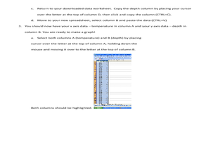
Students import ocean bathymetry data from text files. They then graph these observations along with model predictions to assess the model's ability to simulate observed topographic features of the North Atlantic. Students use Excel to...
Other popular searches
- Sea Floor Topography
- Sea Floor Diagram
- Sea Floor Mapping
- Sea Floor Sediment
- Sea Floor Features
- Sea Floor Bathymetry
- Sea Floor Drilling
- Sea Floor Bathmat
- Sea Floor Spread
- Convection Current Sea Floor
- Mapping the Sea Floor
- Sea Floor Mappng


