Curated OER
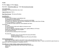
Novel Guide for My Brother Sam is Dead
Fifth graders explore the effects of war. In this American Revolution lesson, 5th graders read My Brother Sam is Dead and complete the provided comprehension, characterization, and vocabulary activities
Curated OER
A Year (a Day or a Week) In My Life as a Shorebird
Students describe the basic life history of one shorebird common to their area. They use the writing process which includes brainstorming, rough draft writing, peer editing, and re-writing to create a factually and grammatically...
Curated OER
The Clever Monkey Rides Again
Students explore a West African folktale. For this folktale lesson, students read the book The Clever Monkey Rides Again and discuss the trickster characters from the tale. Students participate in a discussion about the folktale and...
Curated OER
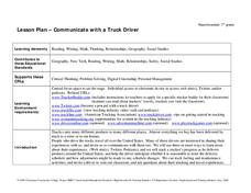
Communicate with a Truck Driver
Eighth graders explore the truck driving profession and ways they use to communicate. In this truck driving lesson, 8th graders visit websites and use Twitter and podcasts to track a trucker's progress travelling through the United...
Curated OER
Watersheds, Watersheds Everywhere
Young scholars identify the watershed in which their school is located. They use maps to locate their homes and school. They define and use the correct vocabulary.
Curated OER
Biomes of The World
Students research different biomes, using links from global pen pal letters.
Curated OER
Mobility: A Green City, Past, Present, and Future
Middle schoolers explore transportation systems through history. In this transportation lesson, students determine how modes of transportation affect quality of life and design transportation plans for cities.
Curated OER
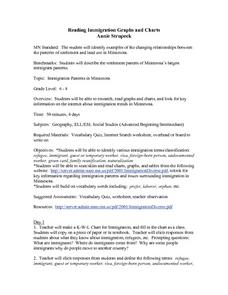
Reading Immigration Graphs and Charts
Students examine the settlement patterns and land use in Minnesota. In groups, they practice reading immigration graphs and charts and discuss why immigrants settled where they did. They are also introduced to new vocabulary related to...
Curated OER
Math Hunt: Extreme Weather
Learners investigate integrals. In this math lesson, students relate real world situation to investing. They may visit a local business to do this assignment.
Curated OER
Sustainable Development and Canada's Natural Resources
Learners use text information, data and graphs to explain what sustainable development is, and to investigate the rate of consumption of Canada's natural resources. In groups, they graph their findings.
Curated OER
Civil Engineering: Designing Bridges
Young scholars examine the bridges of the United States. They discuss the concept of balance. They draw their own design of a suspension bridge.
Curated OER
The First Farmers
Students show how constant irrigation, with repeated evaporation of water that left salts in the soil, eventually ruined much farming land in southern Mesopotamia. They discuss the idea that with the development of irrigation people...
Curated OER
Reading a Local and National Weather Map
Learners practice reading a national and local weather map. Using this information, they work together to make predictions about the weather for the next few days. They discuss the use of symbols and maps as a class and discuss how...
Curated OER
Canada's Climate: Temperature and Rainfall Variations
Students analyze data about various climates in Canada. In this data analysis and climate lesson, students use Canada Year Book 1999 to complete a worksheet and make connections between precipitation and temperature in different climates.
Curated OER
Watershed Model
Students view a presentation of water and land and how we need to protect our water resources. In this water lesson plan, students discuss how we rely on water, and complete activities in all subjects related to water.
Curated OER
Stratigraphy -- Layers of Time in the Earth
Students are introduced to the process of stratification. Using the internet, they read about the Richard Beene archeological site near San Antonio. Using a map, they color code the different layers present at this site and answer...
Curated OER
the Potential Consequences of Climate Variability And Change
Students analyze the consequences of changing variables on a system. Changes in a model are measured and recorded and conclusions drawn based on the data provided in this six lessons unit.
Curated OER
State Heads
Pupils create a narrative image that depicts a formal shape of a state. They review the state facts of whatever state they chose. They draw a person and then add text in the shape of the state they chose.
Curated OER
Minerals, Crystals, and Gems
Students discover the relationships between minerals, crystals and gems. They bring in rocks that they find at home, in the schoolyard, etc. and examine them and attempt to identify them. They set up a classroom exhibit that includes all...
Curated OER
Teaching With the Power of Objects
Students define value of an object. In this value lesson plan, students identify reasons for collecting objects, compile a personal inventory of items they find valuable, and then define why those items are valuable to them. In step two...
Curated OER
Art Using Sequence
Students are introduced to representative works of various artists including Paul Klee, Piet Mondrian, Sonia Delauny, Henri Matisse, Joan Miro and Henri Rosseau. They read books, participate in discussion and create original works of art.
Alabama Learning Exchange
Alex: The Study of Human Geography
Geographers are social scientists who are interested in human activities as well as the physical environment. Human geography includes a wide range of topics, such as the study of languages, religions, customs, economics, and political...
ArtsNow
Arts Now Learning: Musical Geography [Pdf]
In this lesson, students listen to and perform chanted text, then explore how parts of the chant can be linked to geographic features on a map.
Alabama Learning Exchange
Alex: Exploring the World With p.w. Cracker!
This instructional activity can be completed in a whole group or small group setting. After reading the book "P.W. Cracker Sees the World," the students will complete an inquiry project that connects social studies/geography to what they...












![Arts Now Learning: Musical Geography [Pdf] Lesson Plan Arts Now Learning: Musical Geography [Pdf] Lesson Plan](https://d15y2dacu3jp90.cloudfront.net/images/attachment_defaults/resource/large/FPO-knovation.png)
