Curated OER
The Slave Trade
Young scholars map and explore a possible slave trade route. In this slave trade mapping instructional activity, students calculate the distance and amount of time it would take for African slaves to arrive in America.
Curated OER
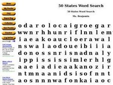
50 States Word Search
In this fifty states worksheet, students identify and locate all fifty states of the United States of America. There are 50 states located in the word search.
Curated OER
Memorandum of a Conference with President Eisenhower after Sputnik
Learners use the National Archives to research how the United States and the Soviet Union south to maintain its supremacy after World War II.
Curated OER
Rights of Non-Citizen Immigrants
Students continue their discussion of if coming to America was the best thing for a group of immigrants. As a class, they complete the citizenship test offered by the INS. They research the benefits and responsibilities of being a...
Curated OER
World Cup: Did England rig the results?
Students discuss a rugby match to understand its world implications. In this rugby lesson, students read and analyze primary documents to find how sports effect world relations. Students answer critical thinking questions related...
Curated OER
We've got the whole world in our hands
Students explore spatial sense in regards to maps about the globe. In this maps lesson plan, students label oceans, locate the continents and poles, follow directions, and explain the symbols on a map.
Curated OER
Africa Capitals Map Quiz
In this online interactive geography quiz learning exercise, students examine the map that includes 53 African countries. Students match the names of the countries to the appropriate locations.
Curated OER
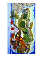
Community Symbols: Heroes and Leaders
Students research the importance of community leaders in portraits. In this art history lesson, students look at the painting "The Ascension of Simon Bolivar on Mount Jamaica" and discuss what they see in the portrait. Students research...
Curated OER
The Age of Exploration
Students apply computer skills to gain further insight into early exploration. They analyze the role of each explorer and evaluate their importance. Students comprehend the Chronology of Discovery and Trade of early explorers. They...
Curated OER
But Where Is It On This Modern Map? A problem-solving, mind-boggling experience!
Trace Columbus' voyages by locating them on 21st Century maps. Using a navigators lesson, 4th graders will examine the Age of Exploration and trace Columbus's routes accurately on laminated world maps using different maps. Note:...
Curated OER
Colonial Life in Virginia
Fourth graders compare and contrast life in England with plantation life in America. They study the dependencies or mini-industries that could be found on plantations.
Curated OER
Yo-ho, Yo-ho a Viking's Life for Me
Students complete a unit of lessons on the Vikings. They analyze maps, read and discuss myths, summarize the main ideas from resource materials, watch videos, sing a song, draw a picture to illustrate Norse mythology, and define key...
Curated OER
Drake’s West Indian Voyage 1588-1589
Students examine the exploration routes of Sir Francis Drake. In this American exploration lesson, students investigate primary sources to trace the routes and contact with the natives that Sir Francis Drake experienced on his voyages in...
Curated OER
African Safari
Seventh graders examine different countries in Africa to research. They choose one to concentrate their research on using the five themes of geography. They design a multimedia presentation that will make up the African safari.
Curated OER
Columbus wants to find a shorter route to Asia
Eighth graders identify the reasons why Columbus wanted to find a shorter route to Asia. They make a timeline of the sequence of events surrounding his explorations. Students draw a map of the routes taken by early explorers around...
Curated OER
Exploring the World's Geography
Students discuss the seven continents of Earth and the diverse geography. After discussion, they create their own paper-mache globes which properly display all seven continents, the equator, and the prime meridian. They conduct research...
Curated OER
Culture Is Like an Iceberg
Students examine features of culture to determine which are visible and which are invisible, and how the invisible affect the visible. They look at both their outline drawing of the iceberg and their Features of Culture worksheet and...
Peace Corps
Features of Culture
Young scholars enumerate features of their own culture and evaluate how those features have influenced their lives. They explain that many differences are related to culture-beliefs and ways of living that are handed down from one...
Curated OER
Continent Word Search
In this continents word search worksheet, students locate the names of the 7 continents, listed in the word bank, within the word search puzzle. Students fill in the blanks in 8 sentences with the appropriate continent names.
World Maps Online
Introduction to the World Map
Students identify the differences between maps and globes. In this map skills instructional activity, students are shown a globe and a map and recognize the differences. Students use post-it notes to locate several locations on the world...
Curated OER
The Good, The Bad, The Ugly
Sixth graders examine the causes of the stock market crash of 1929. In this integrated math/history unit on the stock market, 6th graders study, research, and read stocks, visit a local bank, and create a PowerPoint to show the...
Curated OER
Dot-Commerce
Students analyze the impact that e-commerce has in their community, as well as in small traditional communities that one might not expect to be part of the dot-com marketplace. They develop business plans for imagined businesses.
Curated OER
Mummies Unwrapped
Students investigate various methods of mummification practiced in cultures around the world and present their findings in 'televised' news reports.
Curated OER
Pirates
In this pirates worksheet, students complete a crossword puzzle by researching and finding the answers to eight questions going both across and down.


