BBC
Bbc: News: Country Profile: Singapore
BBC News provides a general overview of the prosperous south-east Asian country of Singapore. Focus is on history, country facts, leaders, and media. Provides links to a timeline of key events and recent news articles.
BBC
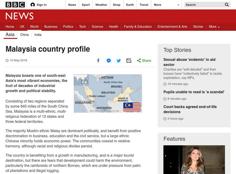
Bbc: News: Country Profile: Malaysia
BBC News features a general overview of the prosperous south-east Asian country of Malaysia. Focus is on history, country facts, leaders, and media. Provides links to a timeline of key events and recent news articles.
NOAA
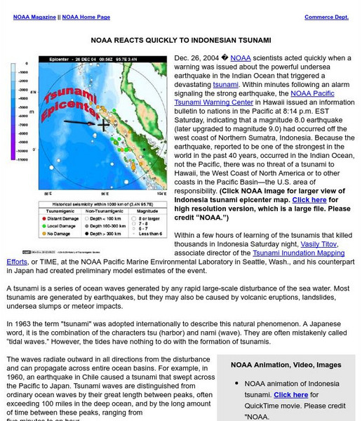
Noaa: Reacts Quickly to Indonesian Tsunami
NOAA discusses its reaction to the tsunami that rocked South Asia in 2004 and gives a scientific explanation to why it happened. Interesting animated map of the tsunami.
Curated OER
Educational Technology Clearinghouse: Maps Etc: Philippine Islands, 1912
A map from 1912 of the Philippine Islands, showing the major islands, cities, coastal features, and surrounding seas. The map shows the railways on Luzon at the time, including the route from Manila to Lingayen in the north, and from...
BBC
Bbc News: The Global Spread of Hiv
This site from BBC News provides a clickable map of the world which shows the spread of the HIV infection. When you click on an area, you will also get a more detailed map with information on the spread of HIV over time.
BBC
Bbc News: Quake's Terrible Toll Is Revealed
This in depth article by the BBC sheds light on the devastation caused by the Pakistani earthquake in 2005. Videos and maps can be viewed on this site also.
BBC
Bbc: News: Country Profile: Brunei
BBC News offers us a general overview of the tiny Asian country of Brunei. Focus is on history, country facts, leaders, and media. Provides links to a timeline of key events and recent news articles.
Nations Online Project
Nations Online: Vietnam
Offers a virtual destination guide and profile of the south-east Asian nation of Vietnam, background details, and numerous links to key information on the nation's culture, history, geography, economy, environment, population, news,...
Curated OER
Map of Maldives
BBC News offers a general overview of the South Asia islands of Maldives. Focus is on history, country facts, political leaders, and news media. Provides access to a timeline of key events, recent news articles, and related internet...
Curated OER
Map of Sri Lanka
BBC News features a general overview of the South Asia island of Sri Lanka. Focus is on history, country facts, political leaders, and news media. Provides access to a timeline of key events, recent news articles, and related internet...
Encyclopedia of Earth
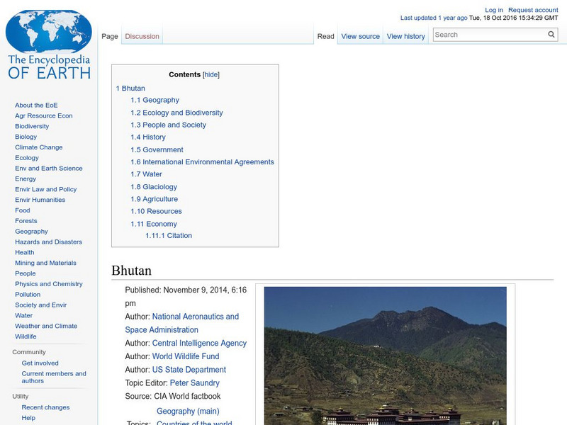
Encyclopedia of Earth: Bhutan
Provides an overview of Bhutan, including its geography, natural resources, history, government, economy, and much more. Maps and images are also included, along with sources used to create the entry.
BBC
Bbc: News: Country Profile: Afghanistan
BBC News features a general overview of the South Asian country of Afghanistan. Focus is on history, country facts, political leaders, and news media. Provides links to a timeline of key events, recent news articles, and related internet...
Nations Online Project
Nations Online: Timor Leste
Features a travel guide and country profile of the Southeast Asian nation of Timor-Leste including a broad overview and numerous links to comprehensive information on the islands' culture, history, geography, economy, environment,...
Nations Online Project
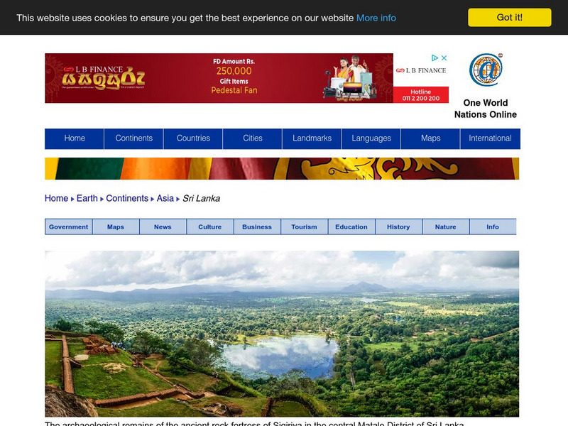
Nations Online: Sri Lanka
This is an interesting reference source and travel guide to the Asian country of Sri Lanka that includes a broad background overview and numerous links to comprehensive information on the country's culture, history, geography, economy,...
Curated OER
A Damaged House in Sopore North of Srinagar
Detailed coverage of the earthquake that rocked South Asia in October, 2005. Article includes video, pictures, maps, and more.
Curated OER
Etc: Maps Etc: Physical, Political, and Economic Asia, 1872
A map of Asia from 1872, showing physical features including mountain systems, deserts, lakes, rivers with direction of flow, coastal features, and ocean currents, political boundaries and foreign possessions at the time, and commercial...
Curated OER
Educational Technology Clearinghouse: Maps Etc: Drawing Asia, 1872
A chart from 1872 illustrating instructions for drawing Asia. "General instructions for drawing the continents. Make a scale by marking on a slip of paper or pasteboard the measures 1,2,3, etc., as on the sides of this map. Every measure...
Curated OER
Educational Technology Clearinghouse: Maps Etc: Plants of Asia, 1906
A pictorial map from 1906 illustrating the principle plants found in various regions of Asia. The map shows tea in the east and southeast of Asia and Ceylon (Sri Lanka), rice in the wet lands of the southeast, cotton, wheat, millet, and...
Curated OER
Etc: Maps Etc: Elevations of the Asian Continent, 1912
An orographic map of Asia from 1912 showing average elevations and land features of the region. The map uses color-contouring to show land elevations from depressions below sea level to above 12,000 feet. Offshore fathom contour lines...
Curated OER
Educational Technology Clearinghouse: Maps Etc: Drainage Basins of Asia, 1916
A map from 1916 showing the various drainage basins across the Asian region. This map is keyed to show watersheds draining to the Bering Sea, Sea of Okhotsk, Sea of Japan, South China Sea, and Pacific Ocean, watersheds draining to the...
Curated OER
Etc: Maps Etc: Babylonia Before the Semitic (Chaldaean) Conquest, About 4000 Bc
A map of Babylonia, in current Iraq, before the Semitic (Chaldaean) Conquest, about 4000 B.C. This map shows the early territories of Makan and Melucha between the rivers Tigris and Euphrates, with the Makan capital Ur inhabited by the...
Curated OER
Etc: Maps Etc: Ethnolinguistic Groups of China, 1971
" Ethnolinguistic Groups - Almost all inhabitants of mainland China are of Mongoloid stock, and ethnic distinctions in the country are largely linguistic rather than racial. The Han comprise nearly 95 percent of the population; the...
Curated OER
Educational Technology Clearinghouse: Maps Etc: Arabia, 700 Bc
A map of Arabia and adjacent countries around 700 BC to "Illustrate the historic era at the beginning of records.". This map shows regions of fertile lands, sandy deserts, steppe deserts, and mountain ridges. The Tigris, Euphrates, and...
Enchanted Learning
Enchanted Learning: The Continents
Brightly colored printouts, maps, and graphics on the greatest land masses on earth. See how continental drift works, look up extremes, label maps, learn about latitude, longitude and other geography terms. Teachers will find a Landforms...


