Curated OER
North Africa & Southwest Asia Map Quiz
In this geography skills instructional activity, students examine the blank outline map of North Africa and Southwest Asia. Students label the countries located in the region.
Curated OER
Central & Southwest Asia: Labeled Map
In this Central and Southwest Asia outline map worksheet, students examine boundaries of each of the countries in the region. This map is labeled.
Curated OER
Music to Learn Countries and Capitals Around the World: Learning Countries and Capitals in Asia
Students use musicto explore the countries and capitals of Asia.
Annenberg Foundation
Teaching Geography: Workshop 4—North Africa/Southwest Asia
Can Jerusalem be equitably organized? Can Israel and Palestine be successfully partitioned? Part one of a two-part workshop looks at the geo-political history of Jerusalem while Part two investigates Egypt's dependence of the Nile River...
Curated OER
Saudi Arabia -- Future city
Seventh graders summarize an article on Masdar. In this summarizing lesson students clearly explain three of the four points provided in an outline of the article. The students write an essay and identify six physical features of the...
Curated OER
Lesson Plan on Map Skills for South Asia
Seventh graders observe and discuss an overhead transparency map of South Asia. In small groups, they label a blank map of South Asia, and listen to a lecture on the realm.
AGSSS
World Regions
Help your learners to visualize where historical events have taken place around the globe with a map that details the major regions of the seven continents.
Curated OER
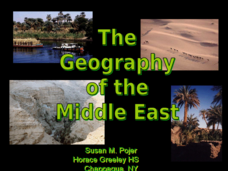
The Geography of the Middle East
Topographic, political, and satellite maps establish the world of the Middle East for your class- a land about which they have heard quite a lot, but might not really understand. This presentation would be a good introduction into a unit...
Curated OER
Anatomy of an Earthquake
In this earthquake learning exercise, students read and study earthquake maps and statistics. They complete 8 short answer questions that follow.
Curated OER
Who Dropped What into the Melting Pot?
Students show the movement of people to the United States from other countries on maps. They study the geographic cultural roots of foods that contribute to the melting pot of food in America. They research where an ingredient comes from...
Curated OER
The Cultural Geography of Egypt
Middle schoolers describe Egypt's historical, cultural and recreational sites and activities. They explain Egyptian customs and conduct; and apply what they have learned to create a travel brochure about Egypt.
Curated OER
Topography of Africa
Students study Africa's diverse landscape and investigate how these features impact the available water supply, food sources, and population distribution of the continent. They compare topographical features and
their affect on each...
Curated OER
Describing A Place - Part I The British Isles
In this describing place worksheet, learners label the cardinal and ordinal directions on a compass rose using the drop-down menus. They complete a matching activity by matching an item from column C with one in A and B. They read an...
Curated OER
Geometry in the Heavens
Ninth graders access a star worksheet and determine properties of polygons. In this investigative lesson students complete a worksheet and discuss myths.
Other
Harper College: North Africa/ Sw Asia Map Tutorial
Quiz yourself on the physical geography of Southwest Asia and North Africa by using this tutorial to Check your knowledge of landforms, bodies of water, and rivers in this area of the world.
Michigan State University
Michigan State University: Map of Afghanistan 2001
A detailed 2001 political map of Afghanistan including the edges of surrounding countries.
University of Texas at Austin
Ut Library Online: Historical Maps of Asia
This collection from the University of Texas Library Online of historical maps contains a wide variety of maps from various parts of the continent and from different parts of history. Each map is accompanied by a brief description and is...
Nations Online Project
Nations Online: Georgia
Offers a travel guide and country profile of Georgia in Southwest Asia including background facts and numerous links to comprehensive information on the nation's culture, history, geography, economy, environment, population, news,...
Curated OER
Educational Technology Clearinghouse: Maps Etc: Animals of Asia, 1906
A pictorial map from 1906 illustrating the various animals that live in regions of Asia. "The white bear, the seal and many sea birds are found near the Arctic shore. In the cold parts of Siberia tribes of yellow people keep herds of...
Curated OER
Educational Technology Clearinghouse: Maps Etc: Plants of Asia, 1906
A pictorial map from 1906 illustrating the principle plants found in various regions of Asia. The map shows tea in the east and southeast of Asia and Ceylon (Sri Lanka), rice in the wet lands of the southeast, cotton, wheat, millet, and...
Curated OER
Etc: Maps Etc: Ethnolinguistic Groups of China, 1971
" Ethnolinguistic Groups - Almost all inhabitants of mainland China are of Mongoloid stock, and ethnic distinctions in the country are largely linguistic rather than racial. The Han comprise nearly 95 percent of the population; the...


