American Battlefield Trust
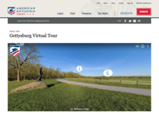
Gettysburg Virtual Tour
Step into one of the most iconic battlefields of the American Civil War with an educational interactive resource. Young historians learn about key moments, locations, soldiers, and turning points in the battle with a clickable map and...
Curated OER
Map Your State: Regions of Arizona
Fourth graders define vocabulary and locate physical features on maps. In this mapping lesson, 4th graders explore regions of Arizona through landforms found on topographic maps. Students research the history and culture of...
Curated OER
The Four Corners Region of the United States Cultures, Ruins and Landmarks
Learners who live in the inner city are introduced to the four corners region of the United States. In groups, they examine how the region differs compared to where they live and their culture. They develop maps of the area and locate...
Curated OER
Mapmaking: Colorado Quarter Reverse
Students examine the Colorado quarter reverse and draw symbols of the state's land and water features on maps. Using copies of the Colorado reverse, they color the coin design. They list reasons for the state's motto of "Colorful Colorado"
Curated OER
Train Of States
Fourth graders create a class book with information about each of the United States. After students draw a state name out of a hat, they use various resources to fill in a facts chart about their state. Students draw the state flag and...
Teach Engineering
Incoming Asteroid! What's the Problem?
Oh, no! An asteroid is on a collision course with Earth!. Class members must rise to the challenge of designing a shelter that will protect people from the impact and permit them to live in this shelter for one year. In this first lesson...
Curated OER
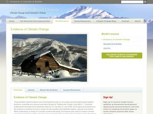
Evidence of Climate Change
Sixth graders examine climate change in the state of Colorado. In this climate lesson, 6th graders watch 2 video clips regarding the topic and research the subtopics- snow pack, precipitation, temperature, forest fires, river flow,...
Curated OER
The Bread of the Sandwich
Students create relief maps of Canada and Mexico out of everyday objects like dried macaroni, dry rice, sand, etc. They create a clue card for a location game and try to stump their classmates. They host a travel fair to display their...
Curated OER
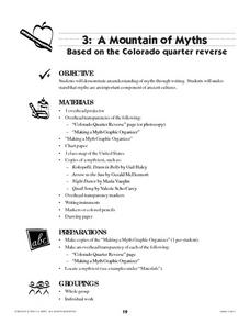
A Mountain of Myths
Students examine myths and the reverse of the Colorado quarter. They define myth, view and discuss a transparency of the Colorado Quarter Reverse, and create a myth to explain the formation of a landform in Colorado.
Curated OER
Traveling Through North America
Students identify places and landmarks in North America, specifically Canada and the United States, by using and constructing maps. Six lessons on one page; includes test.
Curated OER
Arthur's Tooth
Students practice their reading comprehension by reading a story in their class. In this story map instructional activity, students read the Marc Brown book Arthur's Tooth and discuss the story, characters and setting. Students create a...
Curated OER
Globe Skills Lesson 7 The Transcontinental Railroad
Learners explore the Transcontinental Railroad. In this geography skills lesson, students use map skills in order to locate legs of the Transcontinental Railroad on globes.
Curated OER
An Early American Culture
Young scholars identify the locations of the Hopewell culture. In this map skills lesson, students use a globe to mark several locations of the Hopewell culture.
Curated OER
Geography of the United States
Students examine the population growth of the United States. In this Geography lesson, students construct a map of the fifty states. Students create a graph of the population of the USA.
Curated OER
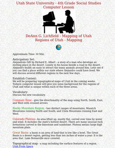
Regions of Utah - Mapping
Fourth graders draw a rudimentary map of the state of Utah, dividing it into the three regions: the Great Basin, the Colorado Plateau, and the Rocky Mountain Region.
Curated OER
We've got the whole world in our hands
Students explore spatial sense in regards to maps about the globe. In this maps lesson plan, students label oceans, locate the continents and poles, follow directions, and explain the symbols on a map.
Curated OER
European Exploration, Trade and Colonization
Students complete many activities including mapping, reading books, and Internet research to learn about European exploration. In this European lesson plan, students study geographical mapping, trade, and colonization.
Curated OER
Contour Map Worksheet #4
There are only four questions here. There is a contour map of Cottonwood, Colorado and the creek that crosses it. Earth scientists tell in what direction the creek flows, identify the highest elevation on the map, draw a topographic...
Curated OER
Different Strokes For Different Folktales
Young readers use graphic organizers, such as Venn diagrams and story maps, to analyze a variety of folktales and the elements of a story. They use writing, sequencing activities, and creative art to identify the morals learned from a...
ReadWriteThink
Biography Project: Research and Class Presentation
I Have A Dream ... that after the lesson, all individuals master the reading, writing, researching, listening, and speaking skills the biography project helps them develop. Martin Luther King, Jr. serves as a topic example for a model...
Curated OER
Real World Investigation- Math and Geography- Elevation Changes
In this math and geography real world investigation, 6th graders plan a driving trip to a city that is located several states away from their home while recording the elevations of three cities that are included in the trip. They use...
Curated OER
Getting to Know My World
Students participate in hands-on activities using maps and globes to identify geographical features. Students use map legends to identify direction. Students locate oceans, continents, countries, states and cities. Handouts and...
Curated OER
The Grand Canyon
Fourth graders study the Grand Canyon. They research the Grand Canyon and locate the Colorado River on the map of Arizona. They discuss erosion and read how sedimentary rock was formed. They view photographs of the Grand Canyon and...
Curated OER
Using Google Squared to Compare and Contrast Canada and the US
Sixth graders compare and contrast Canada and the United States. In this geography skills lesson, 6th graders use Google Squared to research information so that they may compare the geography of Canada and the United States.


