Curated OER
Watershed Island
Middle schoolers make a clay model and a geographic map of a watershed. They talk about the differences between the two representations and the potential human threats to watersheds.
Curated OER
Testing the Waters
Students study the quality of water by running chemical tests on the water. First, they measure pH, temperature, phospates, and nitrates in tap (drinking) water and an outdoor water sample. Then they post and evaluate the results of...
Curated OER
Can You Give Me Directions To the Game?
Students become familiar with the use and capabilities of GIS and use it for research and mapping purposes. They heighten their ability to estimate travel times by incorporating distance, mode of travel and urban congestion into the...
Curated OER
"Pennsylvania Watersheds, Many Ways to the Sea"
Learners trace a molecule of water through the water cycle including each of its three loops. They describe why evapotranspiration demands the largest portion of total precipitation falling on a forested watershed.
Curated OER
Wetlands Project
Students discover how wetlands filter out contaminants before they can reach other bodies of water. In groups, they design and build a model of a stormwater wetland. They test the water quality and inform their classmates about the...
Curated OER
Beyond the Tap
Students explain the basic properties of a watershed including how water flows from higher to lower elevations and how watersheds are interconnected. They comprehend how the placement of buildings, roads, and parking lots can be...
Curated OER
Hydrologic Cycle
In this science worksheet, students examine the hydrological cycle through the coloring of the picture that graphically organizes the concept.
Curated OER
Earth Day Crossword
In this crossword puzzle worksheet, students read the 25 clues about Earth Day. Students then complete the crossword puzzle about Earth Day.
Curated OER
Float the Boat
Students collect data and analyze it using a graph. In this algebra lesson, students identify different bodies of water and relate the flowing to math. They collect data on the rate of flow and the height of flow. They analyze the data...
Curated OER
Our Keystone FFA Spring
Students identify where their water sources and explore a watershed on a map. In this watershed lesson students walk a wetland, and identify sources of pollution.
Curated OER
Sediment Sleuths
Young scholars classify sediments based on their physical characteristics, such as size, shape and color. They identify and describe rocks and minerals that are common to their region of the state.
Curated OER
Salmon Life Cycle Crossword Puzzle
In this salmon life cycle ;crossword puzzle activity, students use the 20 clues to identify the correct words that will solve the crossword puzzle.
Curated OER
THE TRICKLE DOWN EFFECT
Students participate in an exercise which demonstrates how sediments are deposited.
Curated OER
Surface Water Model
Learners examine, through demonstration and experimentation, how water moves through watershed, identify pollutants that can enter water system from different land use activities, and discuss ways people can help prevent water pollution.
Curated OER
Water Features - Lesson 2 - U.S. Political Map Grade 4-5
Students locate water features on maps. In this geography lesson plan, students complete worksheets that require them to identify water features on a U. S. political map.
Curated OER
Tides and Currents
Students research and describe how currents are formed. In groups, they relate specific terms to the formation of currents and locate different currents on a world map. They also examine tides, how they are formed and how they are...
Curated OER
What is Drought?
Students explore and conduct an experiment on the effects of drought on the environment. They define what drought is and the impact that a shortage of rainfall can have on agriculture, municipal water supplies, tourism, recreation, etc.
Curated OER
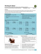
Working for Water
Students examine the ways that government works to help improve aquatic habitats. In this water habitats lesson plan students view a video and plan a school restoration project.
Curated OER
Landforms of Illinois
Students discover the primary landforms of Illinois. They examine how those landforms were formed as well. In groups, they research one of the landforms from their vocabulary list. They create their landform in a shoebox and present it...
Curated OER
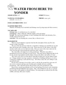
WATER FROM HERE TO YONDER
Learners identify local watersheds and drainage areas by using maps and other resources. They are given copies of the water cycle. Students discuss the movement of water in the environment. They observe, record and transfer information...
Curated OER
Can You Control Floods
Students assume the role of an engineer or planner. As an engineer or planner they must come up with ideas that can be put into place to control floods. They produce a working model of flood control.
Curated OER
Fertilized Death Water
Learners investigate the effect of chemicals on Platyhelminthes and planaria development. They observe the growth and development of planaria and investigate what fertilizer can do to living organisms when it is introduced into their...
Curated OER
Salinity
Learners define and discuss salinity, conduct classroom experiment to determine salinity of water sample by using hydrometer, record predictions, and demonstrate understanding of how salinity influences object's ability to float in water.
Curated OER
Earth Shaped by Water
In this Earth worksheet, students review the different ways water shapes the Earth's surface. This worksheet has 1 short answer and 10 matching questions.
Other popular searches
- Rivers and Streams
- Create Rivers and Streams
- Rivers and Streams Fl
- Rivers and Streams Lab
- Rivers and Streams Biomes
- Rivers Lakes Streams
- Rivers, Lakes, Streams
- Rivers and Streams Bio Mes
- Rivers Streams


