Curated OER
FOLLOW THAT WATER
Students build simple stream tables and vary the angle of the stream tables in order to simulate different flow rates and compare the results. They observe various features formed in a stream table by flowing water and compare these to...
Curated OER
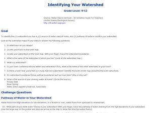
Identifying Your Watershed
Students identify the watershed where they live and how it is related to their own water consumption. In this watershed lesson students locate their watershed on their town map. The students find the source of their water that they use...
Curated OER
The Wolf, the Goat, and the Head of Cabbage
In this problem solving worksheet, students solve 1 word problem about crossing a stream. Students must carry 3 items over a stream while following certain requirements.
Curated OER
Monitoring River Levels
In this environmental science worksheet, learners read and study water maps from an interactive website to complete 8 short answer questions that follow.
Curated OER
Rock River Watershed
Middle schoolers discover what a watershed is and which one they live in. Using the internet, they research why watersheds are important to an ecosystem and how to keep them from getting polluted. They use a map to locate various items...
Curated OER
Tall as a Mountain, Flat as a Plain
Students examine a variety of landforms that are found on the Earth and compare and contrast the distinguishing qualities of these forms. A topographical model of the landforms is made.
Curated OER
Where Does Water Come From?
Perfect for children in pre-K through 1st grade, this presentation provides simplified information about the water cycle. While no academic language is used, the water cycle is fully represented in clear and easy-to-follow slides. This...
Curated OER
Stream Ecology In Wisconsin and Puerto Rico
Young scholars identify the different types of water and explain in what proportions they exist on Earth. They identify and correctly label the parts of the water cycle and how these parts interact with each other. Students identify...
US Environmental Protection Agency
Non-Point Source Pollution
Investigate the different types of pollution that storm drain runoff carries into oceans, lakes, rivers, and streams with this class demonstration. Using an aquarium and an assortment of everyday items that contaminants like motor oil,...
Curated OER
Shedding Light on Watersheds
Students discuss what a watershed is, complete online activities showing them how to take care of a watershed, and create a model of a watershed that they experiment with to see what happens when it is disrupted by civilization.
Curated OER
From Maps to Models
Students explore watersheds through the use of a topographic map. They observe topographical maps and discuss their characteristics. In groups, students create a model clay island and make a topographical map of it. Afterward, groups...
Curated OER
To Protect Your Streams, Protect Your Mountains
Students build and experiment with a watershed to understand the effects of pollution. In this movement of water lesson plan, students work in groups creating rock formations and change the viscosity of the liquids falling down the...
Curated OER
Aquatic Ecosystem Exploration
Students visit a local stream, pond, creek, or river and collect macroinvertebrates. They sort macroinvertebrates and identify each species using a dichotomous key. Students decide on trophic levels and construct a possible food web for...
Curated OER
The Flow of Fresh Water
In this water flow worksheet, students complete 15 word puzzles, a word search, and 2 picture puzzles about the flow of water and erosion.
Curated OER
Wetland Transects
Students lay out transect lines beside a local stream or river. There they record species of plants and insects living around the stream. By doing so, students explore how to use transect sampling techniques, use a variety of methods to...
Curated OER
Salmon Homing Instincts
Students study the conditions of salmon imprinting as the fish returns to spawn in its native waters. Scented cards are used to mimic the imprinting process as the student fishes search for and identify obstacles to reaching their native...
Curated OER
Chemical Consequences of Burning Fossil Fuels
Future scientists are introduced to the chemical consequences of burning fossil fuels, learning that fossil fuel combustion leads to the formation of oxides of three nonmetals: carbon, nitrogen, and sulfur, all of which end up in the...
National Park Service
Rock Ranking
Junior geologists sort rocks and soil. They separate a sample of river gravel by size, shape, color, and other characteristics. To include Common Core standards, you could have little ones graph the number of particles in each sample.
Curated OER
The Water Cycle
A short, but nicely done, presentation on the basics of the water cycle. In it, learners view slides which describe the fascinating process of how the sun creates water vapor, which creates clouds, which create rain, which flows into...
Curated OER
The Five Finger Exercise
Students understnad the importance of keeping our rivers and streams pollution free by remembering the major rivers of northeast Kansas. The see how the rivers contain particles of every substance that drains into them.
Curated OER
Lotic Environment Lesson Plans
Young scholars create and conduct experiments on a "classroom river habitat." They manipulate the biotic and abiotic factors so that they are able to compare an artificially prepared river model to a naturally occurring lotic ecosystem.
Curated OER
Lotic Environment
Students assemble a classroom river model as an example of a lotic system. They control and measure biotic and abiotic information for the in-class system and compare data with a lotic system in a natural environment.
Curated OER
Backwards Goes It Does
Students create a three-dimensional model of the Chicago river watershed to determine the flow of the river at its mouth. They use prepared clear gelatin and topographic maps to discover that the building of canals actually reversed the...
Curated OER
Tracking the Salt Front
Students manipulate Hudson River salt front data from October 2004 -
September 2005 to locate the high and low points of the salt front for each month, They determine the range for each month, determine the modal range for each month,...
Other popular searches
- Rivers and Streams
- Create Rivers and Streams
- Rivers and Streams Fl
- Rivers and Streams Lab
- Rivers and Streams Biomes
- Rivers Lakes Streams
- Rivers, Lakes, Streams
- Rivers and Streams Bio Mes
- Rivers Streams


