Curated OER
Image From the Ending of World War One, and the Legacy of Peace
In-depth look at World War I. Includes summaries of the war years; sound clips of eye-witness accounts; virtual tours of trenches on the Western Front; maps; articles and overviews; and similar resources.
Curated OER
Image From War and Revolution in Russia 1914 1921
In-depth look at World War I. Includes summaries of the war years; sound clips of eye-witness accounts; virtual tours of trenches on the Western Front; maps; articles and overviews; and similar resources.
Curated OER
Image From the Human Face of War
In-depth look at World War I. Includes summaries of the war years; sound clips of eye-witness accounts; virtual tours of trenches on the Western Front; maps; articles and overviews; and similar resources.
PBS
Nova: The Nazi Prison Escape Tunnel
Explore one of the three escape tunnels secretly engineered by Allied airmen imprisoned at the Nazi POW camp Stalag Luft III. Follow the escape of the 76 men through the 300-foot tunnel using this interactive map drawn by one of the POWs...
Other
Macedonian Heritage
Macedonian Heritage offers an extensive look at the history, affairs, and culture of Macedonia. You can see timelines, documents, and look at maps of the area.
World War 1
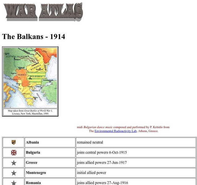
Worldwar1.com: Trenches on the Web: War Atlas: The Balkans 1914
Contains a map of the Balkans, a list of the countries there, and their political positions in World War I.
US Navy
Naval History and Heritage Command: By Sea, Air, and Land
From the Department of the Navy, this site provides a detailed description of naval activities and strategy during the war in Southeast Asia. Great maps and pictures too.
Library of Congress
Loc: Major Events in History: The Treaty of Guadalupe Hidalgo
A synopsis of the events preceding the signing of the Treaty of Guadalupe Hidalgo, plus great pictures and links to excellent maps of the area negotiated for and to the text of the actual document.
PBS
Pbs: American Experience: Building the Alaska Highway
Great site to discover all about the Alaskan Highway and why it was built during World War II. View a video, read a timeline, see a map, and much more.
A&E Television
History.com: Fourth of July
Great reference tool for finding information on the Fourth of July, America's birthday. Provides history of the holiday, videos, maps, and much more.
University of Illinois
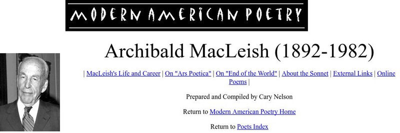
University of Illinois: Modern American Poetry: Archibald Mac Leish
This site houses three poems in full text from the great American poet Archibald MacLeish (1892-1982 CE), as well as criticism on two of his most famous. The three pieces are 'Baccalaureate', 'Two Poems from the War', and 'An Eternity'.
Curated OER
Etc: Maps Etc: War of 1812 Map of Main Operations, 1812
A map of the Great Lakes region showing the main operations during the War of 1812 (1812-1814). It also shows some of the inland waters. This war was between the United States and Great Britain because of "Great Britain's attitude in...
Curated OER
Educational Technology Clearinghouse: Maps Etc: War of 1812, 1812
A series of maps showing the principal campaigns, forts, and battle sites of the War of 1812, including: a map of the northern seat of war in the Great Lakes region of Canada, New York, Pennsylvania, Ohio, and the Michigan Territory; a...
Curated OER
Educational Technology Clearinghouse: Maps Etc: The War of 1812, 1812 1815
A series of maps showing the important sites of the War of 1812-1814 between the United States and England, with insets detailing the northern region of the Great Lakes east to Lake Champlain, the vicinity of Detroit, the vicinity of...
Curated OER
Etc: American Rev War Operations in the West, 1775 1782
A map of the Northwest Territory between the Allegheny Mountains and the Mississippi River and the Great Lakes to the Tennessee River showing the military operations and extent of settlement in the area during the American Revolutionary...
Curated OER
Etc: Chief Scene of Operations French and Indian War, 1754 1755
A map of the eastern Great Lakes region to the Hudson River and Lake Champlain showing the chief scene of operations of the French-Indian War at the outbreak of the war in 1754-1755. The map shows the British and French forts and...
Curated OER
Educational Technology Clearinghouse: Maps Etc: King Philip's War, 1675 1676
A map of Narragansett Bay, Rhode Island, and part of Massachusetts, showing the area of the initial stage of King Phillip's War, also known as Metacom's Rebellion (1675-1676). The map shows the site of Swanzey (Swansea), Mt. Hope...
Curated OER
Educational Technology Clearinghouse: Maps Etc: India, 1792 1804
A map of Hindustan (India) from the end of the Third Anglo-Mysore War (1789-1792) to the Second Maratha War (1803-1804). This map is color-coded to show the British possessions at the time, the territories conquered by the British during...
Curated OER
Educational Technology Clearinghouse: Maps Etc: Seat of War, 1812 1814
A map of the Great Lakes and New England region of North America showing the northern area of conflict during the War of 1812, including the important sites of Detroit, Buffalo, Lewiston, Queenstown, Ogdensburg, Battle of the Thames...
Curated OER
Etc: Northern Region of the War of 1812, 1812 1814
A series of maps showing the northern campaigns, forts, and battle sites during the War of 1812, including details of the campaigns of the Army of the Centre (Lundy's Lane, Beavers Dam, and Burlington Heights), campaigns of the Army of...
Curated OER
Educational Technology Clearinghouse: Maps Etc: The Great Lakes, 1812
A map of the Great Lakes region at the outbreak of the War of 1812, showing the sites of initial English successes, including Fort Mackinaw, Fort Dearborn (Chicago), and Detroit, which was surrendered to the English by General Hull.
Curated OER
Educational Technology Clearinghouse: Maps Etc: Battle of Pultawa, June 25, 1709
A map of the Battle of Pultawa, or Pultava in present day Ukraine, during the Great Northern War. The battle was between the army of Peter I of Russia and the army of the Charles XII of Sweden. This battle, fought on 25th June, 1709,...
Curated OER
Etc: Maps Etc: Europe After the Treaties of Utrecht and Nystad, 1721
A map of Europe in 1721 after the Treaty of Utrecht ending the War of the Spanish Succession, and the Treaty of Nystad ending the Great Northern War between Sweden and the Russians and Danes. The map shows the northern territories of...
Curated OER
Etc: Scene of Operations in the War of 1812, 1812 1815
A map of the Great Lakes Region of North America to the Hudson River showing the northern area of conflict during the War of 1812, including the important sites of Fort Dearborn (Chicago), Battle of Tippecanoe, Detroit, Frenchtown (River...


