University of Groningen
American History: Outlines: Jimmy Carter's Presidency
This site from the University of Groningen takes a general look at the presidency of Jimmy Carter.
Country Studies US
Country Studies: Post Vietnam Foreign Policy
This site discusses U.S. foreign policy after Vietnam encompassed every corner of the globe as Presidents Ford and Carter attempted to work with countries in Eastern Europe, Latin American and the Middle East.
Digital History
Digital History: Three Theories Explaining Imperialism [Pdf]
Read about three theories of Imperialism and how actions by the United States in the late 19th and early 20th centuries were driven by one or perhaps all three of the theories.
Raleigh Charter High School
Mrs. Newmark's Page: Imperialism
This quiz will test your knowledge about imperialism.
Other
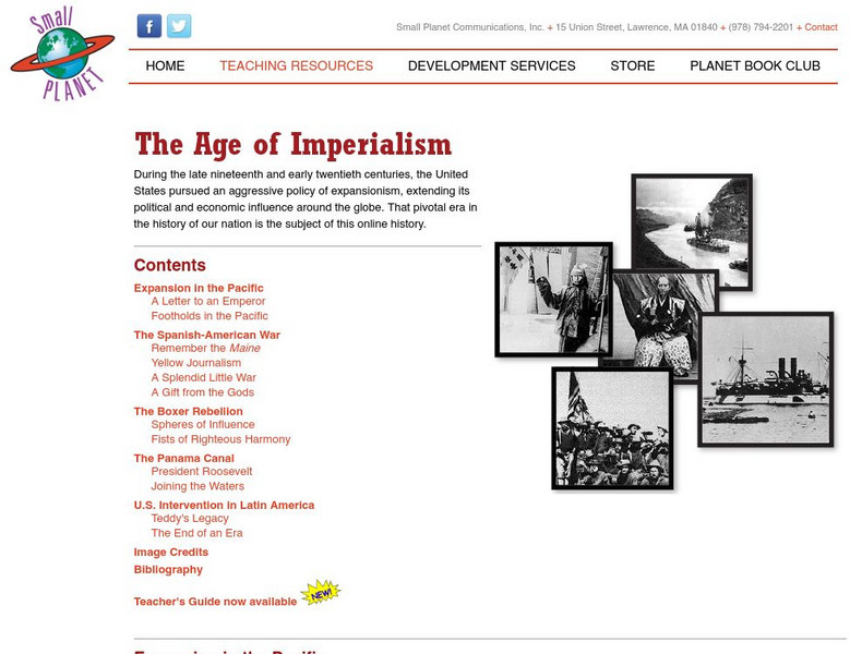
On Line History of the United States: The Age of Imperialism
Online history page containing numerous links to specific incidents of U.S. expansion in the Pacific, Latin America, China, and Cuba.
US Senate
U.s. Senate Committee on Armed Services
The U.S. Senate Committee on Armed Services reviews matters relating to the common defense policy of the United States.
Library of Congress
Loc: America's Story: Theodore Roosevelt
This Library of Congress website provides a brief overview of the life of Theodore Roosevelt (1858-1919), followed by several articles regarding various events in his life and a list of good books written about him.
Curated OER
Panamarrd.jpg (29993 Bytes)
This page is entitled "The Panama Railroad, Chapter XIV" of the book "History of the Panama Canal", by Ira E. Bennett, 1915. It recounts important events of this period (1827-1855) of Panamanian history.
Curated OER
Etc: West Indies and Mexico, 1898 1906
A map of the West Indies and Mexico between 1898 and 1906, showing political boundaries at the time, capitals, major cities and ports, railroads and canals, rivers, terrain, islands, and coastal features of the region. Inset maps detail...
Curated OER
Educational Technology Clearinghouse: Maps Etc: Mexico and Central America, 1910
A map from 1910 of Mexico and Central America showing political boundaries at the time, capitals and major cities, rivers, terrain and coastal features, reefs, and neighboring islands (Cuba and Jamaica). A map note shows the Panama Canal...
Curated OER
Etc: The West Indies and Mexico, 1898 1906
A map from 1907 of Mexico, Central America, and the West Indies (Greater Antilles to Puerto Rico) between the Spanish-American War in 1898 and the Third Pan-American Conference in 1906. The map shows the political boundaries in 1906,...
Curated OER
Educational Technology Clearinghouse: Maps Etc: The Isthmus of Tehuantepec, 1852
A map from 1852 of the Isthmus of Tehuantepec in Mexico, showing the proposed railroad route connecting the Gulf of Mexico and the Pacific. This was an alternative proposal to the construction of the Panama or Nicaragua canals, and was...
Curated OER
Educational Technology Clearinghouse: Maps Etc: United States, 1917
A map of the United States and territories showing the expansion from the formation of the original states to the purchase of the Danish West Indies (Virgin Islands) in 1917. The map is color-coded to show the original states, the states...
Curated OER
Educational Technology Clearinghouse: Maps Etc: Isthmus of Nicaragua, 1901
A map from 1901 of the Isthmus of Nicaragua, showing the proposed route of the Atlantic-Pacific canal from San Juan del Norte (Greytown) on the Caribbean coast to Lake Nicaragua, then to Brito near San Juan del Sur on the Pacific coast....
Curated OER
Educational Technology Clearinghouse: Maps Etc: North America, 1903
A map from 1903 of North America. The focus of this map is the Dominions of Canada, showing the transportation network in from Montreal east to Quebec and Nova Scotia, and west to Vancouver, British Columbia. The map shows the...
Curated OER
Flatarch.jpg (131432 Bytes)
This page is an article from The Panama Canal Review - December 7, 1962, about the flat arch in the ruins of the Church of Santo Domingo (related to the colonial period in the history of Panama). It also has a picture of the Church of...
Curated OER
Educational Technology Clearinghouse: Maps Etc: North America, 1921
A map from 1921 of North America, Central America, Greenland, and the Caribbean showing political borders, capitals and major cities, railroads, canals, mountain systems, lakes, rivers, islands, and coastal features of the region. An...
Curated OER
Educational Technology Clearinghouse: Clip Art Etc: George Whitefield Davis
George Whitefield Davis (July 26, 1839 - July 12, 1918) was an engineer and Major General in the United States Army. He also served as a military Governor of Puerto Rico and as the first military Governor of the Panama Canal Zone.
Curated OER
Educational Technology Clearinghouse: Clip Art Etc: John Hay
(1838-1905) Journalist, historian, poet laureate and paved the way for the building of the Panama Canal.
Curated OER
Panamaflag.gif (8743 Bytes)
Epic site exploring the history, stories, photos, and facts about Panama and its canal. Extremely thorough and interesting.
PBS
Pbs American Experience: Franklin D. Roosevelt: The New Deal
This PBS American Experience site summarizes the domestic policies set in place and carried out by Franklin D. Roosevelt that became known as the Hundred Days.
Curated OER
Educational Technology Clearinghouse: Maps Etc: South America, 1902
A map from 1902 of South America showing the national boundaries at the time. The map shows capitals, major cities, ports, railroads, canals, rivers, and coastal features. Railroads appear as red lines, with important trunk lines shown...
Curated OER
Educational Technology Clearinghouse: Maps Etc: Central America, 1920
A map from 1920 of Central America showing political boundaries at the time, capitals and major cities, railroads, submarine telegraph cables, mountain systems, lakes, rivers, coastal features, banks or reefs, and the islands of Jamaica...
Curated OER
Educational Technology Clearinghouse: Maps Etc: Central America, 1922
A map from 1922 of Central America showing political boundaries at the time, capitals and major cities, railroads, submarine telegraph cables, mountain systems, lakes, rivers, coastal features, banks or reefs, and the islands of Jamaica...


