Beauty and Joy of Computing
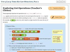
Three Key List Operations
Develop an understanding of the Map, Keep, and Combine operations. The lab leads the class through the exploration of three list operations. Each task contains a self-check to measure scholars' understanding of the operation in the...
NOAA
Mapping the Ocean Floor: Bathymetry
Bathymetry is not a measure of the depths of bathtubs! Through the three lessons, scholars explore two different types of maps and how they are made. The resource focuses on topographic and bathymetric maps and teaching the techniques...
Curated OER
Mapping the Aegean Seafloor
Earth science learners create a two-dimensional topographic map of the floor of the Aegean Sea. They use it to then create a three-dimensional model of the ocean floor features. This comprehensive resource delivers strong background...
Curated OER
Maps
Students investigate three types of maps. In this history lesson plan, students idenitfy different maps and explore how they relate to the area, while keeping climate and topography in mind. They discuss maps used to navigate...
Curated OER
Why All Maps Lie
Eighth graders discover the fundamental advantages/disadvantages of both maps and globes. They see that maps may distort size, shape, distance and direction. They discuss the advantages and applications of 5 types of map projections and...
Curated OER
Weather Lesson Five
Students define a weather forecast, make a forecast using a weather map, identify three prediction guidelines, and explain how computers help to make forecasts. Students make a 24-hour forecast for each of the thirteen states targeted.
EngageNY
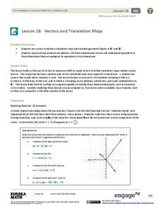
Vectors and Translation Maps
Discover the connection between vectors and translations. Through the lesson, learners see the strong relationship between vectors, matrices, and translations. Their inquiries begin in the two-dimensional plane and then progress to the...
Richmond Community Schools
Map Skills
Young geographers will need to use a variety of map skills to complete the tasks required on this worksheet. Examples of activities include using references to label a map of Mexico, identify Canadian territories and European...
National Science Teachers Association
Using Concept Maps in the Science Classroom
A good concept map requires high thought processes. This makes it a great tool for teaching and evaluating your pupils. A helpful article describes a great approach for teaching young scholars the art of concept map building and how best...
Curated OER
Eastern European Studies
One worksheet, three projects. Learners explore Eastern Europe and mark Eastern European countries on a map. They then collect and record census data on thirteen different countries, and write a 3-5 page expository essay on one of the...
Curated OER
Map Skills
Students create two types of maps. In this map skills instructional activity, students discuss map vocabulary and view maps of Florida. Students draw a free hand map of Florida and include major cities, bodies of water and...
Curated OER
Maps and the Pictures in Our Heads
Geographers of all ages examine different types of maps. They draw maps of their environment, utilizing both three-dimensional and picture maps. They interpret map information, noting how it can sometimes be misleading. Some good...
Curated OER
Mapping Perceptions of China
Students discuss what types of things are included on a map. They compare and contrast maps of China with a map they create and practice using different types of maps. They write analysis of their classmates maps.
Curated OER
What Can a Map Tell You?
Learners investigate how maps can provide useful information about health issues. They study a map to draw conclusions about cholera death in London.
Curated OER
A Model of Three Faults
Students observe fault movements on model of the Earth's surface, find fault movements associated with different types of plate boundaries, research examples of non-plate boundary faults, and research and report on the types of faults...
Mathematics Assessment Project
Middle School Mathematics Test 3
Real-life mathematics is not as simple as repeating a set of steps; pupils must mentally go through a process to come to their conclusions. Teach learners to read, analyze, and create a plan for solving a problem situation. The...
Curated OER
Little Pig, Little Pig
First graders compare versions of the Three Little Pigs. In this comparison lesson, 1st graders read several version of the Three Little Pigs and compare the situations, characters, settings, solutions, emotions and costumes. ...
Curated OER
Volcanoes: Sixth Grade Lesson Plans and Activities
Bring a set of pre-lab, lab, and post-lab lesson plans on volcanoes to your earth science unit. Sixth graders explore the three types of volcanoes found on Earth, plot the specific locations of these volcanoes on a map, and...
Owl Teacher
Introduction to World of Geography Test
Assess your learners on the five themes of geography and the most important key terms and concepts from an introductory geography unit. Here you'll find an assessment with 15 fill-in-the-blank and 14 multiple-choice questions, sections...
Curated OER
Plate Tectonics: First Grade Lesson Plans and Activities
A set of first grade geology lessons focuses on plate tectonics and movement of plate boundaries. During the pre-lab, learners experience three types of plate movement through a kinesthetic demonstration. The lab...
Curated OER
Weather Map
Ninth graders utilize several different types of maps to forecast weather conditions specific areas of the country. Air masses, wind, cloud types, fronts, and the pH of the rain is explored in this lesson.
Curated OER
Be A Perfect Person in Just Three Days- Lesson 7
Students review a book. In this reading comprehension lesson plan, students take a vocabulary and comprehension test. Students complete a book review activity of the book Be A Perfect Person In Just Three Days, complete a...
Curated OER
This Dynamic Earth: The Story of Plate Tectonics
Discuss Earth's tectonic plates at middle school level with an informative presentation. Packed with maps, satellite images, diagrams, and photographs, the slideshow connects with any curriculum focused on plate tectonics. It...
Association of American Geographers
Project GeoSTART
Investigate the fascinating, yet terrifying phenomenon of hurricanes from the safety of your classroom using this earth science unit. Focusing on developing young scientists' spacial thinking skills, these lessons engage...


