Curated OER
United States Map- Map Legend/City Symbols
Students investigate the United States map. In this map skills geography lesson, students explore city symbols on the map legend and identify them. Students use post-it notes to mark various symbols.
Curated OER
Orienteering - Lesson 3 - Topographical Maps and Contour Lines
Learn how to read a topographical map and understand what the contour lines mean. Explore longitude and latitude. Find a cliff, a valley, a mountain peak, and more. This is just one of the ten lessons in this unit on oreinteering....
Curated OER
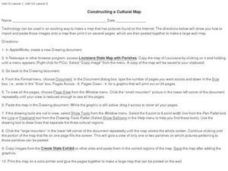
Constructing a Cultural Map
In this constructing a cultural map worksheet, students use cut and paste technology to make a map of Louisiana that has pictures from the Internet.
Curated OER
Two-Step Problems and Money Concepts
Elementary schoolers solve two-step equations and practice money concepts. They solve multi-step addition and subtraction contextual problems and apply money concepts to real life situations. Pupils use pictures and counters to help them...
Curated OER
Communicating With My World - Day Three: Internet
Learners, who are studying ESL, examine the use of web sites. In this web site lesson, students watch a teacher demonstration of different types of web sites. They discuss how much time people spend on the Internet. They take a survey...
Polar Trec
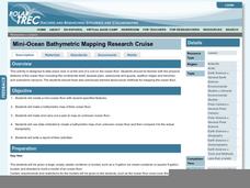
Mini-Ocean Bathymetric Mapping Research Cruise
Middle or high schoolers transform into oceanographers in a week-long simulation. To begin, each group follows directions to create a model of the ocean floor with specified features. Next, the groups prepare to set sail on a research...
EngageNY
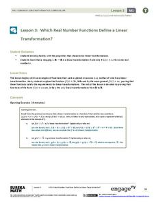
Which Real Number Functions Define a Linear Transformation?
Not all linear functions are linear transformations, only those that go through the origin. The third instructional activity in the 32-part unit proves that linear transformations are of the form f(x) = ax. The lesson plan takes another...
Worksheet Web
Using Pictographs
If one ice cream cone represents three ice cream scoops, and Bob has four ice cream cones, then how many scoops does Bob have? Learners solve these kind of questions with their new understanding of pictographs.
Curated OER
Animal Poetry
Fourth graders write poems that use local wildlife as their inspiration. After a class discussion which produces a list of wildlife that pupils have seen in their town, a review of three types of poetry ensues. They look at how...
National Park Service
News Bearly Fit to Print
There are an average of three human fatalities by bears in North America every year, which is low when you compare it to the 26 killed by dogs and the 90 killed by lightning annually. The lesson encourages researching human-bear...
Curated OER
Putting It on the Map
Students consider the purpose of various types of maps and their different uses throughout history. They create their own maps and reflect on the map-making process.
Curated OER
Our World With MapsQ
Students examine and compare different types of maps. In this map skill instructional activity, students look at neighborhood and national maps on the overhead projector while making comparisons of the symbols and locations. They use a...
Curated OER
Karnaugh Mapping
In this electrical circuit worksheet, students answer a series of 17 questions using a Karnaugh map to generate a Boolean expression, and identify logic gates and functions. This worksheet is printable and the answers are available on-line.
Curated OER
Analyzing Two Dances and Making a Dance Map: The Nutcracker
Students discuss dance elements and create a dance map. They choose a dance theme and incorporate movement into their dance maps and choreography. They also experiment with different types of music.
Curated OER
Maps with a "Spin"
Students, in groups, research and map the effects of a proposed airport three miles outside of town. They prepare a presentation based on a set of maps they make and explains its different points of view from the viewpoints of the town...
Curated OER
How Big is the Playground: Creating a Map
Students create a topographical map of an area outside of the school. In this mapping lesson, students compile data on angles, distances, and key landmarks for a predetermined area on the school grounds to create a map using Geometer's...
Curated OER
Map-A-Buddy
Middle schoolers investigate the concept of tracking and spatial movements of animals in relation to the environment in which they live. They participate in an interactive activity by tracking one another over a pre-defined region,...
Curated OER
Introducing Topographic Maps: Guiding Students from Concrete Models to Graphic Representations
Students interpret topographic maps and infer human activity as it is influenced by the landscape.
Computer Science Unplugged
Tourist Town—Dominating Sets
As an introduction to using a network to determine the fewest number of nodes that meet a given condition, small groups work together to determine the fewest number of ice cream vans, and their locations, to be able to serve the people...
National Wildlife Federation
An Energy Mix: Renewable and Nonrenewable Resources
What did the windmill say about renewable energy? I'm a BIG fan! Lesson three in the series of 12 has classes discuss potential and kinetic energy and then, in pairs, they complete a web quest over the different types of energy...
Curated OER
Finding Meaning in the Badge
Children who are three to five years old study two rank badges from the Qing dynasty to develop an understanding of social rank, language skills, and symbolism. The lesson plan is discussion-based and requires learners to compare and...
Curated OER
Mapmaker, Mapmaker, Make Me a Map!
Young scholars evaluate the different types of historical and geographical information that one can gather through close study of historical maps from the 16th through the 19th centuries. They create their own maps.
MARS - Mathematics Assessment Resource Service
Applying Properties of Exponents
The properties of exponents are all linked together and it is your mathematicians' job to discover and apply those rules. The comprehensive lesson plan begins with a pre-assessment task to check for prior knowledge and then goes into a...
Curated OER
Learning About Maps
Students investigate the many uses and features of maps and globes and locate where they live on both. In this map lesson plan, student play a travel game and create their own maps to explore states, continents, countries, and islands.


