NC State University
Nc State University: Carolina Coastal Science
Explore the Carolina coast with this innovative science site. You'll be asked to investigate issues concerning the fate of a resort threatened by coastal erosion, to judge whether or not it is worth the time and effort to save a...
Enchanted Learning
Enchanted Learning: Inventors & Inventions From the 1700s
Use this site to learn more about early inventors and inventions from the 18th century. This web page offers text and images on various inventors and their inventions. You can also access information about inventors and inventions from...
Wolfram Research
Wolfram Science World: International Date Line
This website provides a good general definition of the International Date Line.
University Corporation for Atmospheric Research
Ucar: Wind
Wind is air moving from a place that has higher pressure to one that has lower pressure. Sometimes wind is just a light breeze and other times it is strong enough to blow the roofs off buildings.
ClassFlow
Class Flow: National Geographic Survey
[Free Registration/Login Required] How much do you know about the world around us? Questions provided by National Geographic Survey. http://www.nationalgeographic.com/roper2006/findings.html
Other
Wild About Gardening: Encyclopedia
Get information on 575 different plant species using the WILD About Gardening Encyclopedia. Information is provided and can be searched under the following categories: Scientific Name,Common Name, Plant Type, Native Province, Zone,...
Curated OER
Educational Technology Clearinghouse: Maps Etc: Pre Colonial Africa, 1872
A map of Africa showing the continent prior to the Berlin Conference of 1885, when the most powerful countries in Europe at the time convened to make their territorial claims on Africa and establish their colonial borders at the start of...
Curated OER
Educational Technology Clearinghouse: Maps Etc: Railroads in United States, 1910
A map from 1910 of the United States showing the railway network and connecting steamship lines. This map distinguishes the transcontinental railroads and secondary lines, and shows the standardized time zones used in 1910. The clock...
Curated OER
Educational Technology Clearinghouse: Maps Etc: Rhode Island, 1872
A map from 1872 of Rhode Island, with map inserts of Providence, Newport, and Block Island. The map shows counties and county seats, principal cities, ports, and towns, railroads, terrain and coastal features, and rivers. Clock symbols...
Curated OER
Etc: Maps Etc: Commercial Map of the United States, 1872
A commercial map from 1872 of the United States showing the principal railroad and steamship routes in the region at the time. The map shows state boundaries and capitals, major cities and ports, submarine telegraph cables to Europe,...
Curated OER
Etc: Maps Etc: The Dominion of Canada and Newfoundland , 1920
A map from 1920 of the Dominion of Canada and Newfoundland (Newfoundland and Labrador were not part of the Canadian Confederation until 1949), showing the provinces at the time, provincial capitals, major cities, towns, and settlements,...
Curated OER
Etc: Maps Etc: The Dominion of Canada and Newfoundland, 1920
A map from 1920 of the Dominion of Canada and Newfoundland (Newfoundland and Labrador were not part of the Canadian Confederation until 1949), showing the provinces at the time, provincial capitals, major cities, towns, and settlements,...
Curated OER
Etc: Maps Etc: The Dominion of Canada and Newfoundland, 1902
A map from 1902 of the Dominion of Canada, showing provinces, province capitals and major cities, railroads, canals, mountain systems, lakes, rivers, and coastal features. Symbols on the map indicate the head of navigable rivers (anchor...
Curated OER
Etc: Maps Etc: Commercial Map: United States, Canada, Mexico, 1904
North American commercial activities including: major agricultural crops (barley, corn, wheat, coffee, tobacco, et cetera) and secondary agricultural crops (oranges, lumber, wine); primary mining extraction (coal, gold, silver,...
Curated OER
Educational Technology Clearinghouse: Maps Etc: Mexico, 1872
A map from 1872 of Mexico, showing states and state capitals, major cities, towns, and ports, railroads, lakes and rivers, mountain systems, terrain, and coastal features. Steamship routes to major ports are shown, with distances marked...
Curated OER
Educational Technology Clearinghouse: Maps Etc: South America, 1872
Physical map of South America with map inserts of the Isthmus of Panama and principal products and sea ports of South America. Included are water currents and routes, railroads, select land elevations, time zones, as well as latitude and...
Smithsonian Institution
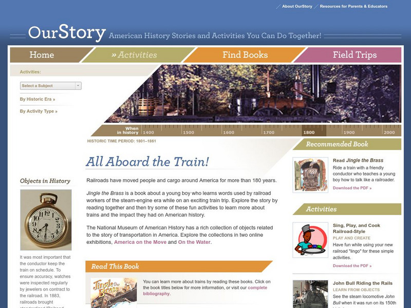
National Museum of American History: Our Story: All Aboard the Train!
Activities and resources, built around a reading of Jingle the Brass by Patricia Newman, for teaching young learners about the importance of railroads in American history.
Alberta Online Encyclopedia
Alberta Online Encyclopedia: Alex Decoteau Edukit: Students
Through a timeline, photographs, history, biography page and game zone, students will enhance learning and understanding of the life and times of Alex Decoteau.
National Council of Teachers of Mathematics
Nctm: Figure This: Can You Run as Fast as a Car?
During the 100 meter dash in the 1988 Olympic Games in Seoul, Florence Griffth-Joyner was timed at 0.91 seconds for 10 meters. At that speed, could she pass a car traveling 15 miles per hour in a school zone?
Curated OER
Etc: Maps Etc: Africa Before the Berlin Conference, 1882
A map of Africa as it was known in 1882 before the Berlin Conference of 1885, when the most powerful countries in Europe at the time convened to make their territorial claims on Africa and establish their colonial borders at the start of...
Curated OER
Educational Technology Clearinghouse: Maps Etc: Central America, 1920
A map from 1920 of Central America showing political boundaries at the time, capitals and major cities, railroads, submarine telegraph cables, mountain systems, lakes, rivers, coastal features, banks or reefs, and the islands of Jamaica...
Curated OER
Educational Technology Clearinghouse: Maps Etc: Central America, 1922
A map from 1922 of Central America showing political boundaries at the time, capitals and major cities, railroads, submarine telegraph cables, mountain systems, lakes, rivers, coastal features, banks or reefs, and the islands of Jamaica...
Curated OER
Educational Technology Clearinghouse: Maps Etc: Central America, 1909
A map from 1909 of Central America showing political boundaries at the time, capitals and major cities, railroads, submarine telegraph cables, mountain systems, lakes, rivers, coastal features, banks or reefs, and the islands of Jamaica...
Other popular searches
- Calculating Time Zones
- World Time Zones
- International Time Zones
- Lessons on Time Zones
- United States Time Zones
- Powerpoint and Time Zones
- Geography Time Zones
- Canadian Time Zones
- U.s. Time Zones
- Time Zones Lessons
- Time Zones and Asia
- Time Zones Manipulatives


