Curated OER
Triangular Trade Route
Eighth graders explore The Middle Passage and the Triangular Trade Route. They read their text to explore the treatment of African slaves and their route to America. After observing maps and pictures of slave ships, 8th graders share...
Curated OER
Triangular Trade and Its Effects
Students investigate the trade routes and investigate goods and services were transported along each route. Given a primary source document, that represents a personal story related to the triangle trade, they discuss given questions.
Curated OER
Triangular Trade and Middle Passage Review Individual Worksheet
Eighth graders explore the key concepts within the Colonization of America, the significance of the Triangular Trade Route, the origin of slavery, and the Middle Passage. After a short discussion and review, 8th graders orally practice...
Curated OER
The Slave Trade
Students map and explore a possible slave trade route. In this slave trade mapping activity, students calculate the distance and amount of time it would take for African slaves to arrive in America.
Curated OER
Colonization
Students explore why the Americas attracted Europeans, why they brought enslaved Africans to their colonies, and how Europeans struggled for control of North American and the Caribbean.
University of California
Antillians: The Growth of Slave Trade
Easy-to-read, colorful maps that show the triangular slave trade routes from 1451 to 1870.
Curated OER
Unesco: Why the Triangular Trade as a Topic?
A nice intro into the topic and history of triangular trade. Includes maps and trade routes. Done as a project for Norwegian students.
British Library
British Library: Caribbean Views
Learn about plantation life during the 18th and 19th centuries by viewing images, maps, and text material in this virtual exhibition from the British Library. Writer Mike Phillips gives his personal interpretation of this exhibit on...
Other
Union College: North Atlantic Trade, 1770
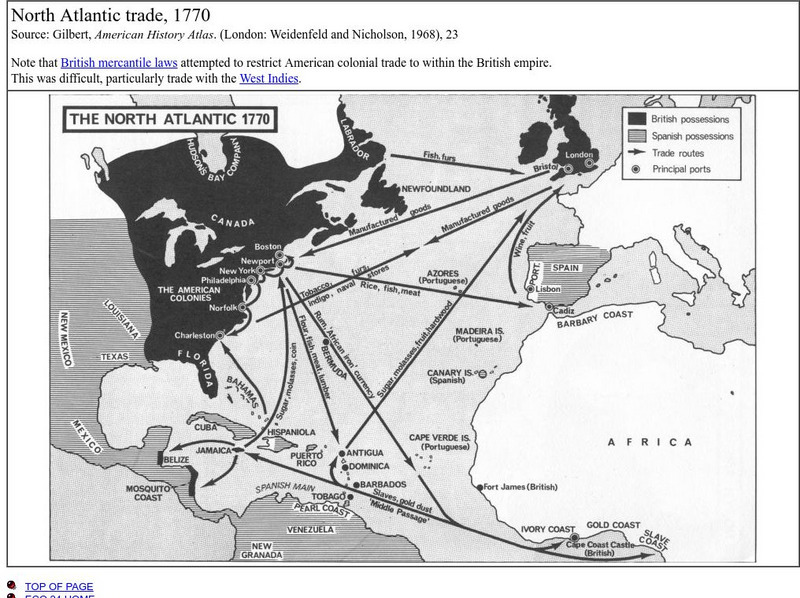
This is a map that shows the trade routes, principal ports, goods being traded, and the areas possessed by the British and the Spanish.


