Curated OER
International Currency Exchange
Students examine coins from around the world and write down their observations. As a class, they discuss the types of symbols used on the coins from different countries and locate the country on a map. To end the activity, they calculate...
Curated OER
Landforms Mobile
Students work together in groups to research the various types of landforms found on the Earth and locate them on a map. As a class, they discuss how the landforms affect the way people live in those areas. To end the lesson, they use...
Curated OER
Word Association Poetry with Visual Thesaurus (or Not)
Young poets get inspiration and guidance for making word association poems with the Visual Thesaurus. Your class could complete this project with nothing more than a pencil and paper as well. A nice one-off for a substitute during your...
Curated OER
Locate Key Information in Nonfiction Text
Interpret nonfiction text with your class. Readers use key information found in nonfiction text to answer questions and problem solve. They utilize the chapter headings, diagrams, glossary, maps, and captions as well as the table of...
Sea World
Saving the Wild: Conservation Around the World
Enhance your unit on conservation, ecosystems, or migration with a series of lessons about ways to save the wild around the world. Kids research types of conservation, such as recycling, and use their geography skills to map the...
Concord Consortium
School Bus Routes
Plan the way to school. Given a map of a school district, class members portray a transportation consultant hired to develop a bus transportation plan that will pick up the eligible riders and get them to school. The plan must contain...
Curated OER
Variables Affecting Earth's Albedo
Young scholars study the variables that affect the Earth's albedo. In this environmental data analysis lesson plan students interpret and graph information and calculate changes.
Curated OER
What's For Dinner?
Eighth graders discover how the location of restaurants affects the future location of different restaurants. Using a fictionous town, they map the locations of all current restaurants and analyze the data to determine what type of...
Curated OER
Trees of Mississippi
Students research tree species found in Mississippi, and record the tree types, numbers of trees, and locations. Students then research the forest industry sites, and determine possible relationships between industry location and tree...
Curated OER
Weather
In this earth science worksheet, students use the clues given at the bottom of the sheet to solve the crossword puzzle related to weather. They identify various cloud types and how they are formed. Students also identify atmospheric...
Curated OER
Exploring Ecosystems
Students examine the characteristics of an ecosystem. They create their own landmass of an ecosystem and creating a map of the area. They develop a brochure sharing information about their new landmass.
Curated OER
Aboriginal Web Design
Young scholars explore world history by participating in a web design activity. In this aboriginal history lesson, students discuss the different jobs associated with designing a web site and identify the types of media that are often...
Curated OER
Gardens Throughout the World
Fourth graders study various aspects of gardens. For this garden lesson, 4th graders discover the location of famous gardens on a map. Students research historic gardens.
It's About Time
Energy from Coal
If plastic is derived from fossil fuels and fossil fuels come from dead dinosaurs, does that mean that plastic dinosaurs are made from real dinosaurs? This lesson goes into depth about coal and other fossil fuels. First the instructor...
Curated OER
Prewriting Strategies
Fourth graders explore various strategies to overcome fears of writing, and utilize a story map as a prewriting strategy. They read and discuss the steps of the writing process, follow the steps along with the teacher as they discuss the...
Curated OER
Westward Expansion
Young scholars locate California and New York on a map and explore available means of travel in the 19th century. Students explore the role of trade in pioneer America and simulate various barter transactions.
Indian Land Tenure Foundation
Indian Trust Lands
An important aspect of studying Native American history is understanding the nature of trust lands. Budding historians will learn that as Native Americans were removed from their home lands, trust lands were provided in the form of...
Curated OER
Adinkra Cloth
Students locate Ghana on a map of Africa and discover features of Ghana culture. They synthesize the importance of Adinkra symbols and cloth to the people of West Africa and design an Adinkra cloth.
Curated OER
Various Industries to Help Hawaii's Economy
Students identify various industries in Hawaii and where those products/services are exported to. They create a timeline which highlights important dates and events of those different industries. Finally, they identify on a map places...
Curated OER
There's a Volcano in my Backyard!
Students utilizing a volcanic hazard map of Mount Rainier, reach conclusions about the potential hazards of future eruptions. They create educational materials about these hazards and what to do if one erupts again in the future.
Curated OER
Culture Regions of the U.S.
Students identify the location of different cultural groups within the United States (agricultural, retirement, urban, etc.) They map these areas and analyze the correlation between the landscape of a given region and the type of...
Curated OER
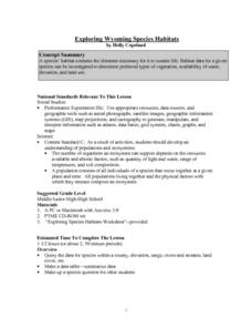
Exploring Wyoming Species Habitats
Learners are introduced to the concept of species habitats and ranges. They introduced to ArcView GIS as a tool for mapping. Pupils use query data for species withina county, elevation, range, rivers and streams, land cover, and etc....
Curated OER
Why the Y2Y?
Learners investigate the proposed route from Yellowstone to Yukon. They listen to lectures about the proposal and the different opinions concerning it. Students research the type of wildlife in the area for the road and they consider how...
Curated OER
Calculating Your Foodometer
Young scholars explore environmental issues by completing a food production class activity. In this carbon footprint instructional activity, students discuss the types of foods they eat, where they come from and what types of methods are...
Other popular searches
- Different Types of Maps
- Reviewing Types of Maps
- Types of Maps Grids
- Types of Maps Worksheets
- 10 Types of Maps
- Three Types of Maps
- 2 Types of Maps
- Types of Maps Australia
- Types of Maps "Australia
- Types of Maps "Australia"
- Maps Types Key Symbols


