Curated OER
Maps In Our Everyday Lives
Learners break into groups and complete a chart about information on maps of their hometown.
Curated OER
Flat Earth Society
Students explore map distortion. In this geography instructional activity, students compare Mercator projection maps to globes in order to understand the strengths and weaknesses of projection maps.
Curated OER
Map Reading
After examining a map from 1803 and 2003, they explore how to become map readers. They describe what they see on the map from 1803 and compare the information to the map from 2003. Students create their own map of the neighborhood that...
Curated OER
Summer Shorts
Want to use sequence maps in your narrative writing unit? Young writers work to create personal narratives about their summer vacation. They write a narrative of their vacation and create a display using summer clothing shapes made from...
Curated OER
Geography of Canada
All about Canada! Learners explore the geography and providences of Canada by watching videos, studying maps and conducting internet research. By the end of this lesson, your class should be able to locate major areas and compare and...
Curated OER
Weather Lesson Five
Students define a weather forecast, make a forecast using a weather map, identify three prediction guidelines, and explain how computers help to make forecasts. Students make a 24-hour forecast for each of the thirteen states targeted.
Curated OER
Guide to Business Process Modelling
Project managers can add another cog in the wheel of understanding. This guide to business process modelling shows how to construct and use a process map to handle major projects. Tip: While the resource is intended for a vocational...
Mathematics Assessment Project
Representing Functions of Everyday Situations
Functions help make the world make more sense. Individuals model real-world situations with functions. They match a variety of contexts to different function types to finish a helpful resource.
Curated OER
Growth of Florida's Railroads
Based on an examination of Florida's railroad system, this multi-step lesson addresses FCAT requirements specific to Florida. After reading a passage, scholars use a map of the state to label railroad systems. They describe the goods...
Curated OER
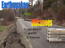
Earthquakes and Volcanoes
Nice pictures, maps and informative diagrams are incorporated into this PowerPoint about earthquake types and the types of waves carrying energy produced. There are a number of pages explaining scientific terminology and diagrams...
Curated OER
Preparing for the WPE
Prepare your soon-to-be graduates to take the Writing Proficiency Examination given at Cal Poly. These slides cover everything from the various types of questions to writing thesis statements. This is more like an overview than a...
Agriculture in the Classroom
A Holiday Tradition: Which Christmas Tree Will You Choose?
Different varieties of Christmas trees provide an interesting way to combine social studies, science, math, and technology. Class members not only research the history of the Christmas tree holiday tradition, they compare and...
SeaWorld
Animal Migrations
Here is a fabulous set of activities for your young scientists. Each lesson contains map, hands-on, and game activities that will help the class understand why and how animals migrate from one place to another. First they'll examine the...
National Wildlife Federation
Quantifying Land Changes Over Time Using Landsat
"Humans have become a geologic agent comparable to erosion and [volcanic] eruptions ..." Paul J. Crutzen, a Nobel Prize-winning atmospheric chemist. Using Landsat imagery, scholars create a grid showing land use type, such as urban,...
Agriculture’s Lasting Heritage
Apples Around Us
Apple tasting launches an investigation of the story and travels of John Chapman, also known as Johnny Appleseed. After listening to his story, class members craft a summary of the tale, chart his journeys on a map, and sample different...
Curated OER
Learn the States and Postal Abbreviations
If you are preparing to cover the 50 states with your class, you don't want to miss this resource. It includes an excellent set of worksheets through which learners practice identifying states from their abbreviations and placing those...
Centers for Ocean Sciences
Ocean and Great Lakes Literacy: Principle 1
Is your current lesson plan for salt and freshwater literacy leaving you high and dry? If so, dive into part one of a seven-part series that explores the physical features of Earth's salt and freshwater sources. Junior hydrologists...
Curated OER
Geologic Mapping I
Students create a geologic map and cross-section of an area of horizontal sedimentary rocks, exposed in several locations. Map must include a complete key or legend with rock descriptions of the various formations.
Curated OER
Cows That Type Friendly Letters
Students engage in a lesson that introduces the parts of a letter. The lesson is taught using a powerpoint presentation with the purpose of integrating technology into instruction. Students create a letter and thinking map to challenge...
Curated OER
Relief Maps
Students study geographical maps and their functions. In this geography lesson students work in groups to build a map to scale.
Curated OER
Cinderella Map Key
Students design a map key in order to show where the different Cinderella stories have taken place. In this map key lesson plan, students place symbols on a map to show the diversity of the stories.
Curated OER
Using Picture Mapping to Improve Student Comprehension
Students draw pictoral representations of a reading selection they read in order to recall information. For this picture mapping lesson plan, students use pictures to comprehend what they read and sequence the pictures as well.
Curated OER
Look for Patterns
In this earthquakes worksheet, students look at maps of earthquake patterns and answer short answer questions. Students answer 12 questions.
Curated OER
Where I Live…
Second graders explore their community. In this social studies lesson plan, 2nd graders use Internet tools to locate their community on a map and then locate where they live.
Other popular searches
- Different Types of Maps
- Reviewing Types of Maps
- Types of Maps Grids
- Types of Maps Worksheets
- 10 Types of Maps
- Three Types of Maps
- 2 Types of Maps
- Types of Maps Australia
- Types of Maps "Australia
- Types of Maps "Australia"
- Maps Types Key Symbols


