Curated OER
Tracking Satellites Using Latitude and Longitude
Students, viewing an Internet site, plot the path of several satellites using latitude and longitude over the course of an hour. They learn the four basic types of satellites and their purpose.
Curated OER
"We're Back ... Eagles Soar!"
Students use information from Internet websites to create a map of where Bald Eagle habitats can be found after being familiarized with the map by the instructor.
Curated OER
The Oregon Trail
Students use maps and diagrams to examine the Oregon Trail. In groups, they create their own poster of the trail showing the different types of artifacts found along the way. To end the lesson, they identify the sources of water and...
Curated OER
Arthur's Nose
Students read a story and complete a story map. In this diversity and acceptance lesson plan, students read Arthur's Nose, make a story map, research Aardvarks, complete a Venn Diagram comparing Arthur's nose to other animals in...
Curated OER
Latitude and Longitude
Students demonstrate how to locate places on a map using a grid. In this map skills instructional activity, students are introduced to latitude and longitude lines. Students define these terms and view a large map of a state. Students...
Curated OER
The Places We Will Go
Second graders demonstrate basic map skills. They each bury a bag of chocolate coins, create a map with directions to find their "treasure," and follow another student's directions to locate a bag of coins.
Curated OER
Understanding Geography
Students create a map of their own neighborhood to show the relationships between the geography of the neighborhood and its economy and culture. They view and discuss an introductory video on how geographers study an area then go out...
Curated OER
Understanding: Geography
Students explore their neighborhoods. In this geography lesson plan, students make a map of their neighborhood. They must include a key, natural terrain, buildings and streets. They also write a descriptive paragraph about their...
Curated OER
This Land Is Your Land, This Land Is My Land
Students review and evaluate the ways land is covered and used in their local community. They consider the environmental effects of the different types of land use. Students act as community planning engineers to determine where to place...
Curated OER
Where in the Latitude Are You? A Longitude Here.
Students distinguish between latitude and longitude on the map. In this mapping lesson, students participate in mapping skills to recognize spatial relationships, and where to find natural resources on the map. Students create...
Curated OER
Lesson 3: Seven Day Road Trip
Students plan a seven day road trip. In this travel instructional activity, students plan a driving trip that includes five major cities or attractions in Florida or another state of their choice. They show the trip on a map, calculate...
Curated OER
Time Zones
Young scholars solve time zone problems and chart travel around the world. In this time zone lesson, students learn about the history of time zones and view a time zone map. Young scholars use the time zone map to solve time...
Curated OER
Sequencing / Story Events
Students read a story and use sentence strips to order story events. In this sequencing lesson, students learn new vocabulary words centered around the story Cloudy With a Chance of Meatballs, preview the story, make predictions...
Curated OER
Forestry and Changing Feelings
Students investigate how the forest affects their daily lives by creating a concept map. In this ecological lesson, students create a concept map linking the forest to the many things they use each day. Students take a field...
Curated OER
Resources of Indiana
Fourth graders examine the resources of Indiana and how they are used to produce goods. In this resources of Indiana lesson, 4th graders explore historical periods in Indiana as they relate to its resources. Students discover that the...
Curated OER
I Can Find that Where? - A Study of Landforms
First graders make landform maps of the United States. In this landform lessons, 1st graders participate in a discussion of local landforms and make a landform map of the United States. They follow the teacher's directions to add plains,...
Curated OER
Producing a concept map for governance of countries in the EU
Students explore, examine and study the terminology associated with governance and discover the types of governance within each EU country. They produce a mind map that concentrates on UK government and monarchy and critique the...
Howard Hughes Medical Institute
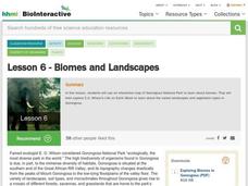
Lesson 6: Biomes and Landscapes
Aside from the amazing animals in Gorongosa National Park, what else is there to discover? The sixth installment in an eight-part themed series contains an interactive map where scholars can learn more about the geographic features of...
Compton Unified School District
How Can We Locate Places?
How can we locate places? Maps, of course! Expose second graders to the tools available in maps and discuss how these tools can help people find locations. Students also look at communities, including what makes a community and the...
Curated OER
Volcanoes: Sixth Grade Lesson Plans and Activities
Bring a set of pre-lab, lab, and post-lab lesson plans on volcanoes to your earth science unit. Sixth graders explore the three types of volcanoes found on Earth, plot the specific locations of these volcanoes on a map, and...
Curated OER
Coral Bleaching in the Caribbean
Young scholars practice analyzing images, maps and graphs from Internet-based educational resources. They explore the correlation between sea surface temperature and coral bleaching. Students comprehend that coral reefs are collections...
Laboratory for Atmospheric and Space Physics
Charting the Progress of New Horizons
In 2006, New Horizons began its mission to fly to Pluto. As it continues its journey, scholars track its progress with the help of an informative website, all the while reinforcing measurement concepts with the construction of a scaled...
British Council
Weather 1
Match weather words with pictures in a weather vocabulary worksheet. Beginning readers look at pictures of various weather patterns and choose/write the word that describes the weather. They create a map and write about the weather...
MENSA Education & Research Foundation
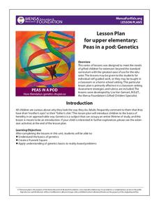
Peas in a Pod: Genetics
Can peas have grandparents? Learn about inherited traits and heredity with a set of activities focused on Mendelian genetics. As your class learns about the process of passing traits along in Punnett squares, they take on the role of...
Other popular searches
- Different Types of Maps
- Reviewing Types of Maps
- Types of Maps Grids
- Types of Maps Worksheets
- 10 Types of Maps
- Three Types of Maps
- 2 Types of Maps
- Types of Maps Australia
- Types of Maps "Australia
- Types of Maps "Australia"
- Maps Types Key Symbols


