Curated OER
Alaska Vocabulary Word Jumble
In this word jumble worksheet, students unscramble the letters to spell words associated with the state of Alaska. Students spell 20 words.
Curated OER
Minnesota Vocabulary Word Jumble
In this Minnesota worksheet, students unscramble the letters in 20 words to spell key cities, people, resources or facts about the state of Minnesota.
Curated OER
Pennsylvania Vocabulary Word Jumble
For this Pennsylvania worksheet, students unscramble the letters in 20 words to spell key cities, people, resources or regions in the state of Pennsylvania. There is a word bank.
Curated OER
New Mexico Vocabulary Word Jumble
In this New Mexico worksheet, learners unscramble the letters in 20 words to spell key places, people, resources or regions of the state of New Mexico. There is a word bank provided.
US Mint
Desert Dwellers
What can a quarter possibly teach young learners about desert ecosystems? More than you might think. After displaying and discussing the included picture of the Arizona state quarter, the class participates in a series of...
Sharp School
Travel Brochure Project
Designing a travel brochure is a classic project that will help your class members develop a variety of skills, such as researching informational texts, designing creative visual products, and communicating what you have learned.
Teach Engineering
What's Wrong with the Coordinates at the North Pole?
Here is an activity that merges technology with life skills as individuals use Google Earth to explore the differences between coordinate systems and map projections. The self-guided instructional activity is the fourth segment in a...
Lerner Publishing
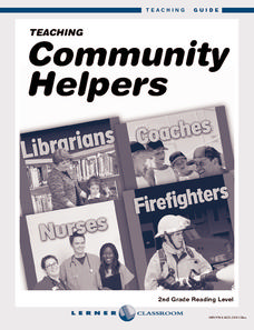
Teaching Community Helpers
Youngsters discover who the leaders in their community are and what it means to build a community in this four-lesson unit.
Curated OER
Ancient Greece: Athens as a City State
Sixth graders find Greece on the map and recognize how the geography of Greece was important in its development. In this ancient Greece lesson, 6th graders research Greece and compare to the civilization of ancient Egypt. Students answer...
Curated OER
The Rise of the City States in Greece
Sixth graders examine Ancient Greece and its development of democracy. In this Greek History activity, 6th graders explore the rise of city-states in Greece and its overall effect on the development of democracy. The class continues with...
Curated OER
Wales: An Interdisciplinary Unit
Students practice basic map and geographic skills as they compare Oregon to Wales. Students color map of Wales and Oregon using color codes to distinguish between land, water, and bordering nations or states, listen to stories and...
Curated OER
Regions and Habitats
Fourth graders identify the different habitats found in the seven regions of the United States. In this ecology lesson, 4th graders write an essay about how humans affect the ecosystem and vice versa. They discuss how changes on one...
Curated OER
Geography, Ecology, and Folklife
Students identify how do geography and ecology influence a region's folklife. Then they investigate this question and consider how an outsider might view their own region in this instructional activity. Students also identify how the...
Curated OER
Caribbean Cooking
Learners complete a unit that explores the cultures of the Caribbean, Puerto Rico, the Dominican Republic, and Cuba through cooking. They follow step-by-step directions of a variety of recipes, create a Caribbean scrapbook or cookbook,...
Curated OER
Project Whistlestop:Missouri Vacation Learning Unit
Fourth graders reserach the state of Missouri. In this Missouri History lesson, 4th graders plan a vacation to a region of Missouri. Students work in collaborative groups to determine all aspects of the trip. Students use math...
Curated OER
Cross Country Adventure
Students practice measurement and geography in this lesson. They build a Lego vehicle using an RCX. They predict how many seconds it will take their vehicle to reach a specific state on the United States of America map that each group of...
Curated OER
Weather Watchers
Students are introduced to an Underground Weather Stations. In groups, they use the internet to research the weather in different parts of the United States locating each city. To end the lesson, they summarize the information they...
Curated OER
China is Unique
Sixth graders study the culture of China by comparing it to that of the United States. They write all questions and notes in a journal. The students access the internet to obtain the information and internet sites are suggested in the...
Curated OER
MAISA and the REMC Association of Michigan
Students complete online research to study geography's impact on weather. In this geography and weather lesson, students research weather in their city for ten days using an online website. Students bookmark the site, enter data into a...
Curated OER
Rivers Run Through It
Using a relief map of New York State, learners answer questions about the distance between different cities, identify bodies of water, and more. First, they discuss vocabulary related to the Hudson River area. Then, they complete a...
Curated OER
Los Angeles, California: ESL Lesson
Take a trip to sunny Los Angeles with this vibrant ESL presentation. English learners study the attributes of L.A, such as beaches, palm trees, and the San Andreas Fault. Perfect for a unit about travel or geography, this is a great way...
Curated OER
The Treaty Trail: Examining an Artist's Perspective
Elementary school leanrners examine artwork from the time period of the United States and Native American treaties. They discuss the causes and effects of the treaties being signed. They also examine how cultural perspective influences art.
Curated OER
Soil: Food Mapping
Students examine the concept of food mapping . In this agriculture lesson plan, students explore food and agriculture systems in the United States in the past and today. Students complete food mapping activities.
Curated OER
Road Trip
Students explore a state, create a travel plan for visiting that state, write postcards from an imaginary trip there, and research selected points of interest in that state.
Other popular searches
- Geography of United States
- Geography United States
- Geography of the United States
- United States Geography Unit
- Physical Maps United States
- United States Geography Maps
- United States Geography 4 6
- Picture United State Maps
- Physical Maps of United States


