Mr. Nussbaum
North Carolina Colony
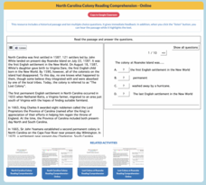
Ten multiple-choice questions make up an interactive practice designed to increase reading comprehension. The topic of the informational reading is the North Carolina Colony.
Curated OER
Geography Review
Third graders name the continent, country, state, and community in which they live. They locate Maryland and Baltimore on a map of the United States.
Curated OER
Geography Overview
Second graders look at the United States often over the next few months. Help them to see how the United States has changed as territories have become states. They may be surprised to know the areas of our country that were territories...
Curated OER
Let Me Tell You About My State
Students develop an awareness of the concepts of the United States through the Amateur Radio communication services by verbally sharing information about their state such as cultures, current events, geography, history and much more.
Curated OER
GEOGRAPHY OF FOOD & FIBER
Students will explain the ways geography determines the crops grown in the United States and other countries, and the resulting trade relationships.1. Discuss trade routes, both ancient and current. Discuss why the most direct route from...
Curated OER
The Golden Door: U.S. Immigration Through Ellis Island
Pupils complete a unit covering various aspects of immigration to the United States through Ellis Island. They plan a fictional trip to America, entering at Ellis Island. and actually visit Ellis Island and the Statue of Liberty.
Curated OER
THE ORPHAN OF ELLIS ISLAND: A TIME TRAVEL ADVENTURE
Fourth graders read the book together and imagine what it was like to come through Ellis Island as an immigrant to the United States. They write a story describing the process at Ellis Island from a first person perspective. They share...
Curated OER
Geological Development of Indiana and the Movement of Peoples Across the State
Fourth graders examine the geological development of the state of Indiana. Using the internet, they interact with the United States Geological Survey. They identify earthquake zones and energy resources in the state. They work...
Curated OER
America the Beautiful
Students listen to a read-aloud discussing the landmarks of the United States. In pairs, they use the internet to research a landmark of their choice. They create a visual aid to be given with a presentation sharing the information...
Curated OER
Let's Play Geography Twister
Young scholars practice geography skills by playing a game based on Twister. Students manipulate their position on a map by placing their arms and legs on the appropriate state or country called out by the teacher.
Curated OER
You Ain't Whistling Dixie
Seventh graders complete a unit of lessons on the Civil War. They identify the factors that led to the Civil War, develop and perform a skit, research and write a report, or create a replica of art from Civil War period.
Curated OER
Point Me to Puerto Rico
Students research the physical features and geography of Puerto Rico as well as locate it on a world map and identify its major characteristics. Pictures and postcards are shown to each class for a visual connection to Puerto Rico as...
Curated OER
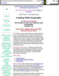
Cooking With Geography
Sstudents use desktop publishing to create "real world" documents from information received from collaborating classes. They create an electronic presentation from Internet research. They experience foods from different states and regions.
Curated OER
Unite These States
Students explore the historical events and people associated with the 13 colonies. The geographic locations of the 13 colonies and ultimately, of all 50 states are investigated.
Curated OER
Civil Engineering: Designing Bridges
Students examine the bridges of the United States. They discuss the concept of balance. They draw their own design of a suspension bridge.
Curated OER
Geography: why is Arkansas a great place to grow rice?
Second graders become familiar with the geography of Arkansas and analyze why it is a good place for certain crops to grow. In this rice lesson, 2nd graders list reasons Arkansas is a good place to grow rice. Students become familiar...
Curated OER
Themes of Geography in the News Contest
Students discuss current events in the world today. After choosing one to focus on, they identify the themes of Geography present in them and practice using new vocabulary. They use the internet to find all of the themes present in...
Curated OER
The Historical Geography of Mesopotamia
Students show how the geography of the Mesopotamia region has impacted the beginnings of civilization. They show how this area has long been the site of the rise and fall of great empires, and how the geography of this region has a lot...
Curated OER
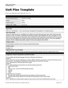
Unit Plan Template
Use this U.S. History unit plan as a template for creating your own! Simply download the resource and edit the text fields with your own customized unit plan. This is a great jumping-off step, especially for newer teachers.
Curated OER
Presidents North and South Timeline
Fourth graders conduct online research to create a timeline of ten US Presidents. In this historical events lesson, 4th graders find online information about the birth dates and birth states of ten US Presidents. This information is...
Curated OER
Geography Words
This learning exercise uses maps of South America and Canada to combine basic geography vocabulary and using prepositions. Students use the maps to answer questions about the locations of various countries on the two maps. This would be...
Curated OER
Studying the States!!!
Students explore the fifty states of America. They also learn the capitals and locations of the states. They also study the population, mottos, flags, and interesting historical facts about each state.
Curated OER
Geography Journey
In this geography worksheet, students use a map of Amtrak train routes (not included) to answer 10 short answer questions. Students describe physical features and landmark cities they would see if traveling by train across the country.
Curated OER
Organizaton of American States Project
High schoolers discover the Organization of American States by researching currents issues in those countries. They create a PowerPoint presentation and share with the class.
Other popular searches
- Geography of United States
- Geography United States
- Geography of the United States
- United States Geography Unit
- Physical Maps United States
- United States Geography Maps
- United States Geography 4 6
- Picture United State Maps
- Physical Maps of United States


