Curated OER
Central America Map Quiz
In this online interactive geography quiz worksheet, students examine the map that includes 22 Central American countries. Students identify the names of the countries in 3 minutes.
Curated OER
Canada Map Quiz
In this online interactive geography quiz activity, students examine the map that includes 13 Canadian provinces and territories. Students identify the names of the provinces and territories in 2...
Curated OER
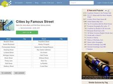
Famous Streets Quiz
In this online interactive geography quiz worksheet, students examine the chart that includes the names of 18 famous streets in the world. Students have 4 minutes to identify the names of the cities where the streets...
Curated OER
State Nicknames Quiz
In this online interactive geography quiz worksheet, learners examine the chart that includes the names of 49 states. Students identify the nicknames of the states in 6 minutes.
Curated OER
Highest Mountain Countries Quiz
In this online interactive geography quiz worksheet, learners examine the chart that includes the elevations of 20 world mountains. Students identify the names of the mountains in 4 minutes.
Curated OER
California Cities Map Quiz
In this online interactive geography quiz instructional activity, students examine the map that includes 12 California cities. Students identify the names of the cities in 3 minutes.
Curated OER
Biggest Cities in Each State Quiz
In this online interactive geography quiz instructional activity, students examine the chart that includes the names of 50 U.S. states. Students identify the names of the two largest cities in each...
Curated OER
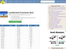
Landlocked Countries Quiz
In this online interactive geography quiz worksheet, students examine the chart that includes details about the population in 44 landlocked countries. Students identify the names of the countries in 5 minutes.
Curated OER
Famous Lakes Quiz
In this online interactive geography quiz activity, students examine the chart that includes details about 15 famous world lakes. Students identify the names of the lakes in 3 minutes.
Curated OER
Biggest Cities in India Quiz
In this online interactive geography quiz instructional activity, students examine the chart that includes the population of 20 Indian cities. Students identify the names of the largest...
Curated OER
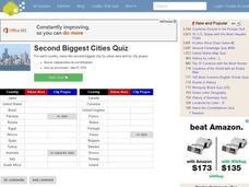
Second Biggest Cities Quiz
In this online interactive geography quiz worksheet, students examine the chart that includes details about 20 major cities in the world. Students identify the names of the cities in 4 minutes.
Curated OER
Countries and Languages Quiz
In this online interactive geography quiz worksheet, students examine the chart that includes 20 languages. Students identify the names of the countries with the greatest number of native speakers in 4 minutes.
Curated OER
City to Country Quiz
In this online interactive geography quiz instructional activity, students examine the chart that includes 20 world cities. Students identify the names of the countries where the cities are located in 4 minutes.
Curated OER
Alaska the Elephant
Students explore an Internet website, locating and matching the shape of an elephant's head to a state in the U.S. They complete an Alaska worksheet, identifying other geographical locations surrounding Alaska.
Curated OER
Winter Holidays Around the World
How much do you know about the holidays around the world? Second graders put their knowledge to the test with a 14-day activity about global celebrations. They read informational text, employ KWL charts, and compare and contrast the many...
Curated OER
Mapping Our Home
Students explore how communities participate in census counting. In this census lesson, students recognize the absolute and relative location of a state and understand ideas about civic life and government.
Curated OER
Lesson 1: Map Data and the Census
Students learn about the history of the census. In this U. S. Census lesson plan, students develop an understanding about how the United States Constitution grants and distributes power and discover how the spatial organization of...
Curated OER
Food For Thought: A Geography of Minnesota Agriculture
Students participate in hands-on activities and discussions about Minnesota's agriculture. They practice reading maps and locating where certain agricultural products are found throughout the state.
Curated OER
International Custody Battle
Students research the relationship between the United States and Cuba by identifying key players and events in Cuban/U.S. history. They also focus on a battle waged between Cuban-Americans in Miami and a father in Cuba over the custody...
Curated OER
Geography Review
Third graders name the continent, country, state, and community in which they live. They locate Maryland and Baltimore on a map of the United States.
Curated OER
Global Geography of Economics: the Indiana Steel Industry
Students research and identify positive and negative effects of imported steel on the Indiana steel industry.
Curated OER
Global Geography of Economics: The Indiana Steel Industry
Students are introduced to how steel is made and investigate the importance of the steel industry. They participate in a role-play that explores the concepts of taxes, tariffs and imports vs. domestic production.
Curated OER
Heritage: Survival and the Geography of Utah
Fourth graders are introduced to the hunting and gathering techniques used by the Native American tribes living in the region that is now Utah. They prepare a role-play of hunting and gathering appropriate to specific geographical areas.
Curated OER
Cultural Anthropology Study Using the Fundamentals of Geography and GPS
Students, in groups, operate the GPS unit, plotting each head stone with accompanying description. Two other students to log in data that corresponds to the given points. One student to note general observations
Other popular searches
- Us Geography Climate
- Us Geography Skills
- Geography Map Skills Us
- Us Geography Pdf
- Us Geography Scavenger Hunt
- Us Geography Northeast
- Us Geography Activity
- Us Geography Slavery
- Us Geography and Economics
- Geography Us
- Us Geography West
- Us Geography Southeast


