Curated OER
Africa: Introduction and Study Guide
In this Africa worksheet, 7th graders answer 26 questions about the geography, economy and climate of the nations of Africa.
Curated OER
The United States and Canada Review Worksheet and Study Guide
In this geography skills activity, students respond to 34 short answer questions about the geographic features and climates found in the United States and Canada.
Curated OER
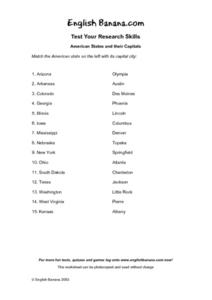
American States and Their Capital- Test Your Research Skills Worksheet
For this geography skills worksheet, students match the American state listed on the left with its capital city listed on the right by drawing a line from one to the other.
Curated OER
Beyond Demographics
Students study the culture of the Dominican Republic. In this Peace Corps lesson, students watch, "Destination: Dominican Republic." Students also examine primary source materials on the nation and discuss their findings.
Curated OER
Scale Skills
For this mapping skills worksheet, students read an excerpt that describes three different types of scales and how to calculate distance on a map. They respond to two short answer questions using the map provided on the sheet and to...
Curated OER
Early America: Jeopardy Game
Fifth graders can put their knowledge of early American life, the 13 colonies, and maps to the test when they play this Jeopardy game. The game covers terminology, famous people, and geography related to Colonial American times. Note:...
Curated OER
Map Skills
Thirds graders reinforce that a map is a drawing that shows what a place looks like from above. They use a map key and symbols to create a map of the school and its neighborhood.
Curated OER
Feudal Powers in Japan
A traditional textbook chapter focuses on feudal powers in Japan, and includes vocabulary, note-taking tips in the sidebar, main ideas, and follow-up assessment questions. It also incorporates opportunities for art...
Curated OER
World Map and Globe-Equator, North Pole, and South Pole
Students identify the Equator, North Pole, and South Pole on a map. In this geography lesson, students use a world map and circle the North and South Pole. Students locate the Equator on a globe and use a map marker to highlight it.
Curated OER
A Tour of Rome Fit for an Emperor
Students travel to Rome. In this geography skills lesson, students explore famous places in Rome with Google Earth tools. Students research the city of Rome and create touring brochures of the city from the perspectives of past emperors...
Curated OER
Touring the Regions of the United States
Fifth graders explore the regions of the United States. In this geography skills lesson, 5th graders examine the landforms, climates, and economies of the regions of the United States. Students conduct Internet research in order to...
Curated OER
Exploring South Carolina
If you are having your students conduct a State study this presentation could be a nice example to show them. This resource provides general information about the geography, animals, and city life one may find in South Carolina. Web...
Curated OER
Introduction to Canada
Ninth graders investigate the country of Canada by examining their media in this geography lesson. They use the Internet to research Canadian newspapers and analyze a topic covered by both US and Canadian media sources. After comparing...
Curated OER
The Ethics of Outsourcing to China
After viewing clips from a documentary on factory work in China and US outsourcing, learners have a fishbowl discussion. They work in groups to build both personal points of view and strong arguments on the effects of outsourcing in...
Curated OER
Understanding Latitude and Longitude
Teaching learners about latitude and longitude can get a little complicated. Present the concept by first representing it as a graph. Just like finding a location on a graph using the x and y-axis, learners will be able to locate items...
Curated OER
Roman Holiday in Google Earth
Young scholars plan an itinerary for an educational trip to Rome. In this research skills lesson, students use Google Earth to conduct research for their project in their travel teams. Young scholars also set up blogs to share their...
Curated OER
Crowley's Ridge: An Upland in the Lowlands
This clever lesson combines elements of geography, art, literature, and storytelling. Pupils take a close look at the six geographical regions of Arkansas, and pay close attention to Crowley's Ridge - which is one of the six. In groups,...
Curated OER
Arkansas: A Changing Climate, a Changing Land
Here is a lesson plan on the climate zones and geography of Arkansas. In it, learners look at maps (embedded) of different climate zones found throughout Arkansas. They engage in discussions regarding how global warming and climate...
Curated OER
Teacher Notes
Gathering information, distinguishing between arguments, preparing an oral presentation; these skills are fostered as 10th graders explore aspects of global trade and politics. They use the Internet to gather information about NATO, The...
Curated OER
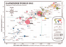
Gapminder World 2012
Here is a very interesting infographic that compares the average life expectancies, per capita incomes, and population sizes of every country in the world in 2012.
Education World
The African American Population in US History
How has the African American population changed over the years? Learners use charts, statistical data, and maps to see how populations in African American communities have changed since the 1860s. Activity modifications are included to...
NOAA
Why is Hawaii's Ocean Important?
Studying the oceans? Focus on Hawaii's ocean with a resource packed with activity-based worksheets. Everything from products that come from the ocean to the abundance of plants and animals that call the ocean their home, Hawaii's ocean...
Curated OER
Amazing Planet DVD-Video Assignment
In this geography skills worksheet, students watch the National Geographic video "Amazing Planet." Students then respond to 13 short answer questions about the content of the video.
Curated OER
Europe To The Max DVD: Four Great Cities of Europe Questions
In this geography skills worksheet, students watch the video "Europe to the Max." Students then respond to 18 short answer questions about London, Amsterdam, Brussels, and Paris.


