Curated OER
How the Great Salt Lake Relates To Us
Third graders name at least three resources that come for the Great Salt Lake. They describe at least one product that is made from each resource. They name and locate on a map at least five different geographic regions where Great...
Curated OER
Race and Ethnicity in the United States
Students explore race and ethnicity as it is defined by the U. S. Census Bureau. They compare data from 1900, 1950, and 2000 and identify settlement patterns and changes in population. In groups, they map these changes and discuss...
Smarter Balanced
Growth and Expansion of America
Despite the difficulty of travel, the US expanded significantly between the 1800s and the early 1900s. To prepare for a performance task assessment on the rapid expansion of the US in the 1800s, class members engage in a...
Curated OER
Did You Know: Facts on Acadians in Louisiana
As an overview of Acadians in Louisiana, this resource could be useful. It could also be used as an example for students designing their own presentations relating to a state. It has an interesting way of presenting information through...
American Battle Monuments Commission
Americans in Great Britain: 1942-1945
Watch the pivotal moments of America's presence in embattled Britain during World War II with an exceptional interactive tool. From personal stories about life on the front lines to a map that tracks every group and division...
K20 Learn
Filling Our Land with Landfills: Solid Waste Disposal
Though it comprises only 5 percent of the world's population, the US generates 40 percent of the world's waste. Scholars learn about landfills, their safety, and other solid waste methods. They use experiments and research to learn more....
Constitutional Rights Foundation
Refugees from the Caribbean: Cuban and Haitian “Boat People”
Should refugees fleeing poverty be allowed the same entrance into the United States as those fleeing persecution? High schoolers read about US foreign policy in the late 20th century regarding refugees from Cuba and Haiti, and engage in...
Curated OER
United States Map
Students compare the United States on a globe and on a map. In this map lesson, students relate the sizes of the continents and locate the United States. Students identify the location of the continental US as well as Alaska and Hawaii.
Curated OER
Story Mapping: Guide for Cross-Disciplinary Application
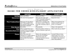
In this story mapping instructional activity, students read how story mapping can apply to 3 different areas of study: history, English and science lab. The components of story mapping that are included here are setting, characters,...
Curated OER
Mapping the Border
Students create maps of the borderland region. They decorate their maps with colors, pictures, icons, scenes, words that reflect their understanding of the character and history of the borderland.
Curated OER
Lesson 8: Changes in Deerfield, Massachusetts Shown in Maps
Eighth graders study maps of the same area from different time periods which show the ways in which the land stayed the same, and the ways this New England village changed over the years.
Curated OER
Mapping It Out
Fourth graders examine various aspects of the environment of Utah. In groups, they create four maps of Utah, based on temperature, precipitation and elevation. To end the lesson, they are asked a question as a group and use their maps...
Curated OER
Weather Maps
Students explain the collection of weather data as presented in different formats. They use appropriate terminology related to weather maps and use the Internet to capture weather data from a city of choice and present a TV style weather...
Curated OER
Lesson 1: Map Data and the Census
Young scholars learn about the history of the census. In this U. S. Census lesson plan, students develop an understanding about how the United States Constitution grants and distributes power and discover how the spatial organization of...
Curated OER
Mapping Constellations
Students become familiar with constellations. In this space science lesson, the teacher introduces constellations by showing students the star patterns and reading myths. Students, observe the stars nightly, then choose one constellation...
Curated OER
Dos mapas de Florida, el Caribe y parte de Sur America
What can maps tell us about the past? Find out with a Spanish lesson that incorporates geography. After examining maps individually, comparing two old maps of Spanish Florida and writing notes in the provided Venn diagram, pupils pair up...
PBS
An Attack on Syria- What Would You Do?
Has United States military intervention in the conflicts of other countries always been warranted? After reviewing a brief background on contemporary US conflicts and reading articles describing the civil war in Syria, your learners...
Advocates for Human Rights
A Global Perspective on Immigration
To gain a global perspective on immigration, groups investigate and create a map of the migration patterns in Africa, Asia, Europe, Latin America, and the Middle East. Class members then examine the background, immigration history, and...
Indian Land Tenure Foundation
More Tribal Homelands
Here is a very fun idea that introduces young learners to how geographical location affects cultural development. They are introduced to four areas where Native Americans have lived in the past by reading stories and examining images....
Curated OER
Just the Facts, Ma'am
Elementary learners identify the main elements of story structure and form questions to summarize their reading. They listen as the teacher reads a story and then write questions to determine (1) main characters, (2) setting, (3)...
Teach Engineering
Incoming Asteroid! What's the Problem?
Oh, no! An asteroid is on a collision course with Earth!. Class members must rise to the challenge of designing a shelter that will protect people from the impact and permit them to live in this shelter for one year. In this first lesson...
Cornell University
Too Much of a Good Thing?
Continuing their study of beneficial insects, young entomologists discover where in the world some of these bugs are. By labeling, coloring, and using the scale on a map, pupils explore the territories and arrival of the Asian lady...
Statistics Education Web
The United States of Obesity
Mississippi has both the highest obesity and poverty rate in the US. Does the rest of the data show a correlation between the poverty and obesity rate in a state? Learners tackle this question as they practice their skills of regression....
Other popular searches
- Us Map 13 Colonies
- Us Imperialism Map Activity
- Us Map Skills
- Geography Map Skills Us
- Blank Us Maps
- Northeast Us Map
- Northeast Us Map Skills
- Map of Us
- Us Maps of States
- Us States Map Color
- Us Map Activities
- Us States Map Florida


