Curated OER
Concept Map
A blank concept map graphic organizer helps learners get their information, thoughts, and ideas organized. One initial concept splits into three sub-topics, which then provide a larger section for more details.
Curated OER
Reading Weather Maps
Fourth graders the symbols that are used on weather maps. They develop five day forecasts based on information they gather from weather maps in the newspaper and on the Internet.
Curated OER
US: Midwest Region
In this United States political map worksheet, students examine the state boundaries of the Midwestern Region. The map also highlights each of the state capitals denoted by stars.
Curated OER
US: Northeast Region Map
In this United States political map activity, students examine the state boundaries of the Northeast Region. The map also highlights each of the state capitals denoted by stars.
Curated OER
US: Northeast Region: Unlabelled
In this United States political map worksheet, students examine the Northeast Region state boundaries. The map also highlights each of the state capitals denoted by stars.
Curated OER
Walking on Maps
Young scholars are introduced to the various types of maps and their functions. As a class, they play a game similar to twister to review map concepts. They answer questions about the map and use the internet to view larger maps of the...
Curated OER
US: Midwest Region Map
In this U. S. outline map worksheet, learners examine boundaries of the Midwest Region states and the placement of the capital cities. This map is labeled.
Curated OER
South US Region Map
In this United States regional outline map, students examine the state boundaries of the states in the Southern Region. Capital cities are denoted with stars.
Curated OER
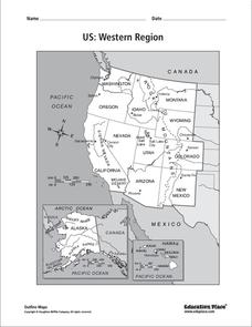
US: Western Region Map
In this United States Western Region instructional activity, students examine the state boundaries and landforms found in this region. The map also highlights each of the state capitals.
Curated OER
Story Map
In this reading worksheet, young scholars recall important story elements by filling out a simple story map. Included are setting, author, characters, beginning, middle and end.
Curated OER
Examining Character Traits through Character Mapping
Some of what we know about a character is directly stated. Some of what we know is inferred by events in the story. Character maps help primary learners recognize the difference. After modeling with a story your class has read, pupils...
Curated OER
Hawaii: A Stolen Star
Explore the islands of Hawaii. Investigate Hawaiian culture and compare their personal traditions to Hawaiian traditions. They locate Hawaii on a map and research the history of Hawaii.
Curated OER
Early America: Jeopardy Game
Fifth graders can put their knowledge of early American life, the 13 colonies, and maps to the test when they play this Jeopardy game. The game covers terminology, famous people, and geography related to Colonial American times. Note:...
Rainforest Alliance
Knowing the Essential Elements of a Habitat
To gain insight into the many different types of habitats, individuals must first get to know their own. Here, scholars explore their school environment, draw a map, compare and contrast their surroundings to larger ones. They then...
CK-12 Foundation
Direction on the Earth: Using a Compass
Navigate the world of orienteering in an informative interactive. Earth science scholars learn practical direction skills, such as proper polar coordinates and pairing compasses with maps. The interactive map allows them to practice...
Rice University
U.S. History
How did the discovery of the Americas change the world? A US history textbook covers topics such as the Americas, changes in European society, and the trans-Atlantic slave trade. Young academics also complete the assessment included in...
Teach Engineering
Projections and Coordinates: Turning a 3D Earth into Flatlands
Introduce your class to map projections and coordinates, the basics for the work done in a GIS, with an activity that uses Google Earth to challenge learners to think about the earth's shape.
New York State Education Department
US History and Government Examination: January 2017
Looking for a resource that tests both US History and government? Here's a test that serves as a great way to test comprehension of complex concepts by using a variety of question formats and covering a wide array of topics. The...
New York State Education Department
US History and Government Examination: January 2012
What led to the United States Civil War? Interested historians consider a variety of political, social, and economic factors using primary sources and an essay prompt in an authentic high-stakes test. Primary sources include political...
New York State Education Department
US History and Government Examination: January 2011
The presidencies of John F. Kennedy, Richard Nixon, and Ronald Reagan were defined by the Cold War. Using primary source documents and scaffolded analysis questions, pupils explore the effect the Cold War had on these presidencies. A...
New York State Education Department
US History and Government Examination: June 2010
Just how successful were the reform movements of the ninteenth and twentieth centuries? Using documents ranging from the writings of Mother Jones to the marriage vows of Lucy Stone, individuals consider the question in a scaffolded...
Curated OER
Exploring Earth Through Maps and Technology
In this maps worksheet, students read 3 pages of detailed information about maps, latitude, longitude, topography, satellites and global positioning. Students then answer 10 questions. There is also a research project assignment available.
Curated OER
The Water Around Us
Students discuss importance of reading maps and knowing about the geography of the United States, and locate bodies of water on different types of maps and examine how they are used in the state or local community.
Curated OER
Tooling Around Arizona: Reading Arizona Maps
Students research Arizona maps. In this map lesson, students discuss map titles, scales, directions, elevation, and symbols. The class will examine topography, landforms, and rivers found on an Arizona map.
Other popular searches
- Us Map 13 Colonies
- Us Imperialism Map Activity
- Us Map Skills
- Geography Map Skills Us
- Blank Us Maps
- Northeast Us Map
- Northeast Us Map Skills
- Map of Us
- Us Maps of States
- Us States Map Color
- Us Map Activities
- Us States Map Florida


