Curated OER
Weather Maps
Students interpret information on a weather map in order to construct a graph, and discuss how the weather impacts their lives.
Curated OER
Learning to Read a Map
First graders identify the map and globe symbols: Cardinal Directions; Compass Rose; Mountains; Rivers; Lakes; Towns; Roads.
Curated OER
Is Urban Sprawl Causing Us To Lose More Than Ground?
Students map the changes that occur in the land as a result of urban sprawl. They explore the problems that paving and building have on the watershed and the habitats on the Northshore.
Curated OER
Learning to Read a Regional Map
Students locate the local community, surrounding communities and major geographic features of the SE Utah and the Four-Corners region on a map, after receiving direct instruction.
Curated OER
Geographical Skills-- Map Scale
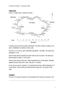
For this maps worksheet, students study a simple map and the scale in kilometres. Students read the directions and answer one question. Students then look at a sketch map of a town and answer 2 questions. Students also read how to show...
Curated OER
Introduction to Canada
Ninth graders investigate the country of Canada by examining their media in this geography lesson. They use the Internet to research Canadian newspapers and analyze a topic covered by both US and Canadian media sources. After comparing...
Curated OER
Teaching With Documents: U.S. Constitution Workshop
What does it mean to be American? Explore the constitution and what it really means to be a citizen here. First, learners of all ages will investigate different primary source documents. Then, they establish each document's...
Curated OER
California's Golden History: 1848-1880
Using a variety of online resources, learners study life and society in California during the gold rush. They use a map to identify area where gold was located, explore pre-selected websites, describe mining practices, and create an...
Indian Land Tenure Foundation
More Tribal Homelands
Here is a very fun idea that introduces young learners to how geographical location affects cultural development. They are introduced to four areas where Native Americans have lived in the past by reading stories and examining images....
Curated OER
Arkansas: A Natural State
Here is a wonderful lesson on natural resources found in Arkansas which is designed for kindergartners. The lesson could be easily adapted for any state. Some clever in-class activities, games, and a song are included in this...
Polar Trec
Global Snow Cover Changes
Snow is actually translucent, reflecting light off its surface which creates its white appearance. Pairs or individuals access the given website and answer questions about snow cover. They analyze graphs and charts, examine data, and...
Channel Islands Film
Cache: Lesson Plan 1 - Grades 9-12
Archaeologists have discovered a cache of Native American relics. They want to preserve these relics by removing them from the rapidly eroding site to a lab where they can be studied. Native American traditions demand that the items...
US Mint
Symbols in My Eyes
Explore the hidden meanings behind the images on US currency with this elementary school lesson on symbolism. Starting with a class discussion about symbols, children go on to brainstorm different objects that represent the Unites...
Curated OER
United States Map- Rivers
Learners learn about rivers. In this maps lesson, students describe rivers and what human activities take place in a river. Learners use a map to locate the rivers in the United States.
Curated OER
Mapping Our Home
Learners explore how communities participate in census counting. In this census lesson, students recognize the absolute and relative location of a state and understand ideas about civic life and government.
Curated OER
Mapping China
Students identify cities in China on a map. In this map skills lesson, students locate the continent of Asia and the country of China. Students use a blank map to label China and bordering countries.
Curated OER
The Vietnam War: Geopolitical map and US Involvement
High schoolers identify the important geographic and political locations on a map of Vietnam, Laos, and Cambodia. They draw and label 19 items of geographic and political importance. Students are introduced to the Vietnam War through...
Curated OER
Hos Do the Jaguar and Howler Monkeys in Belize Depend on Us?
First graders access the internet and use the sites provided to research Belize, and in particular, the Howler Monkey and Jaguar. Students participate in activities/centers utilizing the information they discovered.
Curated OER
How Does Your Garden Grow? Discovering How Weather Patterns Affect Natural Cycles
For the warm-up in this cool climate lesson, you will need to click on "Mapping" and then "US Mapping" once you arrive at NOAA's "US Climate at a Glance" page. Earth science explorers realize that 2012 was a warm winter for us. They read...
Teach Engineering
Let's Get it There Fast
Are planes the best shipping method? Using maps, pupils determine the fastest mode of transportation between two cities. Given a list of items to ship, groups decide the best shipping method to finish the 18th segment of a 22-part unit.
Columbus City Schools
Geological Effects of Plate Tectonics
Don't get your classes all shook up about plate movement, instead use a thorough unit that guides learners to an understanding of plate tectonics. The lessons incorporate a study of the types of plate boundaries and their effects on the...
College Board
2003 AP® Human Geography Free-Response Questions
What role has tourism played in changing the landscape of a country? How do human migration patterns affect a nation? To what extent can urban development patterns help us understand our cities? Learners explore these ideas and more...
Curated OER
Extreme Weather and Mapping
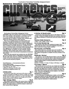
For this environment worksheet, learners read an article about extreme weather conditions and mapping it out. They respond to 10 multiple choice questions about what they read. Then, students explain how droughts can occur and the...


