Curated OER
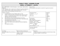
ESOL School Map Identification
Pupils review a school map and identify areas along with vocabulary words. They label a map as a class then create corresponding flash cards and practice new vocabulary flash cards in pairs.
Curated OER
From Home To School
Learners locate and use internet maps to trace a route from their home to school. They calculate the distance of the route using the map legend then determine the distance they travel to school and back in a regular school week and over...
Curated OER
Map Making
First graders explore maps to realize the concept that maps are simply small representations of a much bigger picture. They discuss the importance of maps in everyday life, examine a map of the school, and then make a map of their...
Curated OER
United States Map Quiz
In this online interactive geography quiz worksheet, students respond to 50 identification questions about the shapes of countries shown. Students have 5 minutes to complete the quiz.
Curated OER
Cherstey: What was Cherstey like in the middle ages?
Students examine maps of a medieval village. For this medieval town lesson, students identify major buildings and make inferences about village life. Students could draw a modern day map of medieval Cherstey.
Curated OER
Oceania Map Quiz
In this online interactive geography quiz worksheet, students respond to 14 identification questions about Oceania. Students have 2 minutes to complete the quiz.
Curated OER
Australia Cities Map Quiz
In this online interactive geography quiz worksheet, students respond to 17 identification questions regarding Australian cities. Students have 3 minutes to finish the timed quiz.
Curated OER
Chinese Cities Map Quiz
In this online interactive geography quiz instructional activity, students respond to 10 identification questions about Chinese cities. Students have 3 minutes to complete the quiz.
Curated OER
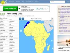
Africa Map Quiz
In this online interactive geography quiz activity, students respond to 53 identification questions about the countries of Africa. Students have 6 minutes to complete the quiz.
Curated OER
Changing Images of Childhood in America: Colonial, Federal and Modern England
Students compare and contrast maps of New Haven, Connecticut from today and the past. After taking a field trip, they draw sketches of the types of architecture and discuss how the buildings have changed over time. They read journal...
Curated OER
Claiming Land
Students examine several European maps with conflicting representations of the same geographic region. They uncover why different European nations produced different maps. In addition, they determine the role maps played in helping...
Curated OER
Spanish Cities Map Quiz
In this online interactive geography quiz worksheet, students respond to 11 identification questions about Spanish cities. Students have 3 minutes to complete the quiz.
Curated OER
Community Map
Students examine the relationship they have with the community and the location of the community in relationship to other communities. They practice using a map of their community and photographs to recongize the area.
Curated OER
Watershed Investigations
Pupils explore the components of a watershed and the factors that affect it. They read a topographical map and use geometry to determine the area of a watershed. Students estimate the volume of a body of water and perform runoff...
Curated OER
Do You Know Your Story Grammar?
Young scholars are introduced to the concept of story structure as a way to aid in reading comprehension. They identify the main parts of the story as they read. Students create a story map of the main plot points of their reading.
Curated OER
Let's Take a Trip!
Sixth graders plan trip for family of four, and choose best travel plan by studying maps, considering different routes, and visiting Web sites to get airline and travel schedules.
Curated OER
Fun with Summarizing
Students practice summarization by creating a story map. After reading Freckle Juice, students working in groups, create a story map of the main events of the story. Groups use their story maps to summarize a chapter of the story and...
Curated OER
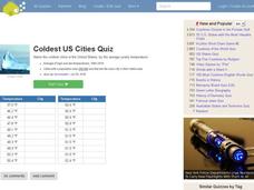
Coldest US Cities Quiz
In this online interactive geography quiz worksheet, students respond to 20 identification questions about the coldest cities in the United States. Students have 4 minutes to complete the quiz.
Curated OER
Biggest US City by Letter Quiz
In this online interactive geography quiz instructional activity, students respond to 26 identification questions about U.S. cities. Students have 5 minutes to complete the quiz.
Curated OER
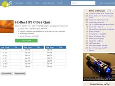
Hottest US Cities Quiz
In this online interactive geography quiz worksheet, students respond to 20 identification questions about the hottest cities in the United States. Students have 4 minutes to finish the timed quiz.
Curated OER
One Country's Slave Trade
Students examine the slave trade. In this research skills lesson plan, students research the slave trade in a selected country. Students use databases to locate pertinent information in order to prepare an oral presentation.
Curated OER
Students Slide to School on Air-Powered Sled
Students locate the Great Lakes on a US map, then read a news article about a sled being used as a wintertime school bus in Wisconsin. In this current events lesson, the teacher introduces the article with a map and vocabulary activity,...
Curated OER
The Desert Alphabet Book
Students explore world geography by researching a science book with their classmates. In this desert identification lesson, students utilize a U.S. map to locate the geographical locations of deserts. Students create an oral report based...
Curated OER
War, and Peace?
Students consider how the war in Iraq has changed life for Iraqis. In this current events lesson, students visit selected websites to investigate how the war has affected the citizens of Iraq and participate in a map skills game.
Other popular searches
- Geography Map Skills Us
- Northeast Us Map Skills
- Us Map Skills Sheet
- Western Us Map Skills
- Map Skills About Us Census
- Southeast Us Map Skills


