Richmond Community Schools
Map Skills
Young geographers will need to use a variety of map skills to complete the tasks required on this worksheet. Examples of activities include using references to label a map of Mexico, identify Canadian territories and European...
Curated OER
All Quiet on the Western Front
Students use unitedstreaming and Google Earth to investigate World War II and All Quiet on the Western Front. In this novel and technology lesson, students view a video about the novel using unitedstreaming video, visit the given...
Curated OER
Getting to the Core of World and State Geography
Students create topography relief maps. In this geography skills lesson, students review geography core knowledge skills, design and make a state relief map, and compile a student atlas.
Curated OER
What if the Mormons had not come to Utah?
Fourth graders use critical thinking, evaluation, and geography skills to find alternative locations that Brigham Young could have taken the Mormons to settle.
Curated OER
California's Golden History: 1848-1880
Using a variety of online resources, learners study life and society in California during the gold rush. They use a map to identify area where gold was located, explore pre-selected websites, describe mining practices, and create an...
Curated OER
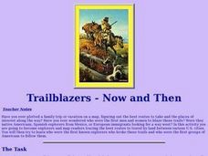
Trailblazers - Now and Then
Learners, working in pairs, use maps to determine the most efficient routes between two cities. They research which route would have been used by early trailblazers. They present a first person account of one of the trailblazers place in...
Curated OER
The Ie Storm 1998: Maps and facts activity
Middle schoolers investigate the St. Lawrence River Valley, ice Storm of 1998. In this middle school mathematics lesson, students interpret ice storm data from tables and maps. Middle schoolers write about their own...
Curated OER
Learning About Location: Charting the Path of the George W. Elder
Students acquire a working knowledge of the geographical concepts: absolute location, relative location, longitude and latitude. They analyze primary sources that shows the physical and human characteristics of the places along the 1899...
Curated OER
Making a Brand for Ourselves the "Cowboy" Way
Students define cowboys and learn about their roles on rangelands. In this rangeland instructional activity, students define cowboys and cowgirls and complete a KWL chart. Students read Cattle Kids and Til the Cows Come Home....
Curated OER
Great Basin Tribes- Use of Land for Sustenance
Students explore four Native American tribes from Nevada. In this Native American history lesson, students identify and generate important corresponding attributes of the Southern Paiute, Northern Paiute, Washoe, and Western Shoshone...
Curated OER
Trailblazers- Now and Then
Students examine and study the routes of trailblazers. In this American history lesson, students find a route on a map and compare that to the route of trailblazers. Students will then compare that map with a topographical map to...
Curated OER
Controlling the Flow of the Colorado River: A Study of Dams
Students research and map the Colorado River and its dams and predict the effects of a dam on an area. They suggest reasons a dam would be built and compare the Colorado River system with other major river systems within the US and...
Curated OER
A Fiedl Study of an Integral Species
Students compile baseline population information on a local species. They design and conduct a scientific investigation of a local species. Students interpret, analyze and communicate results based on sound scientific and mathematical...
Curated OER
States and Capitals, Mountains and Rivers
Students identify geographical locations in the midwestern United States. In this geography lesson, students identify 12 states and capitals and geographical features in the region by using U.S. maps. Students use blank maps to fill in...
Curated OER
Four Immigrant Groups: Their Lives and Music
Fourth graders examine the experiences of four immigrant groups. Class members brainstorm a list of misconceptions of those groups and discuss if these perceptions are still present today. Using maps, groups locate the countries of...
Curated OER
Louisiana History-Unit 4: Early People of Louisiana and a Meeting of Different Worlds
The Poverty Point Culture of Louisiana is described in detail within four slides of this six-slide PowerPoint. Four detailed paragraphs help describe the economic legacy that existed in Louisiana. A table, map, and photo are included to...
Curated OER
The Cold War (1945-1991): An Ideological Struggle
Covering the main topics of the Cold War, including some excellent discussion points on the methodologies of the Soviet and Eastern Bloc nations versus the US and Western Democracies, this presentation is a good way to introduce the...
Curated OER
The Early Cold War: 1947-1970
With a combination of images, maps, and valuable information, this presentation is a strong resource for a history class that is coming out of a WWII unit and into a Cold War unit. Some points are outlined for students, while others are...
Curated OER
World War I
Eighth graders examine the condition of the world from 1880 until the start of World War I. After watching a PowerPoint presentation, they discuss the causes and effects of the war and complete a study guide with a partner. To end the...
Curated OER
Regions of the US: Gulf Stream, States and Their Capitals
Fifth graders identify one way of dividing the US into geographical regions and then consider alternate ways of doing the same. They locate each of the fifty states and their capitals on a map. They research the Gulf Stream region.
Curated OER
Heading West
Students study the concept of the westward expansion. In this exploration of the western U.S. lesson, students participate in different activities that explain economic hardships, jobs, and land opportunities. Students describe...
Curated OER
On The Causes of The Dust Bowl
Here's a new twist on the causes and focus of the 1930s Dust Bowl. Looking to be a part of an intense climate study, the presentation offers maps and explanations for the causes of the Dust Bowl. Global warming, drought, and...
Curated OER
Mesoamerica
Students demonstrate knowledge of early Middle American civilizations. They study Mesoamerican i religions, governments, and achievements. They identify geographies of North and South America.
American Battle Monuments Commission
Honoring Service, Achievements, and Sacrifice: A WWI Virtual Field Trip
The largest offensive in United States military history comes alive in a online interactive resource. Young historians explore the Meuse Argonne battlefield and scour the landscape for evidence from the battle. They then use primary...


