Curated OER
The Nine Planets
A solid instructional activity on teaching the nine planets in our solar system is here for you. In it, young scientists learn the correct order of the planets, and they choose one of the planets to do a research report on. They must...
Rainer Goebel
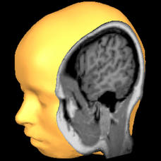
Brain Tutor 3D
The human brain is staggeringly complex, and its structure can seem impossible to grasp. This user-friendly app allows for exploration of the brain's anatomy, providing nomenclature, 3-D mapping, and functions.
Curated OER
Our 50 States
Students identify the location of the 50 states using an interactive map. They practice geography skills by playing a fun game. Pupils become familiar with the state abbreviations for the US states. Students become familiar with the...
Curated OER
States and Capitals, Mountains and Rivers
Students identify geographical locations in the midwestern United States. In this geography lesson, students identify 12 states and capitals and geographical features in the region by using U.S. maps. Students use blank maps to fill in...
Curated OER
Great Lakes Cities Quiz
In this online interactive geography activity, students examine a map of the Great Lakes region and identify the 20 noted cities on the map using a pull down menu within 4 minutes.
Curated OER
Canadian Provinces Quiz
For this online interactive geography quiz worksheet, learners examine the map that includes 13 Canadian provinces. Students identify the names of the provinces in 3 minutes.
Curated OER
The Gullah People of the Sea Islands
Eighth graders examine the lives of the Gullah-Geechee people. In this unique cultures activity, 8th graders explore music, language, and slavery of the Gullah-Geechee people from the southern low-country in the United States. Students...
Curated OER
At Your Fingertips
First graders observe a variety of different foods including kiwi, banbnas, coffee, chocolate and discuss where they come from. They discuss the terms import and export then identify the locations where the items came from and their...
Curated OER
Amazon Rainforest
Seventh graders complete a simulation in which they travel through the Amazon rainforest. Using their map skills, they determine the best route and where to see specific plants and animals. They develop their own database to organize...
Curated OER
Beyond Demographics
Students study the Dominican Republic through watching and discussing a video about the country and its people. They explain life in the Dominican Republic and describe the emerging picture of the Dominican Republic as viewed through...
Echoes & Reflections
Jewish Resistance
Resistance to the Holocaust took on many forms. Learners explore the passive and active resistance of Jewish people who continued their practices and observances, as well as organized resistance against the evils of the Nazis. An...
Curated OER
Water Sources in Cape Verde and West Africa
Young explorers study the scarcity and importance of a continuous supply of fresh water in Cape Verde. They research the five main ways that fresh water is obtained in these countries. Each research group prepares a presentation, and...
Curated OER
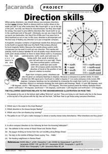
Direction Skills
In this geography worksheet, students read an excerpt on what directions tell someone. They respond to 6 short answer questions related to the neighborhood illustration found on the second page of the worksheet.
Curated OER
Fitness Walking Class
The Fitness Walking Class unit is well-organized, and you could use the skeleton of this unit to organize your own Fitness Walking Class. Use pedometers to keep track of steps, write in journals, and get other people to walk with you....
Teachers' Curriculum Instituted
The Roman Record
Using Google Earth, Google Docs, and other Google Tools, collaborative groups of seventh graders research and then create and share online newspapers reporting on the early development, geographical features, political issues, and...
Curated OER
Max Knows Mexicao, United States and Canada
Students utilize their map skills to explore the regions of North America. They explore the physical characteristics and climates of the regions. Students label their map and prepare a presentation of their findings.
Polar Trec
The Amazing Antarctic Trek
This resource provides two ways to engage learners in using latitude, longitude, and research skills. In pairs, or on their own, learners will locate several Antarctic regions on a map. They will write the name of the place and a few key...
Curated OER
U.S. Geography: The Northeast
Learners investigate U.S. Geography by creating a map in class. For this natural resource lesson, students create a map of the United States and research the Northeast based on their resources and recyclable materials. Learners...
Curated OER
Geography/Current Events Project
Using the Balkan region as an example, fourth graders review the five themes of geography as a class. They identify the physical and human characteristics of a region before labeling the countries and landforms on a map. They then...
Curated OER
Touring the Regions of the United States
Fifth graders explore the regions of the United States. For this geography skills lesson, 5th graders examine the landforms, climates, and economies of the regions of the United States. Students conduct Internet research in order to...
Curated OER
Wars and Conflicts
Students explore the concepts of war and conflict. In this research skills lesson, students use Internet and print sources to research the causes, effects, main events, and significant figures of selected wars.
California Academy of Science
Nuclear Energy: What's Your Reaction?
OSHA confirms that rules governing worker safety at nuclear power plants ranks higher than worker safety in offices. Scholars must consider safety, cost, alternatives, and other factors before recommending whether a town should build a...
Smithsonian Institution
Borders and Community: Early 20th Century Chicago Neighborhoods and Ethnic Enclaves
Chicago is one city, four neighborhoods, and countless nationalities. The lesson plan explores the ethnic division of Chicago in the early twentieth century. Academics read primary sources, analyze maps, and tour an online exhibit to...
Curated OER
ESOL Government and Commmunity Resources
Students study vocabulary words associated with community services. They label each community service on an index card and match a phrase with the service. They identify community service buildings in the area on a local map.
Other popular searches
- Geography Map Skills Us
- Northeast Us Map Skills
- Us Map Skills Sheet
- Western Us Map Skills
- Map Skills About Us Census
- Southeast Us Map Skills


