Curated OER
Mapping Perceptions of China
Students discuss what types of things are included on a map. They compare and contrast maps of China with a map they create and practice using different types of maps. They write analysis of their classmates maps.
Curated OER
Magical Maps
Second graders discuss the importance of using maps and how they are used. After they listen to a folktale, they develop their own story line maps and write their own folktale to accompany a map. They also identify and locate the seven...
Curated OER
Mapping Mistakes
Middle schoolers examine early European maps and explore geographic errors. They also view maps of the geography of North America. Students discuss the obstacles faced by early explorers in mapping unexplored territory. They consider...
Curated OER
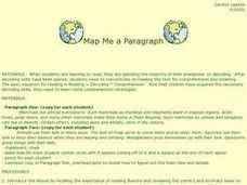
Map Me a Paragraph
There are so many great reading strategies. In this lesson plan, learners practice decoding. They break down two paragraphs to analyze and determine main ideas and details. They each observes ways to model as they map their paragraphs.
Curated OER
Weather Map Challenge
In this weather worksheet students use a weather map to answer given questions. Students answer questions using map symbols and make predictions based on map. Students create additional questions with answers using the same map.
Curated OER
Mapping the Census
High schoolers learn why the census makes a difference. In this U.S. Census lesson plan, students learn the key elements of cartography, examine the difference between data and their representation, and create a map using census data.
Curated OER
Fairy Tale Maps
Students study direction as they listen to the stories of Little Red Riding Hood and The Jolly Postman. In this cardinal direction lesson, learners create a map to show the path Little Red Riding Hood took in the story and label the path...
Curated OER
Topo Map Mania!
Students read and use topographical maps. They also use a compass to find bearing to an object on a map and in the classroom. Ask your students how they might travel to somewhere they have never been to befo
Curated OER
Blank US Map
In this blank outline map activity, students study the physical boundaries of the 50 states that make the United States. This outline map may be used for a variety of geographic activities.
Curated OER
Map Skills: Explorers, Continents, and Oceans
Third graders use a software program to make and label a map of the world. On the map, they locate the seven continents, oceans and the countries of Europe. They also draw the routes of Christopher Columbus, Juan Ponce de Leon and...
Curated OER
Geography Tutor: Maps and Map Projections Questions
In this geography skills lesson, students watch a video titled "The Geography Tutor," and then respond to 14 short answer questions about maps and map projections.
Curated OER
Mapping Your School Grounds
Students create a map of their school grounds. In this mapping lesson, students work in teams to make a map of their school grounds. Students note major features, observe, and record wildlife in the school grounds.
Orlando Shakes
The Great Gatsby: Study Guide
Uncover the exciting world of the Roaring Twenties with The Great Gatsby study guide. Individuals become critics as they write a review of the production. Scholars also read historical information and analyze the differences between the...
Indian Land Tenure Foundation
Maps and Homelands
You are never too young to learn about maps. To better understand the concept of a homeland, students work together to construct a map of their local area out of paper puzzle pieces. They'll put the maps together and then add details by...
Curated OER
Westward Expansion : Mapping
Fifth graders travel along exploring the expeditions of John F. Fremont. In this Westward expansion lesson, 5th graders gain understanding of the events that shaped the west through the use of maps. Students use mapping skills to...
Curated OER
Tooling Around Arizona: Reading Arizona Maps
Students research Arizona maps. In this map lesson, students discuss map titles, scales, directions, elevation, and symbols. The class will examine topography, landforms, and rivers found on an Arizona map.
Curated OER
Should the Ming End the Treasure Voyages?
During the first century of Chinese Ming dynasty (1368-1644), the government sent out a total of seven voyages into the Indian Ocean. Young historians will discuss, explain, role play, and compare the decisions made by rulers during the...
Curated OER
Getting it Straight with Latitude and Longitude Skills
Teachers can help students learn latitude and longitude skills using games and other motivating activities.
Curated OER
Our World With MapsQ
Learners examine and compare different types of maps. In this map skill activity, students look at neighborhood and national maps on the overhead projector while making comparisons of the symbols and locations. They use a T-chart to...
Curated OER
Where Am I: How to Read a Map
Third graders develop an understanding of maps. They explore what a map is, who uses maps, and how to use maps. Students investigate the compas rose. They create a compose rose which illustrates the cardinal directions. Students practice...
Curated OER
California Geography
Fourth graders explore geography of four distinct regions of California: mountains, coast, central valley, and desert. They locate California on map, identify state's boundaries and borders, and explore agriculture, a major economic...
Curated OER
United States Map- State Capitals
Students explore the state capitals. In this geography lesson, students use a political map to identify the state capitals and place post-it notes on various capitals.
Curated OER
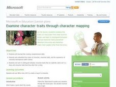
Examining Character Traits through Character Mapping
Some of what we know about a character is directly stated. Some of what we know is inferred by events in the story. Character maps help primary learners recognize the difference. After modeling with a story your class has read, pupils...
Curated OER
Learning About Maps
Students take a "field trip" with the teacher through the school then draw a diagram of what they saw. They bring the maps to the computer lab where they create electronic maps using the software program Neighborhood Map Machine.
Other popular searches
- Geography Map Skills Us
- Northeast Us Map Skills
- Us Map Skills Sheet
- Western Us Map Skills
- Map Skills About Us Census
- Southeast Us Map Skills


