Curated OER
Then and Now
Young scholars conduct research and use census data to compare different times and places. In this census lesson, students interpret data from charts and graphs, comparing census information from two time periods as well as from two...
Curated OER
The Pink Pig
Students identify the short /i/ sound in spoken words and the letter symbol in this lesson plan. They say a tongue twister emphasizing words with the short /i/ sound. They then read the story "Liz is Six" and identify the words with...
Curated OER
Then and Now
Learners explore population and come to understand how it changes over time. In this census lesson, students discover what population is and how it changes as they participate in age-appropriate activities.
Curated OER
Triangular Trade and Its Effects
Students investigate the trade routes and investigate goods and services were transported along each route. Given a primary source document, that represents a personal story related to the triangle trade, they discuss given questions.
Curated OER
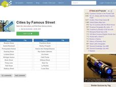
Famous Streets Quiz
In this online interactive geography quiz worksheet, students examine the chart that includes the names of 18 famous streets in the world. Students have 4 minutes to identify the names of the cities where the streets...
Curated OER
State Nicknames Quiz
In this online interactive geography quiz worksheet, students examine the chart that includes the names of 49 states. Students identify the nicknames of the states in 6 minutes.
Curated OER
Highest Mountain Countries Quiz
In this online interactive geography quiz activity, students examine the chart that includes the elevations of 20 world mountains. Students identify the names of the mountains in 4 minutes.
Curated OER
Biggest Cities in Each State Quiz
In this online interactive geography quiz activity, students examine the chart that includes the names of 50 U.S. states. Students identify the names of the two largest cities in each state in 8...
Curated OER
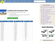
Landlocked Countries Quiz
In this online interactive geography quiz worksheet, students examine the chart that includes details about the population in 44 landlocked countries. Students identify the names of the countries in 5 minutes.
Curated OER
Famous Lakes Quiz
In this online interactive geography quiz worksheet, students examine the chart that includes details about 15 famous world lakes. Students identify the names of the lakes in 3 minutes.
Curated OER
Country Flags Quiz
For this online interactive country flag quiz worksheet, students examine the 20 pictured country flags and try to name all of the countries represented in 4 minutes.
Curated OER
Biggest Cities in India Quiz
In this online interactive geography quiz worksheet, students examine the chart that includes the population of 20 Indian cities. Students identify the names of the largest...
Curated OER
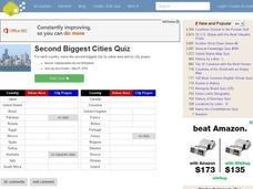
Second Biggest Cities Quiz
In this online interactive geography quiz activity, students examine the chart that includes details about 20 major cities in the world. Students identify the names of the cities in 4 minutes.
Curated OER
Cultural Anthropology Study Using the Fundamentals of Geography and GPS
Students, in groups, operate the GPS unit, plotting each head stone with accompanying description. Two other students to log in data that corresponds to the given points. One student to note general observations
Curated OER
Paleogeographic Mapping (o.k. Fossils Are Neat But What Good Are They?)
Students examine how evidence from fossils can be used in paleogeographic interpretation. They gain experience in developing multiple hypotheses.
Curated OER
MAPPING THE SCHOOL FOREST
Students measure distances and directions using paces and a compass. They determine their own pace, explore how to read a compass bearing, and how to take bearings on given sites.
Curated OER
Canada - US: Approaches to Immigration
Sixth graders explore the Canadian immigration experience through comparison and contrast to American immigration and settlement patterns. In this immigration patterns lesson, 6th graders dialogue their opinions regarding immigration....
Curated OER
The Study of the Spanish-Speaking People of Texas: Understanding Primary Sources
High schoolers analyze Russell Lee's photo essay as a sign of segregation in Texas. They consider the differences between primary and secondary sources and how historians use these sources.
Curated OER
The Great Continental Drift Mystery
Young scholars stud the concept of Pangaea by using Wegener's clues to construct a map of the continents joined together. They determine how fossil distribution can be used to enhance the study of continental drift. They locate the...
Curated OER
The 50 States
Fifth graders use maps and music to learn the 50 states. In this US Geography lesson, 5th graders map out a region of the United States and practice singing the song, The 50 States that Rhyme.
Curated OER
What is the Population Distribution of Cartoon Characters Living On the Pages of Your Newspaper?
Young scholars read various cartoons in their local newspaper and calculate the population demographics, spatial distribution and grouping of the characters. Using this information, they create a population distribution map and share...
Curated OER
Uncharted Territory
Students examine what were preconceived perceptions of the areas Lewis and Clark explored. They compare and contrast past and modern maps of North America. They accurately place route and site information on the map.
Curated OER
Joseph Had a Little Overcoat Lesson Plan
Young scholars discuss various features of a book, aspects of the story, and then engage in a retelling of the story. In this early childhood lesson plan, students identify the author, illustrator, and title of a book, Joseph Had a...
Curated OER
Geological Forces and Topography
Learners discuss and research the Earth's geological processes. In this geology lesson, students study maps of Utah and the United States to learn about geological features. Learners then complete the research cards for each area of...
Other popular searches
- Geography Map Skills Us
- Northeast Us Map Skills
- Us Map Skills Sheet
- Western Us Map Skills
- Map Skills About Us Census
- Southeast Us Map Skills


