Curated OER
Four Main Directions
Young scholars describe directions using a globe for north, east, south and west. In this mapping lesson students identify the north and south pole. Young scholars understand the importance of the equator and the Prime Meridian. Students...
Curated OER
Guillermo Kuitca Art
Young scholars analyze the art work of Guillermo Kuitca. In this art analysis instructional activity, students analyze the geographical art of Kuitca and complete discussion activities. Young scholars read about the artist and complete a...
Curated OER
The Plains Indians
Students have a better understanding of another culture other than their own. This help them to see that there were other people living in this region before us.
Curated OER
Military Tactics and Battle Plans Oh Boy!
Eighth graders compare and contrast a Loyalist and a Patriot. After reading selected pages in the book, 8th graders use a graphic organizer to examine the battle plans of the colonists and the British during the Revolutionary War. They...
Curated OER
OPEC and the Energy Crisis
Students color the Middle East Nations of OPEC on outline maps. They discuss and watch a video about the United States reliance on oil producing nations of the Middle East. They participate in a discussion of the problems of the gas...
Curated OER
An Introduction to the Marine Environment and Geology of City Point: A Model for Experiential Teaching
Students begin the lesson plan by researching the history of City Point, Connecticut. Using a map, they color areas they were asked to find and discuss why the areas are important to the community. As a class, they are shown recent...
Curated OER
Write On! Express and Enjoy Yourself
Students discover how writers put their feelings into language. They identify words of emotion and imagery and see their experience as an important base for language use and writing skills. They use colorful words when describing a...
Curated OER
A Look at the Population Density of the United States
Students acquire census information and create maps of the population density of the United States on different scales. They role play the roles of workers of a retail company and they use the population data to market to their customers.
Curated OER
Watersheds, Watersheds Everywhere
Students identify the watershed in which their school is located. They use maps to locate their homes and school. They define and use the correct vocabulary.
Curated OER
Ute Indians: Past and Present
Fourth graders study the history of the Ute Indians. In this Ute Indians lesson, 4th graders complete a KWL chart about Ute Indians and read the online Ute Indian Fact Sheet. Students study examples of Ute culture, where the Ute Indians...
Curated OER
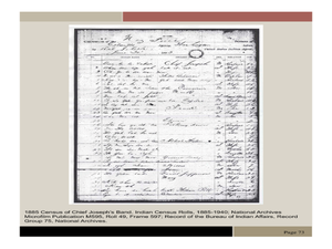
Chief Joseph and the Nez Perce
Eleventh graders explore the life of Chief Joseph and Nez Perce. For this US History lesson, 11th graders analyze paintings and photos detailing the flight of Nez Perce. Students create a narrative newspaper article based on...
Curated OER
Chocolate Place - Factories around the world
Students create a PowerPoint presentation on how chocolate is made. In this chocolate lesson, students locate chocolate factories around the world, and study the process of converting the cacao seed into a chocolate bar. Students share...
Curated OER
From Above
Students use maps and other geographic representations, tools, and technologies to acquire and report information from a spacial perspective.
Curated OER
Values
Students identify their personal values. They determine that values help give us direction and help us set goals for the future. They discover that we develop our values from those around us and from our experiences. They create a...
Curated OER
Japan and The Ring of Fire
Middle schoolers engage in a study of the volcanic forces and earthquakes associated with The Ring of Fire in the Pacific Ocean. The people of Japan are researched in how they have dealt with living in the area. Also students write in...
Curated OER
African Myths and What They Teach
Students identify and locate the continent of Africa on a globe or map. They locate on a classroom map of Africa the place of origin of the myths/stories being read in class.
They discover that the peoples of Africa and their stories are...
Curated OER
Poems, Prayers, Promises, and Possibilities: The Music of Poetry
Twelfth graders express themselves through poetry. They discover the connection between their music and the music of poetry and hear their work and how the sound of a poem or an analytical paper improves their written work. They...
Curated OER
Practical Writing in the Intermediate Grades
Students discuss lists of interesting topics on which to write. They explore those things that interest them, excite them and express themselves freely. They organize the value of their own thoughts and use their individual lists that...
Curated OER
Water in the Texas Coastal Basins
High schoolers, after researching a Texas coastal basin, map and graph the information they collect and then translate it into a short report to be presented to their classmates. They brainstorm unique ways to maintain Texas estuaries as...
Curated OER
Weather
Second graders study the basic components of weather. They construct a thermometer and anemometer to measure temperatures, precipitation, and wind speed. In addition, 2nd graders discover how to find these components on weather maps.
Curated OER
Summarizing is Fun with Flat Stanley!
Learners read the book "Flat Stanley" by Jeff Brown. Through modeling and guided practice, as a class, they complete a story map and 1-paragraph summary of the first chapter in the book. Then, in groups, they follow the same procedure...
Curated OER
Read a Transportation Story
Eighth graders research the career of Arctic transportation. In this arctic transportation activity, 8th graders read a book about Arctic truck travel and review the historical aspects of transporting goods in the Arctic. Students review...
Curated OER
The Lewis and Clark Expedition
Learners study westward expansion. In this US history lesson, students describe the adventures and hardships faced by the explorers known as Meriwether Lewis and William Clark. Learners write a report to the President about the...
Curated OER
Winds of Change
Students investigate extreme weather patterns. In this current events activity, students visit selected websites to study hurricanes and their causes. Students write reports on their findings.
Other popular searches
- Geography Map Skills Us
- Northeast Us Map Skills
- Us Map Skills Sheet
- Western Us Map Skills
- Map Skills About Us Census
- Southeast Us Map Skills


