Curated OER
Campaign 2004: Classroom Electorate
Students role play as political analysts first forecasting the electoral college vote in a presidential election and then, following the results of the actual count. They study the role of swing states, and why political participation is...
Curated OER
Mississippi Gulf Coast Islands
Fourth graders complete a variety of exercises as they study the creation, history, and geography of the Mississippi coastal islands. They discover the natuaral forces that act on the islands and how these forces affect the habitats and...
Curated OER
Apples A"Peel" To Me
Second graders study the characteristics and uses for apples through this series of ten lessons. They look at the importance of apples in the US. They read literature about apples, graph, sort, and measure apples, and make apple snacks....
Curated OER
Food For Thought: A Geography of Minnesota Agriculture
Students participate in hands-on activities and discussions about Minnesota's agriculture. They practice reading maps and locating where certain agricultural products are found throughout the state.
Curated OER
Native Americans in Arkansas: The Quapaw
The Quapaw Indians of Arkansas are the focus of this American history lesson. Learners discover many aspects of the Quapaw culture, such as their dwellings, social organization, food, and how the tribe was eventually driven out of...
Curated OER
Weather Symbols
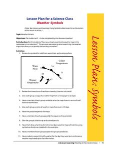
Young scholars study weather symbols. In this weather symbols lesson, students review the symbols for cold, warm, and stationary fronts. Young scholars use a weather map to study the weather symbols, complete a weather illustration and...
Curated OER
Get Ready for the Great Outdoors!
Learners discuss what is a map and what they already know about maps. They brainstorm together to compile a list of responses for the board and observe a map of the United States, including states, capitals, and some of the National Parks.
Curated OER
Find the Rocks
Students gain appreciation about the geology around them. They navigate the schoolyard using a map. They create a list of what people use rocks for. They mark location of rocks on their maps.
Curated OER
Where in the Usa is Radon?
Students determine the areas of New Jersey and the US that are likely to have high radon concentrations. Students draw a map of their own neighborhood that show soil associations in their neighborhood.
Curated OER
Plot Studies
Third graders are introduced to how to properly read a plot map. As a class, they take a field trip to an area surrounding the school and work together in groups to examine small sections of the different environments. To end the...
Curated OER
The Geography of Maine Tourism
Students study topographical maps of Maine to identify the important physical features. They work in groups to create tourism pamphlet highlighting a region of the state.
Curated OER
Tobacco: Exploring Tobacco Culture
Eighth graders are introduced to the tobacco planting process. Using primary sources, they identify the steps necessary to grow the popular crop. They create a flow map to organize the process graphically. They discuss the...
Curated OER
Riding With Alice
Student listen to Don Brown's, Alice's Grand Adventure before discussing cross country travel. They trace Alice's travels on an outline map of the US and focus on the state of Indiana. They color and label the counties that Alice...
Curated OER
World Religions
Seventh graders identify major tenets and the distributions of world religions. In this world religions lesson, 7th graders work with a group to research a religion using the given website. Students complete a graphic organizer for the...
Curated OER
NAFTA Trade Unit
Students research the geography, economics and government of Canada and how that affects US/Canadian trade relations. In this NAFTA instructional activity, students play a game, read about Canadian history, and creat a graph.
Curated OER
Water: On the Surface and in the Ground
Students explore the differences between surface water and ground water. They collect data using maps and graphs and investigate a Texas river basin and a nearby aquifer. They complete a written report including maps and data regarding...
Curated OER
That Sums It All Up!
Students review the concept of silent reading. They listen to a story and create a story map of what they hear. Then, they read their own story and map it the same way. This time, they use this story map to write a summary of what they...
Curated OER
Census Statistics
Twelfth graders become familiar with the geography of Ireland. They explore the processes involved in data collection. Students examine and discuss Census Statistics and read and interpret maps/graphs. They decide how the census data can...
Curated OER
Translating Traditions
Students analyze art reflective of traditions and cultural heritage. In this art analysis lesson, students complete image based discussion.
Curated OER
Cracking the Genetic Code
Students explain what the knowledge of DNA can tell us about ourselves and other organisms and species. They also explore the systematic study of the human genome.
Curated OER
Defining Ethnic Minorities in China
Ninth graders, in groups, research some of China's 56 identified ethnic groups. They prepare maps and posters to display their research.
Curated OER
New Haven's Hill Neighborhood
Ninth graders examine the area around their school known as Hill neighborhood. In groups, they use maps to discover how the area has changed over time and how the city serves its residents. They identify the cause and effect...
Curated OER
The Mathematics of Space and Place
Students investigate the measurements and geometry of the school grounds. They conduct inquiry while measuring the campus and some of the city blocks. Then students draw a map to scale and categorize property types using a pie graph.
Curated OER
Identification of Wildfire/Structure Interfaces, Risk Assessment of Structures, and Risk Management
Students participate in a class discussion about wildfire and urban interfaces as well as risk of wildfire in the area in which they live. After reviewing a wildfire/urban interface fire safety checklist, a walking field trip is...
Other popular searches
- Geography Map Skills Us
- Northeast Us Map Skills
- Us Map Skills Sheet
- Western Us Map Skills
- Map Skills About Us Census
- Southeast Us Map Skills


