Curated OER
Geographical Skills-- Map Scale
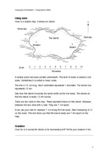
In this maps learning exercise, students study a simple map and the scale in kilometres. Students read the directions and answer one question. Students then look at a sketch map of a town and answer 2 questions. Students also read how to...
Curated OER
Mapping Counties
Students practice reading a map. In this mapping lesson, students illustrate a map and compare and contrast the counties based on their population. Students also explore what a census is and read census data on a map. A student...
Curated OER
Learning to Read a Map
First graders identify the map and globe symbols: Cardinal Directions; Compass Rose; Mountains; Rivers; Lakes; Towns; Roads.
Curated OER
Listening Comprehension: Retell Main Events of a Story
Story retell is a very important skill. Little learners use a story map and a previously heard story to walk through the retell and story sequencing process. They complete this activity as a whole class and then on their own.
Columbus City Schools
Constructive and Destructive Geologic Processes
Show the class the world as they've never seen it before—from way above! Learners try to unravel the mysteries presented by rich satellite imagery, learn to interpret topographic maps, and study erosion by constructing their very...
New York State Education Department
US History and Government Examination: August 2010
Geography has played a complex role in America history. The Atlantic Ocean has served as a buffer to protect the United States from European Wars, but its proximity to Cuba, however, left it vulnerable to nuclear war during the Cuban...
Curated OER
Mapping China
Students identify cities in China on a map. For this map skills lesson, students locate the continent of Asia and the country of China. Students use a blank map to label China and bordering countries.
Curated OER
New York Cities Map Quiz
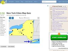
In this online interactive geography worksheet, students examine a map of New York and identify the 11 noted cities on the map using a pull down menu within 3 minutes.
Curated OER
South America Map Quiz
In this online interactive geography quiz learning exercise, learners examine the map that includes all of South America's countries. Students identify the 13 countries in 2 minutes.
Curated OER
Middle East Map Quiz
In this online interactive geography quiz worksheet, students examine the map that includes 26 Middle Eastern countries. Students identify the names of the countries in 4 minutes.
Curated OER
Central America Map Quiz
In this online interactive geography quiz instructional activity, students examine the map that includes 22 Central American countries. Students identify the names of the countries in 3 minutes.
Curated OER
Canada Map Quiz
In this online interactive geography quiz worksheet, learners examine the map that includes 13 Canadian provinces and territories. Students identify the names of the provinces and territories in 2...
Curated OER
California Cities Map Quiz
For this online interactive geography quiz worksheet, students examine the map that includes 12 California cities. Students identify the names of the cities in 3 minutes.
Curated OER
Florida Cities Map Quiz
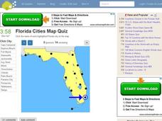
In this online interactive geography worksheet, students examine a map of Florida and identify the 12 noted cities on the map using a pull down menu within 3 minutes.
Curated OER
Texas Cities Map Quiz
For this online interactive geography worksheet, students examine a map of Texas and identify the 15 noted cities on the map using a pull down menu within 3 minutes.
Curated OER
Physical Features
Students draw physical land features using ClarisWorks or Kid Pix, write their definitions, create slideshow, and create class geography book.
Curated OER
Map Making
In this map making worksheet, students draw a map of their home including a map key. In this drawing worksheet, students create one map.
Curated OER
Drawing Conclusions - Is This a Map of the Underground Railroad?
Students complete activities to study potential maps of the Underground Railroad. In this Underground Railroad lesson, students watch a video about map collector Anne Zorela's Underground Railroad map. Students complete a graphic...
Curated OER
Directions, Directions
Third graders review cardinal directions, moving around the room so that they are standing in the part of the room that is nearest the north, south, east and west. They are asked what would you do if they are lost? Pupils work as a...
Curated OER
Choose a Path
In this addition worksheet, students utilize data from a map to answer 6 fill in the blank questions where they provide the missing addends to addition problems.
Curated OER
Acadiana Map (Map of Acadians in Louisiana) PowerPoint Slide
Is your class studying the state of Louisiana? This slide provides a good visual of Acadiana Louisiana, or as it is otherwise known; the Historic Cajun Country. The 22 parishes that make up this French-influenced region are numbered on...
National History Day
“Saving the Bear”: The Russian Expeditionary Force of World War One
How have Russian politics affected countries on a global stage? The discussion of the Russian Revolution and World War I begins with an analysis of primary resource letters. Learners finish with a project where they create a timeline of...
Echoes & Reflections
The Children and Legacies Beyond the Holocaust
Using video testimony, primary source documents that detail international agreements, and structured discussions, learners consider the precarious position of children during the Holocaust and other international conflicts, and how to...
TED-Ed
A Digital Reimagining of Gettysburg
Why would Robert E. Lee order Pickett's Charge, an action that changed the course of the Civil War? Geographer and historian Anne Knowles uses digital technology to explain what she thinks is the missing piece in trying to understand...
Other popular searches
- Geography Map Skills Us
- Northeast Us Map Skills
- Us Map Skills Sheet
- Western Us Map Skills
- Map Skills About Us Census
- Southeast Us Map Skills


