Curated OER
Mapping Puerto Rico
Students use maps to discover where Puerto Rico is located. In groups, they use the internet to research the vegetation. They also compare and contrast the relationship between the United States and Puerto Rico's government.
Curated OER
Mapping Community Values
Students discuss the origin of various maps focusing on the values behind them. Students also explore how human needs and geography influence community settlement patterns. Students extend learning by creating and mapping their own ideal...
Curated OER
Map Analysis Worksheet
For this map analysis worksheet, students decipher what type of map they are using based on a complete list of criteria. Students then answer multiple questions based on their discoveries.
Curated OER
The Roman Empire-Map Activity
For this Roman Empire worksheet, learners complete a map activity in which they label and color civilizations, countries and physical features as instructed. There are no maps included.
Curated OER
Scaling in Maps
For this recognizing map scale ratios worksheet, students use ratios and centimeter measurements to calculate the distances in reality. Students solve 8 problems.
Curated OER
Right Place, Right Time
Fourth graders complete mathematical word problems. They study the relationships among distance, speed, and time; and measure travel distances. They measure distances using a piece of string and a ruler and practice converting several...
Curated OER
Thematic Maps of Your School
Students are able to list the essential elements of a thematic map, understand and use scale effectively to represent a geographic area, use research skills to develop a body of information, plan and draw an accurate thematic map based...
Curated OER
Read a Map ... It's a Snap!
Students are introduced to map and globe skills. They use grids and are able to construct their own simple maps of familiar places. Students are able to define a map, globe, and symbol and use the direction words north, south, east,...
Curated OER
Waldseemüller’s Map: World 1507
Middle schoolers take a closer look at historical maps. In this primary source analysis lesson, students examine the first world map produced by Martin Waldseemuller. Middle schoolers complete the included map analysis worksheet and then...
Curated OER
Mapping the Ocean Floor
Students construct and interpret a line graph of ocean floor depth and a bar graph comparing the height/depth of several well-known natural and man-made objects and places. In addition, they calculate the depth of two points using sonar...
Curated OER
What do Maps Show?
Eighth graders practice the skill of reading maps. In this geography instructional activity, 8th graders participate in a classroom lecture on how to read a map.
Curated OER
Map Your House
Students are introduced to the concepts of maps as scale models of the whole. After a brief lecture on creating and using an accurate scale when drawing and reading a map. They create a scale drawing of the floorplan of their homes.
Curated OER
Topo Map Mania!
Seventh graders describe the major features of maps and compasses. They read a topographical map. They take a bearing using a compass. They practice using scales on a map.
Curated OER
Cattle Trails
Students identify and locate cattle trails on a globe. In this map skill lesson, students use a marker to locate Texas and Montana and use the map scale to calculate the distance of the cattle trail.
Curated OER
Land Use Over Time
High schoolers view aerial photos and topographic maps of their local area. They compare and contrast major land use patterns over time by comparing these images to maps that are at least 50 years old. They analyze them using the four...
Curated OER
Tracing Highs and Lows in San Francisco
On a topographic map, students identify the scale bar, north arrow, and contour interval. They then locate a hill on the map and make note of the contour lines. Students then locate other places with similar contour line patterns....
Curated OER
Introducing the Concept: Proportions
Students measure distances. In this proportions lesson, students use a map to find how far it is between different cities. Students use their knowledge of measurement, multiplication and fractions to find the distances.
Curated OER
Ancient Egypt Geography
Nine questions to answer and one map to read. Seventh graders will use the map of Ancient Egypt to practice map reading skills and build a visual image of Ancient Geography.
Curated OER
Mapping the Bone Field: An Area and Scale Exercise
Here is an excellent cross-curricular lesson plan. Learners relate multiplication to area by making a grid on graph paper, and then creating the same grid in real space outside in the school yard.
Kentucky Educational Television
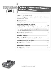
The Road to Proportional Reasoning
Just how big would it really be? Young mathematicians determine if different toys are proportional and if their scale is accurate. They solve problems relating scale along with volume and surface area using manipulatives. The...
EngageNY
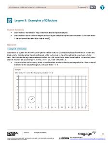
Examples of Dilations
Does it matter how many points to dilate? The resource presents problems of dilating curved figures. Class members find out that not only do they need to dilate several points but the points need to be distributed about the entire curve...
NOAA
Watching in 3D
Bring the ocean floor to life! Earth science scholars discover the process of deep sea mapping in the third installment in a series of five lessons about ocean exploration. The teacher's guide includes helpful resources, worksheets, and...
Rainforest Alliance
Knowing the Essential Elements of a Habitat
To gain insight into the many different types of habitats, individuals must first get to know their own. Here, scholars explore their school environment, draw a map, compare and contrast their surroundings to larger ones. They then...
It's About Time
Volcanic Landforms
Did you know the word volcano comes from the name of the Roman god of fire, Vulcan? During this activity, scholars make a topographic map, interpret topographic maps, and infer how lava will flow based on their analysis.
Other popular searches
- Using a Map Scale
- Using Map Scales
- Using Map Scale Distance
- Using Maps to Scale
- Proportions Using Map Scale
- Maps Using Scale


