Curated OER
Real World Investigation- Math and Geography- Elevation Changes
In this math and geography real world investigation, 6th graders plan a driving trip to a city that is located several states away from their home while recording the elevations of three cities that are included in the trip. They use...
Curated OER
The Seven Continents Scavenger Hunt
Who doesn't enjoy an engaging scavenger hunt? Here, scholars listen to, and discuss, the informative text, Where is my Continent? by Robin Nelson. They then explore the seven continents and four major oceans using...
Curated OER
Geographics in Arkansas
Third graders discuss where Arkansas is located on the United States map. They use geographic tools to participate in activities.
Curated OER
Discovering the Past Using the Future: Remote Sensing and the Lost City of Ubar
Students use a video, maps, worksheets and Internet research to explore the role that sensing played in locating Ubar - the lost city of Arabia.
Curated OER
Dough Lake Topology
Students practice coordinates and measurements, develop 2D, 3D topological map, construct grid with string on real surface, establish "level" fixed point for measurements, take and record data points of elevation, and enter data on...
Curated OER
Unit 2 Worksheet 4-Motion
In this motion worksheet, students analyze motion maps and construct graphs using the data. They write mathematical expressions to show the relationship of velocity versus time and position versus time. They determine displacement using...
Curated OER
Hurricane Tracking
Students access the Internet to find information on current hurricanes. They get locations, speeds, and air pressures and then plot the location of the hurricane on a hurricane-tracking map. They also access the FEMA website to solve...
Curated OER
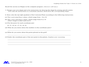
Concept: Points on a Grid
In this coordinate grid graphing worksheet, students play a game of Battleship on the computer. They answer 21 questions about the coordinate grid and graphing.
Curated OER
Treasure Hunt: Coordinate Graphing
Two of the best words any one can hear– treasure hunt! Your class will be excited to practice graphing on a coordinate grraph as they identify and write coordinates for landmarks they see on a treasure map. They trace their route to the...
Curated OER
We Really Dig Archeology and Palentology
Sixth graders examine the differences between archeology and paleontology. Using the internet, they explore the tools and techniques used in each field. They must use the correct tools to uncover and record the objects they find. They...
Curated OER
Geography Grid
Fourth graders search a database to find images and scan and affix them on an 8-foot long map of the state of Illinois. They then use it as a basis for discussion.
Curated OER
Gridding An Archaeological Site
Students investigate using some of the basic skills of an archaeologist while using a Cartesian coordinate system. They establish a grid system for a dig site and determine the locations for different artifacts. Students use the...
Curated OER
Gridding a 2 x 2 Meter Unit
Students use the internet to examine what happens at an archeological dig site. In groups, they practice measuring a 2x2 meter square unit and gridding it out as an archeologist would do. They review the possible solutions at the end of...
Curated OER
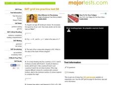
SAT Grid Ins Practice Test 04
In this SAT Practice Test, students solve a variety of problems that range from solving for a variable, rate, probability, and area.
Curated OER
Timothy's Trip
In this route activity, students draw the route Timothy took on his trip based on the information given. Students draw the route on graph paper where each point equals 4 miles.
Mathematics Assessment Project
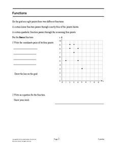
Functions
After identifying which of the given coordinate points fall on the graph of a line and which fall on the graph of a parabola, pupils write equations for each function.
Mathematics Assessment Project
Printing Tickets
That's the ticket! Pupils write and investigate two linear functions representing the cost of printing tickets. Individuals then determine which of two printing companies would be a better buy.
Mathematics Assessment Project
College and Career Readiness Mathematics Test A1
A six-page test covers content from several different high school math courses. It incorporates a few short answer, graphing, and word problems. It also allows room for mathematical reasoning and analysis.
Curated OER
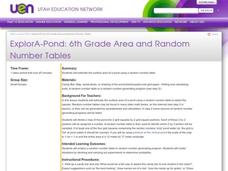
ExplorA-Pond: 6th Grade Area and Random Number Tables
Sixth graders estimate surface area of a pond using a random number table.
Curated OER
Exploring Wyoming Species Habitats
Learners are introduced to the concept of species habitats and ranges. They introduced to ArcView GIS as a tool for mapping. Pupils use query data for species withina county, elevation, range, rivers and streams, land cover, and etc....
Curated OER
Paleo-Dig
Students will comprehend the use of simple grids and the basic principles and skills used on a paleontological dig, such as the Illampi Mound Colony. They incorporate a systematic investigation. Students analyze a variety of different...
Curated OER
Design Your Own Building
Students explore the use of design principles in the real world. They evaluate how problems can be solved using design principles. In groups, students design the floor plan for a building of their choice.
Curated OER
Water Monitoring Vocabulary
As the title implies, this is a list of vocabulary terms relating to water monitoring. If your ecology class is learning about how to test water quality, this will be an appropriate reference sheet for them. As a bonus, if you live in...
Curated OER
Angles - Unlocking Geometry
Students investigate the concept of angles and how they are used in geometry. They construct polygons using various types of angles and then classify them according to their physical properties. Students use a computer program in order...


