Curated OER
Counting Back and Counting On
Read aloud your choice of books about counting on and counting back (a list is provided, or tell stories of your own). Your learners will write horizontal equations to portray what happens in the story. They build a paper chain and...
Curated OER
Let's Go Golfing
Students bring their visions for golf courses to life. In this scale model lesson, students research golf courses online, plan golf courses on grid paper, and then create scale models of the courses they planned.
Curated OER
Mapping Lab and Lead Poisoning
Students are introduced to GIS and its uses. They make predictions before viewing the actual lead poisoning cases by location of Dade County. Pupils use actual Miami-Dade County spatial data to explore basic principals. Students
Curated OER
Student Created Murals
Students, over the course of an acedemic quarter, paint a mural on a wall in their school. They decide on a theme, measure wall space, design images, decide on the amount of paint they need, designate teams, schedules, etc.
Curated OER
The Meaning of Flowers
Young scholars explore the messages sent in bouquets. In this messages lesson, students research the meaning of various flowers by researching online. Young scholars draw a picture of a bouquet with the meanings of the flowers written...
Curated OER
In the Poet's Shoes: Performing Poetry and Building Meaning
Students explore poetry by completing a webquest in which they hear poets reading their own work. Later, they examine the dramatic impact of reading poetry out loud. Finally, they practice reading poetry aloud and performing.
Curated OER
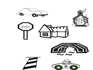
Designing a Safe City Like a Civil Engineer
Students study civil engineering, safety apparatuses in their city, and design their own city. In this civil engineering activity, students discuss their towns safety apparatuses and define civil engineers. Students then design their own...
Curated OER
Create a Hundred Dollar Bill
Students create a $100 bill. In this bills lesson plan, students draw and create their own version of a $100 bill, and call it a "fundred" dollar bill. They fill in a worksheet that has blanks where they can fill in what the bill will...
Curated OER
3-D Topographic Maps
Students create a 3-D topographic map. In this map building lesson, students use cardboard to create a topographic map of the Catskills mountain region.
Curated OER
Orca Search
Students conduct a variety of research activities to widen their knowledge about Orca Whales. They compile their research into a paper.
Curated OER
Newsroom
Students use the Internet and graphic organizers to organize the information they collect about farm products and exports.
Curated OER
Karst Topography
Students observe a movie about karst topography over the Internet and note nonpoint source pollution. They discuss ways to manage pollution and their experiences with any polltion sources.
Curated OER
Handy Map
Students become familiar with the purpose of maps through a hand mapping lesson. In this hand mapping lesson, students draw their hand and use it to explain directions and labeling on a map.
Pennsylvania Department of Education
Let's Learn Those Facts: Looking Back and Moving Forward
Students participate in an adding game. In this adding numbers lesson, students calculate the sum of the dice and remove a number from their activity sheet. Students who first removes the numbers is the winner.
Curated OER
What's My Rule for Sorting?
Students view objects sorted by one characteristic and name that characteristic. In this sorting rule lesson, students explore to find a new characteristic and write a description of that rule. In early grades the rule might be supplied.
Curated OER
Brick Memorial Flyer
Students conduct research using the internet, school server and newspapers on the history of the brick memorial for veterans and its developmental process. They create and design a three column page layout for a brochure using Microsoft...
Curated OER
Franklin Learning Activities
Middle schoolers participate in different activities examining Benjamin Franklin and his activities. They work together in groups and as a class to research his inventions and his self-improvement plans.
Curated OER
Inventors & Trailblazers
Learners are introduced to a groups of African American inventors. In groups, they research the role of each person in improving different industries. They also examine the barriers African Americans faced from the Civil War to the...
Curated OER
Technology-Lesson 2-Resolving Issues
Students define resolution. They explain the relationship between probe size and resolution and explain why information in three dimensions is necessary to describe the structure of an object. Research technology to the study of Cellular...
Curated OER
Bobbie Bear
Students examine how many different outfits can be made out of a given set of different colored shirts and pants. In this word problem lesson, students list or graph the possible results of an experiment. Students make a list of all...
Curated OER
Food Pyramid Power: Looking Back and Moving Forward
Students show their knowledge of properties of objects as it pertains to sorting and creating patterns. In this food pyramid power instructional activity, students show their ability to use whole numbers in different representations by...
Curated OER
Ozone Layer
Students read a CNNfyi.com article in order to identify causes of ozone depletion. They compare and contrast the effects of chlorofluorocarbons and bromine on the ozone. They develop a plan to prevent future destruction of the ozone.
National Science Teachers Association
Hop into Action
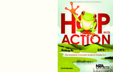
Young scientists find out what makes amphibians such unique and interesting animals in this simple life science lesson. After looking at pictures and discussing the characteristics of amphibians, learners complete a series of three Venn...
Curated OER
Using Maps To Make Public Health Decisions Case Study: Wildfires in Mexico 2000
Students study environmental health. Using actual NOAA satellite imagery, students investigate the basic concepts of mapping. They explore the relationship between monitoring satellite images and public health decision making.


