Curated OER
Lesson 3: Japan's "Southern Advance" and the March toward War, 1940-1941
High school historians interpret historical evidence presented in primary resources to decide if the southern advance was a reckless step toward war, or if it was reasonable. They research the Japanese southern advance tactics during the...
Curated OER
Globe Lesson 17 - Alaska and Hawaii - Grade 4-5
Students develop their globe skills. In this geography skills lesson, students explore the area added to the United States when the Alaskan territory was purchased from Russia.
Curated OER
Louisiana History-Unit 4: Early People of Louisiana and a Meeting of Different Worlds
The Poverty Point Culture of Louisiana is described in detail within four slides of this six-slide PowerPoint. Four detailed paragraphs help describe the economic legacy that existed in Louisiana. A table, map, and photo are included to...
American Battle Monuments Commission
Honoring Service, Achievements, and Sacrifice: A WWI Virtual Field Trip
The largest offensive in United States military history comes alive in a online interactive resource. Young historians explore the Meuse Argonne battlefield and scour the landscape for evidence from the battle. They then use primary...
Curated OER
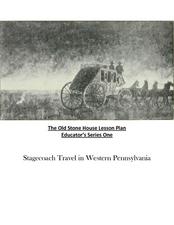
Old Stone House Lesson Plan
From stagecoach to railroad tracks, your class will discover how advancements in travel in the United States during the nineteenth century played an integral role in the industrialization and development of American society. The main...
Curated OER
The Western Migration Lesson Plan
Students examine the western migration in the United States in the early 19th century and identify the factors that caused the migration as well as how government adapted to meet the needs of an expanding country.
Curated OER
From Sea to Shining Sea
Students study the geography of the United States of America. Students write letters, create travel brochures, make maps, graph population numbers, read fiction and nonfiction selections, complete KWL charts, and watch films.
Curated OER
North American Biomes
In this Science worksheet, students color a biome map of North America. Students color the map by solving the clues listed on a separate sheet of paper.
Curated OER
5th grade social studies geography
In this geography worksheet, 5th graders complete multiple choice questions about hemispheres, maps, cities, ecology, and more. Students complete 25 questions.
Curated OER
U.S. Mint Releases New Jefferson Nickel
Students share their knowledge of Lewis and Clark, then read a news article about the redesign on the U.S. nickel to commemorate Lewis and Clark's expedition. Introduce the article with a discussion and vocabulary activity, then students...
Curated OER
Mapping the Human Movement
Young scholars research data on African-American emigration, place the data in a chart and create a human movement map. They also create another map using research on current immigration information.
Port Jefferson School District
Hurricane Katrina
Young scientists track Hurricane Katrina across the Atlantic Ocean as they learn about these destructive forces of nature. Provided with a table of data tracking the location and conditions of Katrina over a one week span, students...
Curated OER
Ancient Greece: Athens as a City State
Sixth graders find Greece on the map and recognize how the geography of Greece was important in its development. In this ancient Greece lesson, 6th graders research Greece and compare to the civilization of ancient Egypt. Students answer...
Curated OER
The Rise of the City States in Greece
Sixth graders examine Ancient Greece and its development of democracy. In this Greek History lesson, 6th graders explore the rise of city-states in Greece and its overall effect on the development of democracy. The class continues with...
Curated OER
Migration of the African American Family
Students investigate the influence Africa has had on African-American families as they have migrated from Africa to various sections of the United States. They utilize map skills to locate regions in Africa and in the United States.
Curated OER
Regions of the US: Gulf Stream, States and Their Capitals
Fifth graders identify one way of dividing the US into geographical regions and then consider alternate ways of doing the same. They locate each of the fifty states and their capitals on a map. They research the Gulf Stream region.
Curated OER
Number the Stars
Learners read Number the Stars. In this social studies lesson, students read the story and use a map of western Europe and identify the countries involved in the war. Learners locate the cities of Denmark that are discussed in the story.
Curated OER
Estimating Distances
Middle schoolers investigate distance measurement. In this middle school mathematics lesson, students find the average length of their pace and use their pace to measure various unknown distances in feet and miles. Middle...
Miama-Dade County Public Schools
Ancient Rome
This resource outlines several general activities for a study of Ancient Rome, and includes guiding questions, a handout on the story of Romulus and Remus, and ideas for incorporating mapping and timeline activities into your review.
Curated OER
How the West Was One: A Layered Book
Students create a layered book about the information they learn about the Western region of the United States. In this Western states lesson plan, students create a book about the land, economy, and culture.
Curated OER
Trailblazers - Now and Then
Students, working in pairs, use maps to determine the most efficient routes between two cities. They research which route would have been used by early trailblazers. They present a first person account of one of the trailblazers place in...
Curated OER
Geography: Map Making
Learners, working in groups, share notes and maps collected during a study of the Lewis and Clark Expedition. They draw large composite maps of the western United States on butcher paper including land formations, bodies of water, and...
Curated OER
Lesson #3: Internet Map Activity
Learners label assembly centers and relocation camps on a given map of the United States in order to create a better understanding of the relocation experience of Japanese-American citizens and the distance that families had to move and...
Curated OER
Causes of the Civil War: Missouri Compromise, Compromise of 1850 and Kansas Nebraska Act
How did the Missouri Compromise, the Compromise of 1850, and the Kansas-Nebraska Act contribute to the growing tensions that led to the Civil war? To better understand the events that led to the Civil War, young historians engage in a...


