Curated OER
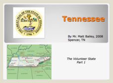
Tennessee: The Volunteer State Part 1
Explore the state of Tennessee, PowerPoint style! Regions, geographical features, and some amazing state facts are yours for the asking. Major cities are named and followed by related facts. This neat presentation on an interesting state...
Curated OER
Map Skills
In this map skills worksheet, students research and label the states in Australia and add in the major cities, oceans and seas.
Curated OER
Pile 'em High?
Students explore the concept of architectural heritage. In this architecture activity, students visit selected websites to compare and contrast the architectural features in world cities.
Curated OER
City Life In Europe
Middle schoolers explore Paris. In this geography skills lesson, students watch "City Life in Europe," and conduct further research on the city of Paris and the country of France. Middle schoolers create postcards that feature Parisian...
Student Handouts
Working with Primary Sources: The Spanish-American War
Examine the introduction to Our Islands in Their People, written by Major-General Joseph Wheeler. The excerpt, which is about two-and-a-half pages long, is included here along with six questions about the text. Pupils can learn about the...
Curated OER
Texas Map
In this Texas learning exercise, learners explore the state of Texas. Students look at a blank map of Texas and add the state capital, major cities, and any other major attractions of the state of Texas on the blank map.
Curated OER
Rhode Island Map
In this recognizing the shape of the state of Rhode Island instructional activity, students fill in the state capital, major cities, and other attractions or follow their teacher made directions. Students write at least 7 answers.
Freecloud Design
Stack the States™
Kids have fun learning US geography and state facts, including capitals, nicknames, major cities, and landmarks. They can choose between the game, or informational flashcards for each state.
San Antonio Independent School District
Global PC and Google Earth
Learners take notes on the physical geography of an assigned country, as well as its type of economy, major cities, and the student's own first impressions of the country, with this graphic organizer.
Curated OER
5th grade social studies geography
In this geography worksheet, 5th graders complete multiple choice questions about hemispheres, maps, cities, ecology, and more. Students complete 25 questions.
Curated OER
The Minority Majority
Students design a census class and school, then tabulate the results. They respond to a sample census, then reflect on why questions of race and national origin are different.
Curated OER
Describe My City
Young scholars explore the functions of cities by creating a visual image of their own neighborhood. Students diagram, list, and label the major businesses and cultural areas of the neighborhood where they grew up, then write a letter to...
Curated OER
Charlie and the Cell City
Middle schoolers investigate the major components of the cell and their function through an adventure inside the cell with an imaginary little guy named "Charlie." Through the use of the Internet and viewing a video, students identify...
Curated OER
Exploring Canadian Cities - a Day To Remember
Young scholars research information on the geographical features, climate, and cultural activities of a Canadian city. They plan a day in the city with a schedule of activities. They synthesize information and create a large poster...
Curated OER
Development on the Edge of a City
Students explore and analyze examples of changing relationships between patterns of settlement and land use in the state of Minnesota. They view different avenues of transportation, cities, suburbs, city planners and suburbanization.
Curated OER
Our Green City
Young scholars practice beginning reading while exploring an environmental theme. In this our green city lesson, students create their own published books, examine phonemic awareness, alphabetic principle, comprehension, and vocabulary.
Curated OER
Growing up in Las Vegas; Memories of Childhood in the Neon City
High schoolers investigate the history of Las Vegas through conducting interviews. For this oral history lesson, students locate and speak with older residents of Las Vegas in order to gain a better understanding of the city. High...
Curated OER
Conditions of City Life in the Late 19th Century
High schoolers examine tenement life. In this lesson on early urbanization, students research the role of journalism for social change in early American cities. High schoolers write a journal article for themselves that demonstrate an...
Curated OER
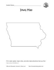
Iowa map
For this Iowa worksheet, students fill in cities and attractions in a map of Iowa. Students fill in as many cities and attractions they can find.
Curated OER
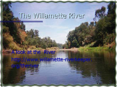
The Willamette River
An informative set of slides inspects the Willamette River. Hydropower dams, agriculture, and the presence of major cities on its banks have led to increased bacteria, temperature, and mercury content as well as skeletal deformities in...
Curated OER
City Lesson Plan
Students examine the patterns and processes of urbanization and describe patterns of urban land use. They choose one of five cities using riddles and research why this city is desirable. The groups make quizzes for each other on the city...
Curated OER
United States Regions
In this United States political map instructional activity, students examine regional census boundaries of the US. State boundaries are also included.
Curated OER
United States Map
In this United States political map worksheet, students examine national and state boundaries. The map also highlights the location of each of the state capitals and the national capital.
Curated OER
Europe Map Quiz
In this online interactive geography quiz learning exercise, students respond to 45 identification questions about the countries located in Europe. Students have 5 minutes to complete the quiz.


