DocsTeach
Red Record of Lynching Map Analysis
Long before the civil rights movement, leaders were working to secure equal rights. An informative activity explains the 1922 anti-lynching campaign with a map. Scholars analyze the map, complete a worksheet, and participate in group...
Curated OER
Probability and the U.S. Map
Learners solve and complete 20 different problems that include using a U.S. map and data table. First, they calculate the probability that they will select a state that begins with each letter of the alphabet. Then, everyone completes...
Curated OER
Unit II: Worksheet 5 - Velocity and Motion Maps
A chart with eight rows makes up this handout. The columns are labeled with two graphs ("x vs. t" and "v vs. t"), a written description, and a motion map. One cell in each row is filled in, leaving the rest for your class to complete....
Curated OER
How To Make a Science Concept Map
Here is a clever way to get your pupils thinking about a science topic they'd like to research for a report, or a project they'd like to do for a science fair. The three-step process is easy to follow, and it really should help your...
Teacher's Corner
Dr. Seuss Story Map
Guide young readers through their first book report with a story map designed for a Dr. Seuss book. After your class finishes their story of choice, they list the title, characters, conflict, and other elements of literature on the book...
Edgate
Why Map a Map?
After brainstorming reasons why Native Americans mapped their lands, your young critical thinkers will work together to review their ideas and determine the definition of a map. With today's extensive use of mapping technology and GPS...
Curated OER
State Map of Utah
In this social studies learning exercise, students examine a state map of Utah and answer 7 questions, using the map as a reference. The map includes freeways and bodies of water. There is no compass rose.
Curated OER
Map of Africa
Using a completed map (not provided), pupils will use this map to fill in the geographic features of Africa. An appropriate map can be printed using the Internet and placed under a document camera for the class to reference.
Curated OER
War of 1812: Map and Label
Map test! Hand out this map of the East Coast of the United States and let learners mark each of the nine sites listed. They'll be making a map that shows the battle sites and areas involved in the War of 1812. Great as a test or as a...
Curated OER
The Netherlands: map
Use the provided list to label a map of Europe and the Netherlands. There are 77 locations to label. You have to know your stuff to fill out this challenging map.
Curated OER
Character Map
A character map worksheeth as this would be handy for your class to support characterization study for any text. It is completely adaptable: your learners choose a character, write three traits in ovals and identify two instances that...
Curated OER
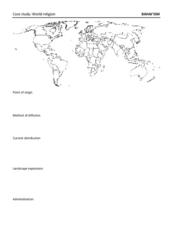
Map: Bahai'ism
How much do you learners know about the Bahai religion? If this is a topic of study in your class, they'll be able to use the provided map to show the diffusion, location, origin, and distribution of this not-so-well-known sect that...
Indian Land Tenure Foundation
Create a Map
Do your students have a connection to their natural environment? Create neighborhood maps together with your little learners. The lesson starts as the class talks about where they live and what their homes look like. They review their...
Public Schools of North Carolina
Democratic Republic of Congo - Map Skills
Work on your map skills with a packet of activities about the river basins in the Democratic Republic on Congo. Learners study the maps provided before answering the geography questions and writing an acrostic poem about the region.
Royal Geographical Society
An Introduction to Maps
First graders are introduced to a variety of maps such as globes, street maps, atlases, and different types of floor plans. The focus of the lesson requires individuals to create their own plan of the classroom using the PowerPoint...
Owl Teacher
Introduction to World of Geography Test
Assess your learners on the five themes of geography and the most important key terms and concepts from an introductory geography unit. Here you'll find an assessment with 15 fill-in-the-blank and 14 multiple-choice questions, sections...
Biology Junction
Cell Reproduction Concept Map
For this cell reproduction worksheet, scholars complete a concept map using different vocabulary words that describe the different phases a cell goes through in the reproduction process.
Novelinks
Where the Red Fern Grows: Graphic Organizer, Story Map
How do you grow a goal from a dream to reality? You make a plan! After reading chapters two and three of Where the Red Fern Grows, learners map how Billy earns his dogs by completing an organizer in pairs and then discussing answers in...
PBS
Concept Map
Make the thought process visible with a handy concept map organizer. As learners develop their main ideas in research, writing, or creative development, they can add details and like ideas to the worksheet as needed.
Museum of Science
Make a Map
It's important to know the final destination. Scholars first measure distances in a region of interest using a standard measuring device or by counting steps. They then use an appropriate scale and graph paper to create a map of the...
NASA
Lava Layering: Making and Mapping a Volcano
Looking for an out-of-this-world volcanic activity? Geologists study Earth's volcanic history and the neighboring planet Mars by modeling volcanic eruptions, lava flows, and building a shield volcano. Participants use graph paper and...
Curated OER
Topographic Maps
Your choice of hands-on topographic mapping tasks is provided in this resource. From actual map-making to viewing and interpreting stereographic photos, the activities are sure to succeed. To make the most of this lesson, you will need...
Perkins School for the Blind
Beginning Map Skills
Maps can be so much fun, they help you understand spatial relationships, distance between objects, and can foster direction skills. Budding cartographers with visual impairments use the Wheatley Tactile Diagramming Kit to create their...
Curated OER
We're on the Map!
Students identify a variety of topographic map symbols. They make generalizations about an unidentified community by reading and interpreting map symbols.
Other popular searches
- Using a Map Key
- Using a Map Scale
- Reading a Map Key
- Read a Map Legend
- Reading a Map Scale
- Create a Map Rubric
- Using a Map Legend
- Create a Map Interactive
- Mind Mapping a Story
- Mapping a Story
- Concept Mapping a Theory
- Fill in the Map From a Story


