Curated OER
Geo-portrait of the Caribbean: 1492 -1992
Students compare and contrast the Caribbean region in 1492 with the same region today , and use five themes of geography as avenues of comparison.
AGSSS
World Regions
Help your learners to visualize where historical events have taken place around the globe with a map that details the major regions of the seven continents.
Curated OER
Native People of the Caribbean
Eleventh graders use a map and locate and define the Caribbean region and then work in groups to read the passage and timeline. The groups' reader will read the passage aloud and the recorder makes a list of why colonists used slave...
Curated OER
Surface Air Temperature Trends of the Caribbean
Learners use real satellite data to determine the changes in near-surface air temperature at different times of the year over the Caribbean Sea. They discover how Earth's tilt causes seasonal differences in incoming solar energy. They...
Curated OER
Central America and the Caribbean
Use the library or Internet to find resources on a chosen topic. The class will comprehend the collected information, structure the information with texts and graphics for a presentation. Each presentation focuses on Hispanic culture and...
Curated OER
Geography: Caribbean
Students research and view a video on the geography of the Caribbean. In this Caribbean geography lesson, students go on an imaginary trip to the Caribbean and write postcards and letters telling of their trip. Students will include...
Curated OER
A Bird's Eye View of the Caribbean: Art, Folklore, and Music
Students examine the Caribbean in terms of its music, art, and folklore. As a class, they listen to a folktale and discuss the difference between telling a story and reading a story. In groups, they write their own folktale and share...
Curated OER
Central America and the Caribbean Culture Travel Brochure
Ninth graders take a trip to Central American and the Caribbean. In this culture and geography lesson, 9th graders research selected countries of the region. Students use their findings to create tri-fold brochures to share with others.
Curated OER
Caribbean Music-- An Introduction
For this music worksheet, students investigate the history of music and the musical style of the Caribbean islands. Students read a 1 page information sheet about the region and its music. Students answer 8 questions.
Curated OER
The Brief American Pageant: America on the World Stage
America's presence in Alaska and the Caribbean are the focus of this short presentation. Two detailed maps help to illustrate America's growing influence in the regions past its continental borders, which could supplement a more thorough...
Curated OER
Hershey and the World: The 5 Themes of Geography and Google Earth
Learners invsestigate cocoa producing regions in the world. In this geography skills lesson, students examine how the 5 themes of geography affect the Hershey Chocolate Company as they compare and contrast cocoa production in America,...
Curated OER
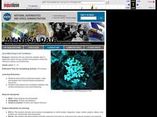
Coral Bleaching in the Caribbean
Students practice analyzing images, maps and graphs from Internet-based educational resources. They explore the correlation between sea surface temperature and coral bleaching. Students comprehend that coral reefs are collections of tiny...
Curated OER
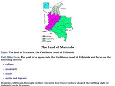
The Land of Macondo
Students research the culture, geography, music, myths and legends of the Caribbean coast of Colombia using online tools. They determine how these factors influenced the writing style of Gabriel Garcia Marquez. They design and write a...
Curated OER
Telecollaboration Lesson
Sixth graders explore the Caribbean sea and the Arctic ocean. They become familiar with the living conditions of others. Students investigate the geographic location of each area. They become familiar with important events that helped...
Curated OER
Searching for Meanings Beneath the Surface of the Poem
Students examine poems from Latin America and the Caribbean. They compare different perspectives and subjects in the poems. They research Peace Corps volunteers as well.
Curated OER
Regions of the US: Gulf Stream, States and Their Capitals
Fifth graders identify one way of dividing the US into geographical regions and then consider alternate ways of doing the same. They locate each of the fifty states and their capitals on a map. They research the Gulf Stream region.
Curated OER
Sea Horse Habitats
Students research sea horses around the world. In this sea horse habitats lesson plan, students use the Internet to take a virtual tour of a sea horse in its natural habitat. Students work in groups to study a geographical region such...
Curated OER
Currents and Climate
In this ocean currents worksheet, students will compare two different currents found in the Atlantic Ocean to determine how currents affect the climate in these regions. This worksheet has 3 short answer questions.
Curated OER
Early European Explorers Map
Fifth graders create an explorer's map. In this explorers lesson students use a map of the world as reference to draw their own map of Europe, North America, Central America, and the Caribbean Islands. The students use their maps to show...
Curated OER
Coral Bleaching in the Caribbean
Students use authentic satellite data on the NASA website to determine when the sea surface temperature meets the criteria to induce coral bleaching.
Curated OER
Colonization
Students explore why the Americas attracted Europeans, why they brought enslaved Africans to their colonies, and how Europeans struggled for control of North American and the Caribbean.
Curated OER
Mapping La Salle's Travels
Students use the internet to create a map showing the path of La Salle through North America and the Caribbean. They identify the main geographic features of the two areas and the main French forts. They also complete a timeline.
Curated OER
History Today
Young scholars use the newspaper to determine how history is being made in your community, region or country.They identify the different components that comprise a newspaper. This lesson contains adaptations from elementary to high school.
Curated OER
Sir Francis Drake
Help your learners prep for an exam testing content knowledge related to Florida's State History. Your class can use this printable page to review vocabulary, identify locations on a map, and research both knights and the Sir Francis...
Other popular searches
- Caribbean Region Geography
- Caribbean Regional Geography
- Define Caribbean Region
- Caribbean Region Maps


