AGSSS
World Regions
Help your learners to visualize where historical events have taken place around the globe with a map that details the major regions of the seven continents.
Curated OER
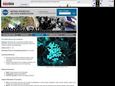
Coral Bleaching in the Caribbean
Students practice analyzing images, maps and graphs from Internet-based educational resources. They explore the correlation between sea surface temperature and coral bleaching. Students comprehend that coral reefs are collections of tiny...
Curated OER
Map Quiz 1
In this map quiz 1 worksheet, students answer questions relating to geography, not interactively, then scroll down to see the answers.
Curated OER
Native People of the Caribbean
Eleventh graders use a map and locate and define the Caribbean region and then work in groups to read the passage and timeline. The groups' reader will read the passage aloud and the recorder makes a list of why colonists used slave...
Curated OER
Sir Francis Drake
Help your learners prep for an exam testing content knowledge related to Florida's State History. Your class can use this printable page to review vocabulary, identify locations on a map, and research both knights and the Sir Francis...
Curated OER
Central America and the Caribbean Culture Travel Brochure
Ninth graders take a trip to Central American and the Caribbean. In this culture and geography lesson, 9th graders research selected countries of the region. Students use their findings to create tri-fold brochures to share with others.
Curated OER
The Brief American Pageant: America on the World Stage
America's presence in Alaska and the Caribbean are the focus of this short presentation. Two detailed maps help to illustrate America's growing influence in the regions past its continental borders, which could supplement a more thorough...
Curated OER
North American Biomes
In this Science worksheet, learners color a biome map of North America. Students color the map by solving the clues listed on a separate sheet of paper.
Curated OER
Early European Explorers Map
Fifth graders create an explorer's map. In this explorers lesson students use a map of the world as reference to draw their own map of Europe, North America, Central America, and the Caribbean Islands. The students use their maps to show...
Curated OER
Biome Map
In this biomes worksheet, students color the map of North America according to the biome clues. Students then answer questions about the North American biomes.
Curated OER
Mapping La Salle's Travels
Students use the internet to create a map showing the path of La Salle through North America and the Caribbean. They identify the main geographic features of the two areas and the main French forts. They also complete a timeline.
Curated OER
Regions of the US: Gulf Stream, States and Their Capitals
Fifth graders identify one way of dividing the US into geographical regions and then consider alternate ways of doing the same. They locate each of the fifty states and their capitals on a map. They research the Gulf Stream region.
Curated OER
The Acadian Odyssey
The dispersion of the Acadians is outlined in this informative PowerPoint. Colorful maps help show where different Acadians settled throughout the United States. Tip: After viewing this slideshow, have students create a timeline of the...
Curated OER
Coral Bleaching in the Caribbean
Students use authentic satellite data on the NASA website to determine when the sea surface temperature meets the criteria to induce coral bleaching.
Curated OER
Currents and Climate
In this ocean currents worksheet, students will compare two different currents found in the Atlantic Ocean to determine how currents affect the climate in these regions. This worksheet has 3 short answer questions.
Curated OER
The British Empire and the Royal Navy
Students locate on a map colonies belonging to the British Empire in 1775. They discuss the importance of colonies to the British Empire. They analyze the comparative sizes of period navies.
Curated OER
Colonization
Students explore why the Americas attracted Europeans, why they brought enslaved Africans to their colonies, and how Europeans struggled for control of North American and the Caribbean.
Curated OER
From Sea to Shining Sea
Students study the geography of the United States of America. Students write letters, create travel brochures, make maps, graph population numbers, read fiction and nonfiction selections, complete KWL charts, and watch films.
Curated OER
What and Where is Puerto Rico?
Learners explore Puerto Rico. They create K-W-L charts of their prior knowledge of Puerto Rico and observe maps of Puerto Rico. They code the map for measurements and land and water forms. They explore websites to gain background on...
Smithsonian Institution
The Sounds of an Island: Jamaican Music for the Classroom
Introduce young explorers to the music and history of Jamaican culture through game songs and dances. As a bonus, class members get to play simple songs transcribed for the recorder.
Curated OER
Message in a Bottle - A Satellite Journey through the Gulf Stream
The Gulf Stream has historically provided humans with a faster trade route because of its swift-moving waters. It continues to be a source of information and fascination for oceanographers today. As your class views this collection of...
EngageNY
Modeling an Invasive Species Population
Context makes everything better! Groups use real data to create models and make predictions. Classmates compare an exponential model to a linear model, then consider the real-life implications.
Curated OER
The Sugar Cane Curtain/ Defining Political and Social Struggles Between Haiti and the Dominican Republic
Twelfth graders explore historical events that created conflict between Dominican Republic and Haiti, examine how need for cheap source of labor has led to exploitation of Haitian workers, and discuss how topography of island of...
Curated OER
Painted Dreams
Third graders explore the importance of art in Haitian culture by analyzing the cause and effect within the story, "Allie's Basketball Dream." They examine all the aspects of the story and characters including their goals, dreams,...


