Curated OER
The Built Environment-An Integrating Theme
Students observe, record, and present knowledge of their local built environment while conducting a walking tour of their community. They develop written and photo journals, drawings, time lines, graphs, and charts to engage in...
Curated OER
Charlotte's Web Trading Card
Students read Charlotte's Web, view variety of trading cards, discuss what they know about trading cards and their purpose, choose character from story, complete bubble map about character, and create character trading card using...
Curated OER
Winter Holidays Around the World
How much do you know about the holidays around the world? Second graders put their knowledge to the test with a 14-day activity about global celebrations. They read informational text, employ KWL charts, and compare and contrast the many...
Curated OER
How the Environment Affects Our Health
Ninth graders explore how the environment affects health. In this infectious disease instructional activity, 9th graders investigate what environmental situations cause infections diseases. Students study the symptoms, treatments,...
Curated OER
Volcanoes and Plate Tectonics
In this earth science worksheet, students read and study about divergent and convergent boundaries, tectonic plates and volcanoes to complete 1 data chart 7 short answer questions.
Curated OER
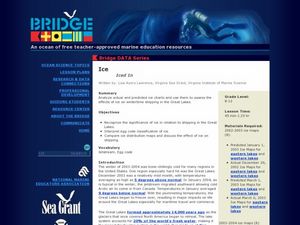
Iced In
Introduce junior oceanographers to ice conditions in The Great Lakes. The ice map links are no longer available, so you will not be able to have your class perform the mentioned data activity. You can, however, access the Canadian Ice...
Curated OER
Exploring California
While incomplete, this lesson could be used as a starting point for an exploration of the geographic features of California. Learners describe the four regions of California and discuss population and economic development. Then, they use...
Curated OER
Discussing Non-Fiction Texts
Discuss non-fiction texts and fact and opinion. Learners discuss the features of non-fiction text, identify how to distinguish fact from opinion, and list ways to display information, including graphs, charts, and diagrams. While this is...
Delegation of the European Union to the United States
The Geography of Europe
What is the European Union? Where is it? Why is it? To begin a study of the EU, class members examine the physical geography of Europe and the size and population density of 28-member countries in comparison to non-member countries...
Center for Learning in Action
Density
Explore the concept of density within states of matter—gases, liquids, and solids—through a group experiment in which young scientists test objects' texture, color, weight, size, and ability to sink or float.
Chicago Botanic Garden
Recent Weather Patterns
Decide whether weather is changing! A two-part activity first challenges classes to review the differences between weather and climate. Once finished, individuals then analyze historical data to determine if climate change is happening...
Virginia Department of Education
Functions 1
Scholars learn what it means for a relation to be a function and see various representations of functions. After learning the definition, they participate in a card sorting activity classifying relations as functions or not.
Curated OER
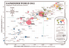
Gapminder World 2012
Here is a very interesting infographic that compares the average life expectancies, per capita incomes, and population sizes of every country in the world in 2012.
NASA
Astronomy Mission Module
Yes, scientists say, there is other life in our solar system! And the best place to look is on Europa, a moon of Jupiter. Here, learners mimic the techniques scientists use to gather information about objects in our solar system, write...
Curriculum Corner
Camping Literacy Pack
Increase camping vocabulary just in time for summer with a camping themed literacy pack. Use word cards and sentence cards to enhance fluency, build vocabulary, and strengthen writing skills. The activities are perfect for centers,...
Columbus City Schools
Totally Tides
Surf's up, big kahunas! How do surfers know when the big waves will appear? They use science! Over the course of five days, dive in to the inner workings of tidal waves and learn to predict sea levels with the moon as your guide.
Macmillan Education
White Fang
Jack London's adventurous novel White Fang may seem removed from students' everyday lives, but with an engaging set of reading activities, learners can relate to the story's themes. A three-page assignment delves into the...
West Virginia Department of Education
History Scene Investigators - John Brown's Raid
An informative resource covers the event of John Brown's Raid, an event that became an important part of West Virginia history. It serves as a standalone and covers the event and John Brown's life in depth using group work, online...
Curated OER
Making Sense Of A Round World On A Flat Surface
Young scholars engage in a instructional activity that is concerned with the development of geography skills. They take part in a number of activities that center around finding and traveling to different locations. The instructional...
Curated OER
COLD SEA WATERS
Students examine how old sea waters affected the local and state area during the summer of 1998. Studying a detailed web-site helps students examine sea temperatures.
Curated OER
A Bird's Eye View of our 50 States
Third graders focus on state birds as they learned absolute location (latitude/longitude) of each state, as well as their relative location (bordering states).
Curated OER
Asian Civilizations
Seventh graders complete computer based research to complete a travel brochure that highlights an Asian civilization.
Curated OER
Home: the Story of Maine "A Love for the Land": Where Are You? Who Are You?
Pupils investigate their neighborhood both as it is now and as it was 100 years ago. They take a walk around their neighborhood and fill out a worksheet before completing a worksheet.
Curated OER
Lost at Sea: The Search for Longitude
Students research and chart the shortest course to circumnavigate the globe.
Other popular searches
- Maps and Charts
- Analyze Maps and Charts
- Reading Maps and Charts
- Ireland Maps and Charts
- Tables, Maps and Charts
- Maps Graphs and Charts
- Maps, Charts, Globes
- Interpreting Charts and Maps
- Tables Maps and Charts
- Graphs, Charts and Maps
- Graphs\, Charts and Maps
- Word Maps and Charts


