Curated OER
Where in The World Am I?
Students explore the concept of absolution location. In this geography skills lesson, students discuss how to identify and locate latitude and longitude. Students play a game to reinforce the skills.
Curated OER
Globe Skills Lesson 3 Voyage to the New World
Students explore the globe. In this globe skills instructional activity, students use their knowledge of latitude and longitude to respond to questions regarding Christopher Columbus's maiden voyage to the Americas.
Curated OER
Globe Skills Lesson 6 The Louisiana Purchase
Students explore the Louisiana Purchase territory. In this geography skills lesson, students use map skills in order to plot and note latitude and longitude, measure scale distance, and locate landforms that were part of the Louisiana...
Curated OER
Post Roads
Students locate the major cities in the colonies during the Revolutionary War. In this map skills instructional activity, students use a globe to locate cities such as Charleston and Boston using latitude and longitude coordinates.
Curated OER
Globe Skills Lesson 2: Paving the Way for Columbus
Students explore the expedition of Christopher Columbus. In this geography skills lesson plan, students consider the technological advances that made Columbus's expedition possible as they complete a latitude and longitude activity.
Curated OER
Latitude and Longitude
Fifth graders study latitude and longitude. They estimate the latitude and longitude of their hometown and find the latitude and longitude of other cities using a map. They use a website to find out the cities' actual latitude and...
Curated OER
States with Attitude, Latitude and Longitude Dude
Sixth graders identify states whose boundaries are formed by lines of latitude and longitude or natural borders such as rivers. They trace a map of the U.S., and fill in borders, rivers and lines of latitude and longitude.
Curated OER
Tracking Satellites Using Latitude and Longitude
Students investigate how to track satellites using latitude and longitude. They investigate what man learns from all the satellites currently being studied today. Students analyze the four basic types of satellite orbits.
Curated OER
Lights, Shoals & Soundings
Students explore nautical charts and their symbols, with a bit of fun thrown in.
Curated OER
Snow Cover by Latitude
Students create graphs showing the amount of snow coverage at various points of latitude and compare graphs.
Curated OER
Globe Skills Lesson 7 The Transcontinental Railroad
Students explore the Transcontinental Railroad. In this geography skills lesson, students use map skills in order to locate legs of the Transcontinental Railroad on globes.
Curated OER
Globe Skills Lesson 5
In this map skills worksheet, students read a text selection about locations during the American Revolution and then respond to 8 fill in the blank questions.
Curated OER
Globe Skills Lesson 1 Some Early American Cultures
Students apply their knowledge of geography. In this geography skills instructional activity, students read brief selections regarding early Americans. Students respond to the questions included in the self-guided map...
Curated OER
Basic Mapping Skills
Establish and study the parts of a map with your class and, then they will work in small groups to create their own detailed map, including a legend. There are specific instructions to follow on what needs to be included.
Curated OER
Finding Longitude and Latitude on Pennsylvania Maps
Students draw the lines of longitude and latitude on a map. Students look at a topographical maps to see how topography relates to land use.
Curated OER
World War II New Guinea Campaign
Although the big picture for this lesson plan on the New Guidea Campaign of WWII is taking a field trip to the Douglas MacArthur Memorial, you can easily use it as a guide to an independent or group research project as well. However, if...
Curated OER
Globe Lesson 6 - Longitude - Grade 6+
In this longitude worksheet, learners read a 3-paragraph review of longitude and respond to 13 short answer questions.
Curated OER
Longitude
In this globe worksheet, students learn how longitude is measured on a globe. Students read the information before answering 5 questions. A globe will be required.
Curated OER
Globe Lesson 5 - Latitude - Grade 6+
For this latitude worksheet, students read a 3-paragraph review of latitude and respond to 12 short answer questions.
Curated OER
What's Your Temperature?
Learners take a look at the local newspaper and focus on the weather section. They get into small groups, and each one looks at the same map, but of a different part of the country. They must prepare a presentation that shows how...
Curated OER
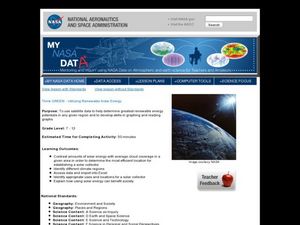
Think GREEN - Utilizing Renewable Solar Energy
Young scholars use data to find the best renewable energy potential. For this solar energy lesson students import data into Excel and explain how solar energy is beneficial.
It's About Time
Where are the Volcanoes?
Middle school geologists map the volcanoes closest to themselves, learn about map distortion, and infer possible future volcano locations. A focus on latitude, longitude, and volcanoes beneath the ocean helps connect the lesson.
Science Matters
Ring of Fire
Over a period of 35 years, earthquakes and volcanoes combined only accounted for 1.5 percent of the deaths from natural disasters in the United States. The 15th lesson plan in a 20-part series connects the locations of earthquakes...
Curated OER
Weather With a Latitude
Students read the temperature from a thermometer. In this weather lesson, students read a thermometer and record the temperature at twenty minute intervals. Students discuss results.
Other popular searches
- Maps Latitude and Longitude
- Maps, Longitude and Latitude
- Longitude & Latitude Maps
- Longitude Latitude Maps
- Maps, Longitude Latitude
- Maps, Latitude/longitude


