Enchanted Learning
Enchanted Learning: Kentucky
This site is an organized list of information about the state of Kentucky. The list includes things like the state's nickname, major rivers, symbols, flag, and lots more.
United Nations
United Nations: Cartographic Section: Central Asia [Pdf]
The countries of central Asia are shown on this map from the United Nations. It also shows the major rivers and cities.
United Nations
United Nations: Cartographic Section: Southeast Asia [Pdf]
This map from the United Nations shows the countries of Southeast Asia. Major rivers are labeled, as are cities.
Curated OER
University of Texas: Afghanistan: Relief Map
A relief map of Afghanistan from the Perry-Castaneda Collection showing how truly mountainous much of Afghanistan is. You can also trace the borders of the provinces and follow the major rivers.
US Geological Survey
Usgs: Edna Derived Watersheds for Major Named Rivers
A watershed index where students can click on a map of the U.S. to find the names and locations of watersheds. Students can also download a file that can be run in Google Earth to view more about the watershed.
Curated OER
University of Texas: Bangladesh: Relief Map
Click on this relief map of Bangladesh to get a close up look of the major rivers that flow across this flat country and form the mouths of the Ganges. From the Perry Castaneda Collection.
PBS
Pbs: American Experience: Fatal Flood
This resource is a companion site to a documentary about a major flooding of the Mississippi River in 1927, where in Greenville, Mississippi, efforts to contain the river pitted the majority black population against an aristocratic...
Curated OER
University of Texas: Bhutan: Political Map
This political map of Bhutan from the Perry-Castaneda Collection shows the major cities, rivers, rail lines, and major trails that traverse this tiny country.
Curated OER
University of Texas: Bangladesh: Political Map
A political map of Bangladesh showing its major cities, the boundaries of its divisions (provinces), roads, and, most spectacularly, the rivers flowing across this country.
Curated OER
University of Texas: Bangladesh: Small Map of Bangladesh
On this small map of Bangladesh, you can clearly see the rivers, major cities, and outline of the country.
Other
Arkansas Department of Parks and Tourism: Arkansas Virtual Regional Map
Take a virtual tour of Arkansas by clicking on each of its major regions .. the Ozarks, River Valley, Central, Delta, Timberlands, and the Ouachitas region. Terrific photos, video clips, maps, and descriptive information is included for...
TeachEngineering
Teach Engineering: Carve That Mountain
In this activity, students further investigate major landforms (e.g., mountains, rivers, plains, hills, oceans and plateaus). They build a three-dimensional model of a landscape depicting several of these landforms. Once they have built...
United Nations
United Nations: Cartographic Section: Great Lakes Region (Map 1) [Pdf]
The United Nations offers this very clear map of part of the Great Lakes region in eastern Africa. The lakes, of course, are labeled, as are the rivers, major cities, and countries.
Curated OER
University of Texas: Small Map of Vietnam
Look at a map of Vietnam with all the major cities and the Mekong River and delta. Very easy to read.
Curated OER
University of Texas: Small Map of India
See India's major cities and rivers in this easy-to-read map from the Perry Castaneda Collection.
Curated OER
University of Texas: Pakistan: Political Map
A political map of Pakistan from the Perry-Castaneda Collection showing the major cities, province boundaries, rail lines, highways, and rivers.
Curated OER
University of Texas: Sierra Leone: Political Map
This political map of Sierra Leone shows the province boundaries, the major cities and highways, the neighboring countries, and the many rivers running through it. From the Perry Castaneda Collection.
Curated OER
University of Texas: Shaded Relief Map of India
On this relief map of India from the Perry Castaneda Collection, you can easily see the major physical features of India along with the major cities and the states.
Other
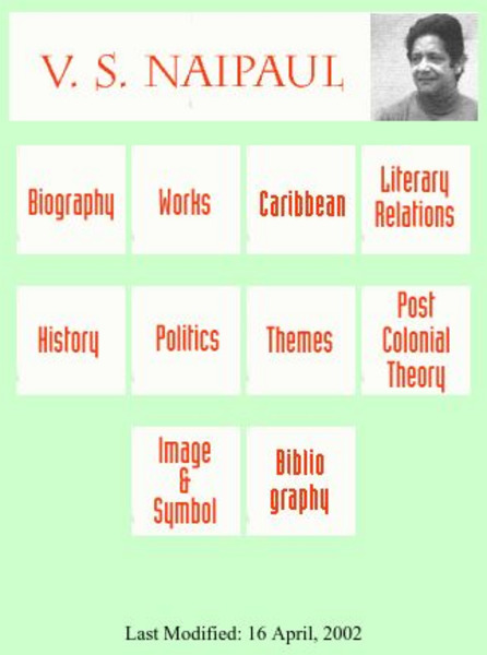
Postcolonial and Postimperial Authors: v.s. Naipaul
An excellent resource on V.S. Naipaul, a Carribean writer, this website provides articles on his status as a "rootless wanderer," his major works, and the key themes and ideas conveyed in Naipaul's writing.
Curated OER
University of Texas: Map: Syria
A political map of Syria from the Perry-Castaneda Collection showing the major cities, highways, and neighboring countries.
Curated OER
University of Texas: Mali: Political Map
A political map of Mali showing its regions' borders, major cities and highways, and neighboring countries. Take note of virtual lack of cities in the north. From the Perry Castaneda Collection
Curated OER
University of Texas: Senegal: Political Map
This political map of Senegal not only shows the province boundaries, major cities, highways, rail lines, and neighboring countries, but it also clearly shows how it completely engulfs the country of The Gambia. Clicking on the map will...
Curated OER
University of Texas: Democratic Republic of the Congo: Political Map
A political map the the Democratic Republic of the Congo that shows the province boundaries, major cities and highways, neighboring countries, and significant physical features. From the Perry Castaneda Collection.
Curated OER
University of Texas: Republic of the Congo: Political Map
A political map of the Republic of the Congo showing the regions, major cities and highways, and neighboring countries. From the Perry Castaneda Collection.
Other popular searches
- Geography Major Rivers
- Major Rivers in Tennessee
- World Major Rivers
- Major Rivers in Arkansas
- Major Rivers in Us
- Major Rivers u.s.
- Major Rivers in World
- Major Rivers United States
- Major Rivers United Statea
- Major Rivers Us
- Major Rivers United Stat Ea
- Major Rivers Texas Map


![United Nations: Cartographic Section: Central Asia [Pdf] Graphic United Nations: Cartographic Section: Central Asia [Pdf] Graphic](https://d15y2dacu3jp90.cloudfront.net/images/attachment_defaults/resource/large/FPO-knovation.png)


