Curated OER
Map Lesson Plan
Fourth graders locate and label major sites related to the Revolutionary War in the Hudson River Valley. They examine topographical features of each site and list a few of these features and list two advantages of each military site.
Curated OER
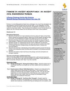
Farming in Ancient Mesopotamia: An Ancient Civil Engineering Problem
Sixth graders identify the major obstacles in farming in Mesopotamia. They work together to design and build a model that solves these problems. They write a short essay that describes the problems and their possible solutions.
Ms. Catsos
Ancient Rome Map Worksheet
It wasn't just the great leaders of ancient Rome that shaped their civilization—the geography of the region played a major role as well. After first identifying major land masses, bodies of water, and city states on a map of Europe,...
Curated OER
The Ocean Floor and Shore Zones
Make textbook reading more engaging using this reading activities activity, through which scholars review major features found on the ocean floor and the processes that formed these features. They complete 11 terms in a crossword puzzle,...
Curated OER
Putin: 'No way back' from democracy
Imagine a meeting between President Bush and Putin. Get your class thinking about global awareness, democracy, and totalitarian modes of government. They examine how two leaders approach major governmental issues and run their countries...
Curated OER
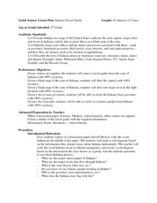
Indiana Travel Guide
Fourth graders create a travel guide about the state of Indiana with 100% accuracy. They label the capital within the travel guide with 100% accuracy. Students label one major river in the right location with 100% accuracy. They circle...
Curated OER
Mapping Landforms of South Carolina
Third graders analyze South Carolina maps. In this geography lesson, 3rd graders locate the five land regions in the state are and discuss how the regions are different. Students identify the major bodies of water and analyze how...
Curated OER
United States Identifier
Fifth graders examine and research a major region of the Unites States in groups of four. In addition, they locate the states, capitals, mammals and two bodies of water or mountain ranges found within their region. After the research,...
Curated OER
Nutrients In Chesapeake Bay
Students perform pH and turbidity test to determine water quality. In this environmental science lesson, students analyze NASA database on chlorophyll-a in the bay. They explain how a small river area affects Chesapeake Bay.
Curated OER
Chesapeake Bay
The Chesapeake Bay is the largest estuary in the United States. Explore its origins, organisms, and contributing rivers with this PowerPoint. It opens with several slides of general information on the formation of estuaries, then it...
Curated OER
On the Surface
Learners draw and label the 15 major rivers in Texas. They then draw and label another map with the major lakes and reservioirs of Texas. Students use the maps and locate and label the location of the following major Texas cities:...
Curated OER
Design a State Seal
Fourth graders examine the meanings of symbols on the Ohio state Seal. They create their own personal seals which include three items about themselves. They write explanations about their seals.
Curated OER
Searching the Digital Atlas
Learners become familiar with the tools of a digital atlas. They use a digital atlas of Idaho to located specified information. Students identify national forests, locate butterfly families, find examples of resident fish, and explore...
Curated OER
Carve That Mountain
Students investigate major landforms (e.g., mountains, rivers, plains, hills, oceans and plateaus). They build a three-dimensional model of a landscape depicting several of these landforms. Once they have built their model, they act as...
Curated OER
Transportation in Indiana
Fourth graders investigate Indiana transportation. In this transportation lesson students discover early forms of transportation such as railroads, rivers, boats, and roads. Students compare and contrast the different...
Curated OER
Canada: A Land Rich in Beauty and Culture
Third graders in groups research the different regions of Canada. They create a timeline to put the major events of Canada's history in order.
Curated OER
Shipping on the Hudson
Learners track movements of ships, tugboats, and barges on the Hudson River estuary in order to practice addition and subtraction skills. They solve word problems by reading and interpreting data from a table. They calculate distances...
Curated OER
Maps
Maps, globes, and computer software aid young explorers as they locate state capitols, major cities, geographic features, and attractions for states they are researching. They then use desktop publishing software to create a map to share...
Curated OER
Africa Review
Seventh graders trace the major events in African history. In this social studies lesson students, create a flowchart depicting the things they learned during this lesson. Students understand the chronology of major events that took...
Curated OER
Floodplain Modeling
Learners simulate the impact of fluctuating river volumes on structures and landforms. They experiment with table top-sized riverbed models and water. Students consider how human design can help mitigate the effects of a flood.
Curated OER
Trekking to Timbuktu: Trade in Ancient West Africa
Students research how trade in Timbuktu was affected by geography. Students conduct online research to determine the major trade routes, main products of trade, plus how and why trade spread across Africa.
Curated OER
War of 1812
Eighth graders locate the major land forms and bodies of water on a map of Louisiana. In groups, they discuss the role of the Mississippi River in the Battle of New Orleans and how land and water affect the outcome of battles. To end...
Curated OER
Missouri Time Scale and Earth Time Scale
In this time scale learning exercise, students create a time scale of Missouri and the earth using adding machine tape. The length of the tape represents the history of Missouri and the history of earth. Students identify the major...
Curated OER
You be the Tour Guide
Students research the natural features and wildlife of Arizona and Utah. They draw a map of the region that includes rivers, towns, mountains and roads. They work together to create a travel brochure of the area.
Other popular searches
- Geography Major Rivers
- Major Rivers in Tennessee
- World Major Rivers
- Major Rivers in Arkansas
- Major Rivers in Us
- Major Rivers u.s.
- Major Rivers in World
- Major Rivers United States
- Major Rivers United Statea
- Major Rivers Us
- Major Rivers United Stat Ea
- Major Rivers Texas Map


