Curated OER
BOUND TO BE NEW HAMPSHIRE
Students identify neighborhood, town, and state boundaries. They distinguish between natural and man-made boundaries. They identify major state geological features and explain how NH boundaries have changed over time.
Curated OER
Chain Across the Hudson
Fourth graders role play as contractors responsible for constructing a chain across the Hudson River. They apply math skills to determine the total weight, number of links, and cost of the project.
Curated OER
Water: On the Surface and in the Ground
Students explore the differences between surface water and ground water. They collect data using maps and graphs and investigate a Texas river basin and a nearby aquifer. They complete a written report including maps and data regarding...
Curated OER
Mongolia Geography
Students examine the geography and culture of Mongolia. Individually, they cut out cut-outs of animals to place on their maps and label the grasslands and desert areas. They locate major cities and rivers along with vegetation.
Curated OER
Floodplains in the Field
Students measure a topographic and geologic cross-section across a floodplain using simple surveying and auguring techniques in a field lab. Students also reconstruct the history of a river system.
Curated OER
Modeling the Rock Cycle
Students explore the differences in sedimentary, metamorphic, and igneous rocks. They discuss the rock cycle of the different formations. Students discuss how rock is formed into different shapes. They explore, predict, and create each...
Curated OER
"Label Me" Texas Map
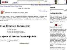
In this Texas map learning exercise, students research, label and discuss the top ten major cities in Texas on a map, label the physical attributes and identify the surrounding states around Texas.
Curated OER
Practical Marketing Skills in Travel and Tourism 2
Student review and identify the main marketing and promotional methods in the travel and tourism industry. They examine advertising, press releases, brochures, leaflets and other techniques. They complete an activity sheet while...
Curated OER
Evaluating an Illinois Earthquake
Students develop awareness of occurrences of earthquakes in Illinois and their past and potential future damage, and examine distribution of earthquakes in central U.S. regions.
Curated OER
Water Quality and Watersheds: A GIS Investigation
Requiring more than one class period, this resource takes earth science learners on a journey through a watershed. Using ArcGIS Explorer, an online geographic information system, they view maps of watersheds and surrounding landscapes....
Curated OER
The 1927 Flood
Upper elementary and middle schoolers examine the Great Flood of 1927 in the state of Arkansas. They each prepare an oral report about this flood and the huge impact it had on the economics of that time. Additionally, learners research...
Curated OER
Exploring China
Second graders explore the geography, holidays, important teachers, and inventions from China in the nine lessons of this unit. The results of their inquiries are expressed through a variety of products, writings, and presentations.
Curated OER
Early Settlements
Students embark on a journey through colonial times. In this early settlement lesson, students come to understand what life was like for the settlers in the early colonies. Students research and create projects illustrating their...
Curated OER
Field Trip to Mammoth Cave
Students, when given a microscope or a camera, write two observations they have seen using technology that they did not see with just their eyes with 100% accuracy. When given a blank map, they mark the location of Mammoth Cave along...
Curated OER
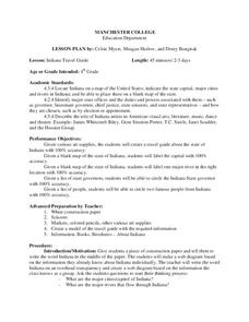
Indiana Travel Guide
Fourth graders share their information about their home state. For this research lesson, 4th graders use graphic organizers to make a travel guide about the state of Indiana. This lesson could be modified for use with any state, it also...
Curated OER
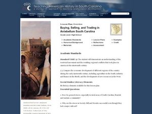
Buying, Selling, and Trading in Antebellum South Carolina
High schoolers research the role of general stores in the development of communities. In this South Carolina history instructional activity, students study the economic development of early U.S. communities. High schoolers write essays...
Curated OER
The Gifts of the Nile
Get your class thinking about the geography that shaped the Egyptian landscape and culture. They compare ancient climate zones and geogrpahical fetures, locate evidence of plate tectonics, take and quiz, and write a short essay. The...
Curated OER
Estuary and Watershed
Students investigate the San Francisco Bay Estuarine Research Reserve and watershed. In this estuary and watershed lesson plan, students complete 4 activities to better understand estuarine systems. They include studying the San...
Curated OER
The Oregon Trail
Students use maps and diagrams to examine the Oregon Trail. In groups, they create their own poster of the trail showing the different types of artifacts found along the way. To end the instructional activity, they identify the sources...
Curated OER
Countries of South America
Students focus on the geography of the countries of South America. Using a map, they identify the European countries who claimed the South American countries and research the influences they had on South America. To end the lesson,...
Curated OER
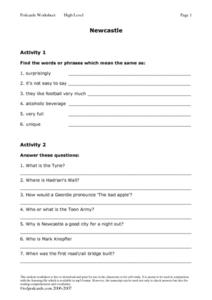
Newcastle
In this language arts worksheet, students listen to a podcast. They listen for words that mean the same as 6 words or phrases. Students answer 7 comprehension questions. A cloze activity of the article is included for students.
Curated OER
Animals Finding Rice Paddies
Fourth graders examine the animals who live in rice paddies and create a chart. In this rice lesson, 4th graders link the types of animals living in each ecosystem with a bar graph. Students use colored bars to show...
Curated OER
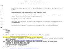
Pre-Colonial Native American Groups
Students investigate U.S. history by researching the Internet and taking a test. In this American Indian group lesson plan, students identify the many specific Native American tribes and their geographic locations. Students research the...
Curated OER
Where in the World Is ...
Students locate and place countries and continents on a large map using tag board and yarn. They locate a new geographic location on the map each morning.
Other popular searches
- Geography Major Rivers
- Major Rivers in Tennessee
- World Major Rivers
- Major Rivers in Arkansas
- Major Rivers in Us
- Major Rivers u.s.
- Major Rivers in World
- Major Rivers United States
- Major Rivers United Statea
- Major Rivers Us
- Major Rivers United Stat Ea
- Major Rivers Texas Map


